 NERC Data Catalogue Service
Economic geology
Type of resources
Topics
Keywords
Contact for the resource
Provided by
Years
Formats
Representation types
Update frequencies
Scale
-
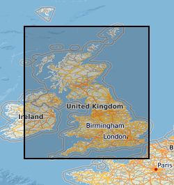
Many mineral resource maps for areas of Great Britain at scales of 1:25 000 and 1:50 000 have been produced by the British Geological Survey and its predecessors. Many of these maps were produced by the Industrial Minerals Assessment Unit (IMAU) from 1971 to 1986. Most maps cover a single 10 km x 10 km grid square, but some cover larger areas. The majority of maps are sand and gravel resource maps, but conglomerate, limestone, dolomite and celestite are also covered in certain regions. The maps show the locations of IMAU mineral resource blocks, the locations and categories of resource deposits and the locations of boreholes with indicative logs. A series of technical reports (Mineral Assessment Reports, MARs) was also created alongside the maps. Refer to the metadata entry for the Mineral Assessment Reports for more information. The maps are intended to be used for resource development, strategic planning, land-use planning, the indication of hazard in mined areas, environment assessment and as a teaching aid. The data was originally published in printed map form. The printed maps have been scanned and added to the BGS Maps Database.
-

This dataset relates to sample metadata and the results of geochemical analyses conducted on samples as part of the Mineral Reconnaissance Programme (MRP). It contains metadata including sample names, sample project areas, sample types and analytes. The MRP was a programme undertaken by BGS which ran continuously from 1973 to 1997, funded by the UK Government's Department of Trade and Industry (DTI). The datasets it produced provide baseline information on areas prospective for the occurrence of metallic minerals in particular locations across Great Britain. The programme was designed to stimulate private sector exploration and to encourage the development of Britain's indigenous mineral resources. The emphasis during the MRP varied in response to market conditions and strategic interests. Work on ‘strategic’ metals, such as platinum, palladium, chromium, cobalt and nickel, dominated the 1980s. From the late 1980s, the principal focus of the programme was gold. Numerous studies examined gold mineralisation in porphyry, epithermal, orogenic and unconformity-related settings. Towards the end of the programme, a small number of projects concerned with gemstones and industrial minerals were also completed. Various samples were taken throughout the course of the programme, including rock, soil, stream sediment, stream water and deep overburden samples. These samples underwent analysis for a variety of analytes, the results of which are held by BGS. This dataset includes the geochemical information derived from the samples and sample metadata, including the location of sampling. The sampling and analysis methodology varied by MRP project area. For more information about the samples from a specific project area, refer to the MRP report for that project: https://nora.nerc.ac.uk/cgi/search/archive/advanced?screen=Search&dataset=archive&_action_search=Search&series=Mineral+Reconnaissance+Programme For more information about obtaining the results of sample analyses, contact BGS Enquiries (enquiries@bgs.ac.uk). For more information about the MRP, see the MineralsUK website: https://www.bgs.ac.uk/mineralsuk/exploration-and-maps/mrp-reports/.
-
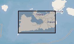
This dataset provides an overview of hydrothermal alteration samples from the island of Milos, Greece, that were analysed using a portable infrared mineral analyser (PIMA) or AgriSpec spectrometer. During data acquisition, spectrums were input into The Spectral Geologist (TSG) to provide an instant and estimated mineral identification using the shortwave infrared (SWIR) part of the electromagnetic spectrum. The samples were acquired during field visits between 2017 - 2019 by the British Geological Survey and the GW4+ Doctorial Training Partnership (NE/L002434/1). This data was primarily used to aid sample collection for further hydrothermal alteration analyses to improve our understanding of regional and local paleo-hydrothermal activity across the island. Identification by the TSG provides an estimation only, and the raw data files in .txt, .fos and .csv formats, are supplied for each analysis in the attached zipped file. This may be useful within the metallic and industrial mineral mining sector and associated researchers. The data includes grid references (± 5 m), TSG interpretations, and field/sample observations noted during data acquisition. GW4+ Doctoral Training Partnership (NE/L002434/1) is supported by grant award GA/09F/139 – RMS E3557, and the British Geological Survey’s University Funding Initiative (BUFI S345).