 NERC Data Catalogue Service
Dykes
Type of resources
Available actions
Topics
Keywords
Contact for the resource
Provided by
Years
Formats
Representation types
Update frequencies
Service types
-
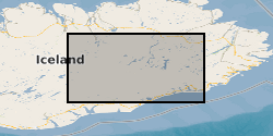
The dataset contains 3-component seismic data from seismometers deployed for one year Sept 204-August 2015 following the dyke intrusion from Bardarbunga which led to a 6 month long eruption at Holuhraun. The data is in miniseed format, archived at SEIS-UK and IRIS. The locations of all the microearthquakes we have identified from this data are published in Supplementary Information of Ágústsdóttir et al. (2016) [approx. 31,000 events from the Bardarbunga dyke], in Greenfield et al. [approx. 70,000 events from the Askja-Herðubreið area], and in Hudson et al. (2017), where they are publicly available for download. Ágústsdóttir, T., Woods, J., Greenfield, T., Green, R. G., White, R. S., Winder, T., Brandsdóttir, B., Steinthórsson, S. & Soosalu, H. (2016). Strike-slip faulting during the 2014 Bárðarbunga-Holuhraun dike Intrusion, central Iceland. Geophysical Research Letters, plus Supplementary Information, 43, 1495-1503, doi: 10.1002/2015GL067423 Greenfield, T., White, R. S., Winder, T. Ágústsdóttir, T. Seismicity of the Askja and Bárðarbunga volcanic systems of Iceland, 2009-2015, Journal of Volcanology and Geothermal Research, submitted 2017. Hudson, T. S., White, R. S., Greenfield, T., Ágústsdóttir, T., Brisbourne, A. & Green, R. G. (2017). Deep crustal melt plumbing of Bárðarbunga volcano, Iceland, Geophysical Research Letters, 44, doi: 10.1002/2017GL074749
-

These spatial and temporal image datasets are of mixing fluids in a dyke-like (slot) geometry investigated using low-temperature laboratory experiments which are described in the paper Analogue experiments to investigate magma mixing within dykes (Havard et al., in review in Bulletin of Volcanology, January 2025). The experiments are low-temperature analogue models of magma mixing within dykes and are dynamically scaled to the natural system. Seven unique experiments using seven different miscible fluid pairs, representing two magmas of differing composition, were conducted at the University of Liverpool. The miscible fluid pairs were (and the shortened experiment name is): water and diluted glycerol (ExpW1); water and pure glycerol (ExpW2); water and glycerol mixed with golden syrup (ExpW3); water and pure golden syrup (ExpW4); diluted glycerol and pure glycerol (ExpD1); pure glycerol and diluted golden syrup (ExpG1); pure glycerol and pure golden syrup (ExpG2). The experiment setup consisted of the lower density fluid placed above the higher density fluid in the tank apparatus, then the tank was inverted to initiate the interaction between the fluids. The raw data is a temporal series of photographs (JPGs) collected over the course of each experiment located within the subdirectories “Raw”. The raw data is processed using the scripts accompanying the dataset to show how density and mixing evolves spatially and temporally within the slot. Further details are available in the directory metadata file.
-
Spatial and temporal datasets for shear-thinning and Newtonian small-scale analogue dyke experiments

These data consist of spatial and temporal datasets for 7 different small-scale laboratory experiments of fluid-driven fractures, described in the paper The hidden internal flow dynamics of shear-thinning magma in dikes (Kavanagh et al., 2025, accepted in AGU Advances, March 2025). These experiments, conducted at the University of Liverpool, are analogue models of magma transport via flux-driven dykes. The 7 experiments are named HEC1, HEC2, HEC3, XG1, XG2, W1, W2. Experiments HEC and XG involved the injection of a shear-thinning fluid (a hydroxyethyl cellulose polymer (HEC) and xanthan gum solution (XG)), whilst experiments W1 and W2 involved Newtonian water injections. Experiments HEC1, HEC3, XG1 and W1 were ‘seeded fluid experiments’ or ‘PIV experiments’, whilst experiments HEC2, XG2 and W2 were ‘seeded gelatine experiments’ or ‘dyke-thickness experiments’. We provide the raw experimental data along with the Matlab scripts used to process and plot the data. Further information is provided in the containing README documents.
-
Fault analyses used to estimate underlying dyke properties, imaged in 3D seismic reflection data. The seismic reflection data are located offshore NW Australia and image a series of Late Jurassic dykes and overlying dyke-induced normal faults; these structures occur within a sedimentary basin and are now buried beneath several kilometres of rock. The specific seismic reflection dataset used for this study so far is the Chandon 3D survey, which is freely available through https://www.ga.gov.au/nopims. Other 3D seismic surveys (e.g., Glencoe) near Chandon will be used in due course to extend the study area. Analyses of these faults uses an array of point pairs, defined by X, Y, and Z co-ordinates, that mark where certain sedimentary beds are intersected by the fault in its footwall and hanging wall. Mapping of these points every 125 m along each studied fault, for 11-14 sedimentary horizons, was conducted using Petrel seismic interpretation software. From the footwall and hanging wall point pairs, the throw, heave, displacement, and dip of each fault was calculated. By measuring distances between corresponding point pairs on opposing faults, graben width properties and estimated down-dip fault continuations were calculated. The expression of dyke-induced faults observed at the surface in active volcanic areas is often used to estimate dyke location, thickness (expected to roughly equal the heave on overlying faults), and upper tip depth (expected to occur where overlying, oppositely dipping faults meet; i.e. the point of the ‘V’). This study represents the first time natural dyke-induced faults and underlying dykes have been imaged in 3D and quantitatively studied. The dataset presented here allows hypotheses concerning relationships between dyke-induced fault geometries and dyke properties to finally be tested, and provides insight into normal fault kinematics; this will be useful to structural geologists and volcanologists.
-

This Web service provides layers containing data from the BGS Geology 625k (DiGMapGB-625) dataset. BGS Geology 625k provides small-scale (1:625 000 scale) bedrock and superficial geology mapping for use at a regional and national level. The bedrock and superficial data are symbolised by lithology and lithostratigraphy, and a bedrock age layer is also provided for the bedrock layer. Additional linear features (faults) and dykes layers are provided for use in conjunction with the bedrock layer. For more information about the digital maps available from the British Geological Survey, please visit https://www.bgs.ac.uk/geological-data/. The data are provided through this service for view and download under the Open Government Licence.
-
These data consist of spatial and temporal datasets for 11 different small-scale laboratory experiments of fluid-driven fractures, described in the paper Up, down, and round again: the circulating flow dynamics of flux-driven fractures (Chalk and Kavanagh, accepted in Physics of Fluids, February 2024). These experiments, conducted at the University of Liverpool, are analogue models of natural fluid-driven fractures in glacial and magmatic settings. Fractures were created by injecting water or silicone oil into transparent gelatine at a constant rate. The total experimental data set consists of 11 different experiments named: S1,S2,S3,S4,S5,W1,W2,W3,W4,SH,WH. S experiments involve the injection of silicone oil, and W experiments involve the injection of water. The raw data consist of a temporal series of jpegs from camera recordings of each experiment, located in the subdirectory "frames". For all experiments except for WH and SH, the data also consist of a temporal series of csv files containing spatial velocity data of the internal fluid flow, located in the subdirectory "PIV". These data are described in further detail in the metadata file in the raw data directory.