Devonian
Type of resources
Topics
Keywords
Contact for the resource
Provided by
Years
Formats
Representation types
Update frequencies
Resolution
-

This raster dataset represents the depth in metres to the top of the Upper Devonian in the Midland Valley of Scotland (top Kinnesswood Formation) over the extent of the model developed by Kearsey, T.I., Receveur, M. and Monaghan, A.A., 2024. Modelled hot sedimentary aquifer geothermal potential of Upper Devonian strata in the Midland Valley of Scotland. Uncertainties in the model are linked to the absence of boreholes penetrating both the top and the base of the Upper Devonian (except the Inch of Ferryton well) and poor seismic reflection data in the centre of the basin where it is thickest and deepest. The extent of the geological units is as shown on the published BGS geology maps, considering the re-interpretation of the Kinnesswood Formation as Devonian in age. The model is presented with high uncertainty.
-

This raster dataset provides the maximum temperature in the Upper Devonian formations in the Midland Valley of Scotland. The reservoir temperature is modelled over the extent of the base of the Kinneswood Formation and Stratheden Group, based on an updated geological model created by Kearsey, T.I., Receveur, M. and Monaghan, A.A., 2024. Modelled hot sedimentary aquifer geothermal potential of Upper Devonian strata in the Midland Valley of Scotland. The model is presented with high uncertainty.
-

This raster dataset shows the modelled P50 distribution of the theoretical potential 'heat-in-place' (HIP) across the combined Upper Devonian Kinnesswood Formation and Stratheden Group in the Midland Valley of Scotland (PJ/km2), at a resolution of 500 m x 500 m x 50 m. The HIP is calculated for resource temperatures greater than 50 °C (> 1400 m depth), which represents minimum temperature required for direct use of heat from hot sedimentary aquifer resources. The HIP represents the heat resource available in an aquifer according to the USGS definition described in e.g. Muffler and Cataldi (1978). Its calculation is part of the research published by Kearsey, T.I., Receveur, M. and Monaghan, A.A., 2024. Modelled hot sedimentary aquifer geothermal potential of Upper Devonian strata in the Midland Valley of Scotland. The model is presented with high uncertainty.
-

This dataset represents the thickness in metres of the Upper Devonian in the Midland Valley of Scotland (Stratheden Group and Kinnesswood Formation) over the extent of the model developed by Kearsey, T.I., Receveur, M. and Monaghan, A.A., 2024. Modelled hot sedimentary aquifer geothermal potential of Upper Devonian strata in the Midland Valley of Scotland. Uncertainties in the model are linked to the absence of boreholes penetrating both the top and the base of the Upper Devonian (except the Inch of Ferryton well) and poor seismic reflection data in the centre of the basin where it is thickest and deepest. The extent of the geological units is as shown on the published BGS geology maps, considering the re-interpretation of the Kinnesswood Formation as Devonian in age. The model is presented with high uncertainty.
-

All paleointensity data gathered from the project at University of Liverpool. The data is divided into multiple four letter coded sections which refer to a specific locality and/or experiment type. The sections are as follows: CFEH - Thermal paleointensity experiment on natural clinkers from Montana, USA, looking primarily at the Epsilon Hematite phase, with an additional high-power alternating field demagnetisation step after each infield step of the experiment. LPRM - volcanic material from Kinghorn and Wormit Bay, Scotland (335 and 410 million years old). This was a specific experiment with samples given a prior high temperature applied field of 80 micro Tesla and a pressure remanent magnetisation of 80 micro Tesla. VFSS – a microwave paleointensity experiment carried out on Scottish vitrified fort material, sampled in the 1980s. WTBY – microwave paleointensity experiments carried out on Scottish volcanics from Wormit Bay. Sampled September 2015. YDSR – volcanics from Yandiniling Dike Swarm, in Yilgarn Craton, Australia, 2.6 billion years old. Sampled Nov 2018. Sampled with Yebo Li from the University of Curtin (Perth) as part of a collaboration, resampling of 16WDS sites from his palaeodirections paper. These were microwave demagnetisation (specimen orientation only) and paleointensities. NERC grant NE/P00170X/1.
-
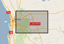
Rock magnetic data corresponding to demagnetisation (LIV_DEMAG) and paleointensity (LIV_PI) data submitted as part of this grant. This data is divided into two subfolders, "Kappabridge" and "VFTB", corresponding to the instrument used to acquire the data. Those folders each contain one or more folders labelled with a four letter code, corresponding to a specific locality and/or experiment type, matching the letter codes in LIV_DEMAG and LIV_PI. The Kappabridge folders then contain raw data files of temperature-dependent magnetic susceptibility, and the VFTB folders contain raw data files of hysteresis, coercivity, isothermal remanent magnetisation and thermomagnetic curve measurements. CFEH corresponds to clinker samples from USA attempting to isolate an Epsilon Hematite phase. LPRM are data from Kinghorn and Wormit Bay volcanics in Scotland, ~330 Ma, specifically for samples given a lab TRM at 80uT and a PRM at 80uT. WTBY are Devonian volcanics from Wormit Bay, sampled in 2015. YDSR are data from Yandiniling Dike Swarm, Yilgarn Craton in Australia, sampled Nov 2018.
-
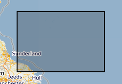
Reports, images, GIS and gridded products describing the Palaeozoic geology and conventional petroleum in and around the Mid North Sea High (Quadrants 25-44). Covering a large area of the Central North Sea from the Forth Approaches to the northern side of the Southern North Sea, the focus is on Devonian and Carboniferous rocks. The peer-reviewed products were produced for the 21CXRM Palaeozoic Project by BGS for DECC/OGA, Oil and Gas UK and oil company sponsors between November 2014 and May 2016, to improve regional digital datasets and knowledge of the underexplored Palaeozoic petroleum systems, and to stimulate exploration. The petroleum systems analysis was based on new interpretations of extensive well, seismic, gravity-magnetic and source rock datasets, integrated with petrophysical studies, basin modelling and UK onshore knowledge. Released data were collated and interpreted, and interpretations of unreleased data were included with agreement of the data owners. Unreleased raw data is excluded, as is the UK Government Seismic data released in 2016. The datasets are applicable for use at scales between 1:750,000 to 1: 3,000,000.
-
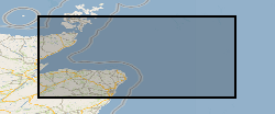
Reports, images, GIS and gridded products describing the Palaeozoic geology and conventional petroleum systems of parts of the UK offshore from the Orcadian Basin, Moray Firth to northern Forth Approaches (Quadrants 6-21). Devonian and Carboniferous rocks are the focus. The peer-reviewed products were produced for the 21CXRM Palaeozoic Project by BGS for DECC/OGA, Oil and Gas UK and oil company sponsors between November 2014 and May 2016, to improve regional digital datasets and knowledge of the underexplored Palaeozoic petroleum systems, and to stimulate exploration. The petroleum systems analysis was based on new interpretations of extensive well, seismic, gravity-magnetic and source rock datasets, integrated with petrophysical studies, basin modelling and UK onshore knowledge. Released data were collated and interpreted, and interpretations of unreleased data were included with agreement of the data owners. Unreleased raw data is excluded, as is the UK Government Seismic data released in 2016. The datasets are applicable for use at scales between 1:750,000 to 1: 3,000,000
-
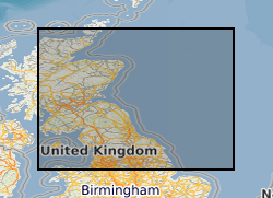
Reports, images, GIS and gridded products describing the Palaeozoic geology and conventional petroleum systems of parts of the UK offshore. Devonian and Carboniferous rocks are the focus in and around the Mid North Sea High, Central North Sea, the Moray Firth and Orcadian Basin. In the greater Irish Sea area, Carboniferous rocks are described. The peer-reviewed products were produced for the 21CXRM Palaeozoic Project by BGS for DECC/OGA, Oil and Gas UK and oil company sponsors between November 2014 and May 2016, to improve regional digital datasets and knowledge of the underexplored Palaeozoic petroleum systems, and to stimulate exploration. The petroleum systems analysis was based on new interpretations of extensive well, seismic, gravity-magnetic and source rock datasets, integrated with petrophysical studies, basin modelling and UK onshore knowledge. Released data were collated and interpreted, and interpretations of unreleased data were included with agreement of the data owners. Unreleased raw data is excluded, as is the UK Government Seismic data released in 2016. The datasets are applicable for use at scales between 1: 750,000 to 1: 3,000,000.
-
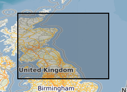
GIS versions of a regional structural summary and palaeogeographic reconstructions describing the Palaeozoic geology of parts of the UK offshore and onshore, plus a set of summary posters and a summary presentation capturing the conventional petroleum systems. Devonian and Carboniferous rocks are the focus in and around the Mid North Sea High, Central North Sea, the Moray Firth and Orcadian Basin. In the greater Irish Sea area, Carboniferous rocks are described. The peer-reviewed products were produced for the 21CXRM Palaeozoic Project by BGS for DECC/OGA, Oil and Gas UK and oil company sponsors between November 2014 and May 2016, to improve regional digital datasets and knowledge of the underexplored Palaeozoic petroleum systems, and to stimulate exploration. The petroleum systems analysis was based on new interpretations of extensive well, seismic, gravity-magnetic and source rock datasets, integrated with petrophysical studies, basin modelling and UK onshore knowledge. Released data were collated and interpreted, and interpretations of unreleased data were included with agreement of the data owners. Unreleased raw data is excluded, as is the UK Government Seismic data released in 2016. The GIS layers were digitised from figures prepared for project reports and are applicable for use at scales between 1:1,000,000 and 1:3,000,000.
 NERC Data Catalogue Service