 NERC Data Catalogue Service
Cross sections
Type of resources
Topics
Keywords
Contact for the resource
Provided by
Years
Formats
Representation types
Update frequencies
Scale
-
This dataset contains scans of Applied Geology Maps (AGMs) and sections, which are also known as thematic maps, Environmental Geology Maps (EGMs) or Planning for Development Maps (PfD). They were produced as part of 'Geological Background for Planning and Development' and preliminary sand and gravel projects carried out by the British Geological Survey for the Department of the Environment, Transport and the Regions (DETR), the Scottish Development Department and Scottish Office from 1975 to 1996. The maps and sections cover a number of themes (up to 22) for specific areas relating to the project area within the United Kingdom (which are mostly urban areas). Themes include simplified bedrock and superficial maps, drift thickness, drift lithology, rockhead contours and a range of mining-related themes. Each area had its own custom set of maps and were issued with an accompanying BGS Technical Report. The maps and report were sometimes issued as a pack, but for some areas they were made available separately. The geological linework and the methods used to produce the maps are those current at the time of production. Map scales are predominantly 1:10 000 or 1:25 000, with a few 1:50 000 maps. The maps have Ordnance Survey map bases and are bounded by the project area. The maps could be used for geological, engineering geological, environmental and resources research, as an information and reference resource and for inclusion in reports and papers. These maps are hard-copy paper records and digital scans, stored in the National Geoscience Data Centre (NGDC).
-

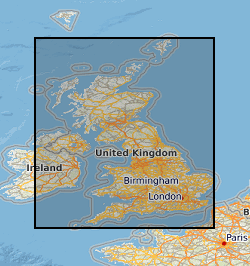
3D geology models have been created for London, Glasgow, Cardiff, Liverpool and Gateshead. Users can create geological cross-sections, synthetic boreholes and horizontal slices through the 3D models. Underpinned by BGS geological data and expertise, the models and reports provide an enhanced understanding of the geological structures and sediments for urban practitioners to inform construction projects, infrastructure design, groundwater assessments and land use planning. These models cover depths from +300 m OD (Ordnance Datum) to -600 m OD. The models which cover Liverpool and London include superficial and bedrock units. The models which cover Glasgow and Cardiff include superficial units on an undifferentiated bedrock base model. The Gateshead Model includes undifferentiated superficial deposits on a bedrock model, but the Superficial Deposits top layer shows the hydro domains map produced for Project Groundwater Northumbria. The models were constructed in the National Geological Model, Urban Geoscience programmes and Project Groundwater Northumbria between 2008-2025 in GSI3D, Groundhog and ASPEN SKUA for deployment to the web viewer. These datasets are managed by the 3D GeoModel project (National Geoscience).
-
[This metadata record has been superseded, see http://data.bgs.ac.uk/id/dataHolding/13606458] Scanned copies of Scottish 1 inch scale maps which are annotated with fossil locations and geology. Printed topography with hand annotated fossil locations and geology with cross sections and colour-wash with index and observations. Considered working material towards published geological maps.
-
Annotated Scottish 1 inch scale maps. Printed topography with hand annotated fossil locations and geology with hand drawn cross sections, colour-wash with index and observations. Considered working material towards published geological maps.
-

BGS LithoFrame models provide 3D geological characterisation for parts of the onshore and offshore UK at a range of scales. They present framework geological interpretation consistent with the stratigraphic framing schemes and scales used in BGS geological maps. Models have been constructed under a range of project activities and include local-scale superficial and bedrock models covering sites and focused study areas, medium-scale superficial and bedrock models covering many urban areas, transport corridors and smaller catchments, and regional-scale bedrock models covering large catchments, district areas, and geological basins. The 3D geological models have been constructed in a period between 2003 and 2018 and is managed by the 3D GeoModel project (National and International Geoscience).