 NERC Data Catalogue Service
Format
TIF files
Type of resources
Topics
Keywords
Contact for the resource
Provided by
Years
Formats
Representation types
Update frequencies
From
1
-
1
/
1
-
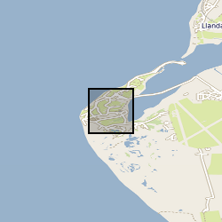
X-ray computed tomography (XCT) scans of four samples of consolidated shale from the Lower Jurassic (C.exaratum subzone) of the Cardigan Bay Basin (Wales, UK). The samples were taken from the Mochras Core, at depths of 789, 810, 812, and 818m (all samples within data measured in metres). Each sample is distinguished by its unique sample identification number (SSK). For each sample, there is a stack of XCT orthoslices (.tiff) files, and for SSK109633, an incomplete Avizo file. Mochras core location (aprox.) 52°48'39.74"N, 4° 8'48.09"W. Mochras Island, west of Llanbedr, Gwynedd, Wales, UK