TIF
Type of resources
Topics
Keywords
Contact for the resource
Provided by
Years
Formats
Representation types
Update frequencies
Scale
-
H2 adsorption data on sub-bituminous coal as a function of pressure. Hydrogen flooding of a coal core. Micro CT imaging of the effect on coal swelling after hydrogen injection. Hydrogen is trapped, and no swelling is observed indicating that coal might be a good candidate for the storage of hydrogen.
-

A continuous four-year record of physicochemical properties of soils deglaciated in the last century due to the retreat of Midtre Lovénbreen (ML) glacier in the vicinity of Ny-Ålesund, Svalbard. Below ground data are accompanied by an over ground three-year (2022-2024) photographic record aimed at capturing snow depth levels during the transition seasons between Arctic summer and winter (NET0105681_SUNSPEARS_Photographic data). This dataset aids our understanding of deglaciated soil evolution in the current rapidly changing Arctic landscape. At four locations (reported in NET0105681_SUNSPEARS_GPS data) along the ML glacier forefield, in October 2020, soil in four different stages of development, depending on time elapsed since deglaciation, was sampled. Samples were processed in the laboratory in order to determine their texture (results reported in NET0105681_SUNSPEARS_Particle Size Analysis data) and X-ray CT scanned in order to determine their internal structure (CT reconstructed images reported in NET0105681_SUNSPEARS_Computed Tomography data). At two of the four sampling locations (SUN1 and SUN2), geophysical monitoring stations were installed, which use an array of sensors to continuously measure soil electrical resistivity in 3D (NET0105681_SUNSPEARS_PRIME 3D ERT data). Raw electrical resistivity data, instrument health data and corresponding reconstructed 3D electrical resistivity profile images (and timelapse videos) of the subsurface are included. Topographic surveys of all the sensors operated by the monitoring stations are included. In the vicinity of the two geophysical monitoring stations, longer and deeper electrical resistivity profiles were acquired. These allow one to image the boundary between the active layer (that freezes and thaws depending on ambient temperature) and underlying permanently frozen ground. Raw electrical resistivity data and corresponding reconstructed 2D electrical resistivity profile images of the subsurface are included (NET0105681_SUNSPEARS_PRIME 2D ERT data).
-
ARSF project 04/27 led by John Hilton. Site:Dorchester.
-
This dataset contains photographs from an optical microscope by transmitted light and reflected light. The data was collected in 2022-2023. The data was collected for the purpose of visualising spatial textures and microstructures in the collected samples. The data was collected by John MacDonald and Robin Hilderman (University of Glasgow) who retain the original data.
-

The response of the benthic microbial community to a controlled sub-seabed CO2 leak was assessed using quantitative PCR measurements of benthic bacterial, archaeal and cyanobacteria/chloroplast 16S rRNA genes. Similarly, the impact of CO2 release on the abundance of benthic bacterial and archaeal ammonia amoA genes and transcripts, and also to the abundance of nitrite oxidizer (nirS) and anammox hydrazine oxidoreductase (hzo) genes and transcripts. Samples were taken from four zones (epicentre (zone 1); 25m distant (zone 2), 75m distant (zone 3) and 450m distant (zone 4)) during 6 time points (7 days before CO2 exposure, after 14 and 36 days of CO2 release, and 6, 20 and 90 days after the CO2 release had ended). Changes to the active community of microphytobenthos and bacteria were also assessed before, during and after CO2 release using Denaturing Gradient Gel Electrophoresis of cyanobacteria/chloroplast 16S rRNA. Changes to the composition of the active bacterial community was assessed first using Terminal Restriction Fragment Length Polymorphism (T-RFLP) of bacterial 16S rRNA. In depth comparisons of possible changes to the active bacterial community at zone 1 and 4 before, during and immediately after the CO2 release was performed using 16S rRNA 454 pyrosequencing. This dataset was created by Plymouth Marine Laboratory (PML) under the program QICS (Quantifying and monitoring environmental impacts of geological carbon storage) which was funded by the Natural Environment Research Council (NERC), with support from the Scottish Government. The results are contained in three text files. QICS project website: www.bgs.ac.uk/qics/home.html. Tait et al. (2015) Rapid response of the active microbial community to CO2 exposure from a controlled sub-seabed CO2 leak in Ardmucknish Bay (Oban, Scotland). IJGGC DOI: 10.1016/ijggc.2014.11.021. Watanabe et al. (2015) Ammonia oxidation activity of microorganisms in surface sediment to a controlled sub-seabed release of CO2. IJGGC DOI: 10.1016/j.ijggc.2014.11.013.
-
This dataset contains bulk rock, glass, melt inclusion and host phenocryst geochemical compositions for materials from Tolbachik volcanic field, Kamchatka, Russia, together with supporting petrographic information. Sampling localities are provided together with the bulk rock compositional data. Samples were acquired between 2016 and 2019 and the data were collected between 2016 and 2020 using secondary electron microscopy, electron microprobe analysis, secondary ion mass spectrometry, laser ablation ICP-MS, X-ray fluorescence and solution ICP-MS, and multi-collector ICP-MS methods. Most of the data are included in a manuscript (Iveson et al.) to be submitted to Journal of Petrology in March 2022.
-
Data has been recorded during triaxial rock deformation experiments where Lanhelin granite samples were subjected to dynamic and half-controlled shear failure. The data consists of mechanical data (load, displacement, confining pressure, strain gauge data), ultrasonic data (AE source locations and arrival times, sensor locations, arrival times of active acoustic surveys), and scanning electron microscope images of the samples after shear failure. Dataset contains all data necessary to evaluate the results presented in the paper entitled: 'Off-fault damage characterisation during and after experimental quasi-static and dynamic rupture in crystal rock from laboratory P-wave tomography and microstructures' by Aben, Brantut, and Mitchell, Journal of Geophysical Research: Solid Earth.
-
Results of piston cylinder experiments on lower-crustal material from the Ivrea Zone, Italian Alps. Natural sulfides and sulfide-silicate mixes from lower crustal cumulates were heated and pressurised to conditions matching those of the MASH zone, which is hypothesised to be the source of metals for post-collisional porphyry Cu deposits. This was done in order to simulate partial melting and examine the mobility of metals in this environment. This data contains experimental logs stating the experimental conditions; reflected light photographs of the experimental capsules; scanning electron microscope element maps and identification of platinum group minerals and precious metal minerals in the capsules; and trace element concentration of sulfides in the capsules. This data was collected as part of the TeaSe consortium NERC grant in order to test hypotheses about porphyry Cu deposit formation. This data was collected by researchers at Cardiff University and the University of Edinburgh.
-

Textural data and major element geochemical data for plagioclase crystallisation experiments. Data were collected 2020-2022. The aim of the experiments was to produce plagioclase crystals at a variety of sizes at low to moderate undercooling conditions (~0 < ΔT < 45 °C) and characterise their shapes. Experiments, data acquisition and processing were conducted by Dr Martin Mangler and Eshbal Geifman. This research was funded by a NERC grant to Madeleine Humphreys, Richard Brooker, Fabian Wadsworth and Alex Iveson, and by an ERC Consolidator award to Madeleine Humphreys under the European Union’s Horizon 2020 research and innovation programme (grant agreement 864923). Full details of the data analysis and interpretation can be found in Mangler et al. (2023): Melt diffusion-moderated crystal growth and its effect on euhedral crystal shapes, Journal of Petrology, doi.org/10.1093/petrology/egad054.
-
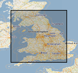
This dataset comprises data from Wessex Archaeology surveys which were conducted over various wreck sites between 2003 and 2010. Three of these datasets were acquired in English waters, one in Welsh waters and one in Scottish waters. The geology and geophysics component of the data are archived by British Geological Survey (BGS) in the Marine Environmental data and Information Network (MEDIN) Data Archive Centre (DAC) for Geology and Geophysics. The data include multibeam echosounder, single-beam echosounder, sidescan sonar, sub-bottom profiler, magnetometer, and geological data (vibrocore logs and photos). Data were also provided to other archive centres as appropriate - UKHO (bathymetry), Royal Commission Ancient and Historic Monuments Wales (geophysics), Royal Commission on the Ancient and Historical Monuments of Scotland (geophysics and diving/ROV), Archaeology Data Service (diving/ROV). Although generated for archaeological purposes, these high quality and resolution data are capable of re-use by marine surveyors and scientists from a range of different fields. Data are delivered via the BGS Offshore GeoIndex www.bgs.ac.uk/GeoIndex/offshore.htm and additional data are available on request enquiries@bgs.ac.uk.
 NERC Data Catalogue Service