 NERC Data Catalogue Service
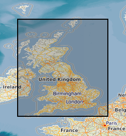
Indicative Atlas of Radon Potential for Great Britain version 3
Radon is a natural radioactive gas which enters buildings from the ground. The joint UK Health Security Agency (UKHSA) - British Geological Survey (BGS) Digital Indicative Atlas of Radon in Great Britain presents an overview of the results of detailed mapping of radon potential, defined as the estimated percentage of homes in an area above the Radon Action Level. Exposure to high concentrations increases the risk of lung cancer. UKHSA (formerly Public Health England) recommends that radon levels should be reduced in homes where the annual average is at or above 200 becquerels per cubic metre (200 Bq m-3). This is termed the Action Level. The UK Health Security Agency defines radon affected areas as those with 1% chance or more of a house having a radon concentration at or above the action level of 200 Bq m-3. The Indicative Atlas of Radon in Great Britain presents a simplified version of the radon potential for Great Britain, in which each 1 km grid square is classed according to the highest radon potential found within it, so the dataset is indicative rather than definitive. The joint UKHSA-BGS Digital Radon Potential for Great Britain dataset provides the current definitive map of Radon Affected Areas in Great Britain.
Simple
- Date (Creation)
- 2021-07-01
Distributor
British Geological Survey
-
Enquiries
0115 936 3276
Environmental Science Centre, Nicker Hill, Keyworth
,
NOTTINGHAM
,
NOTTINGHAMSHIRE
,
NG12 5GG
,
United Kingdom
0115 936 3143
0115 936 3276
Point of contact
British Geological Survey
-
Enquiries
0115 936 3276
Environmental Science Centre, Nicker Hill, Keyworth
,
NOTTINGHAM
,
NOTTINGHAMSHIRE
,
NG12 5GG
,
United Kingdom
0115 936 3143
0115 936 3276
- Maintenance and update frequency
- notPlanned Not planned
- GEMET - INSPIRE themes, version 1.0
- BGS Thesaurus of Geosciences
-
- Natural hazards
- Radon protection
- Geohazards
- UK Location (INSPIRE)
- Geochemistry
- Radon potential
- dataCentre
- Keywords
-
- NERC_DDC
- Access constraints
- otherRestrictions Other restrictions
- Other constraints
- no limitations
- Other constraints
- The dataset is made freely available for access, e.g. via the Internet. Either no third party data / information is contained in the dataset or BGS has secured written permission from the owner(s) of any third party data / information contained in the dataset to make the dataset freely accessible.
- Use constraints
- otherRestrictions Other restrictions
- Other constraints
- The copyright of materials derived from the British Geological Survey's work is vested in the Natural Environment Research Council [NERC]. No part of this work may be reproduced or transmitted in any form or by any means, or stored in a retrieval system of any nature, without the prior permission of the copyright holder, via the BGS Intellectual Property Rights Manager. Use by customers of information provided by the BGS, is at the customer's own risk. In view of the disparate sources of information at BGS's disposal, including such material donated to BGS, that BGS accepts in good faith as being accurate, the Natural Environment Research Council (NERC) gives no warranty, expressed or implied, as to the quality or accuracy of the information supplied, or to the information's suitability for any use. NERC/BGS accepts no liability whatever in respect of loss, damage, injury or other occurence however caused.
- Other constraints
- Available under the Open Government Licence subject to the following acknowledgement accompanying the reproduced NERC materials "Contains NERC materials ©NERC [year]"
- Spatial representation type
- vector Vector
- Distance
- 1000 urn:ogc:def:uom:EPSG::9001
- Metadata language
- EnglishEnglish
- Topic category
-
- Geoscientific information
- Geographic identifier
-
GBN
- Date (Revision)
- 2009
- Geographic identifier
-
GREAT BRITAIN [id=139600]
- Date (Creation)
- 1979
N
S
E
W
))
- End date
- 2021-06 Before
- Unique resource identifier
- OSGB 1936 / British National Grid (EPSG::27700)
- Unique resource identifier
- WGS 84 (EPSG::4326)
- Distribution format
-
-
ESRI Shapefile (.shp)
()
-
GeoPackage (.gpkg)
()
-
ESRI Shapefile (.shp)
()
Distributor
British Geological Survey
-
Enquiries
0115 936 3276
Environmental Science Centre, Nicker Hill, Keyworth
,
NOTTINGHAM
,
NOTTINGHAMSHIRE
,
NG12 5GG
,
United Kingdom
0115 936 3143
0115 936 3276
- OnLine resource
- BGS Datasets - Radon data: Indicative Atlas of Radon Homepage
- OnLine resource
- Digital Object Identifier (DOI)
- Hierarchy level
- dataset Dataset
- Other
- dataset
Conformance result
- Date (Publication)
- 2011
- Explanation
- See the referenced specification
- Pass
- No
Conformance result
- Date (Publication)
- 2010-12-08
- Explanation
- See http://eur-lex.europa.eu/LexUriServ/LexUriServ.do?uri=OJ:L:2010:323:0011:0102:EN:PDF
- Pass
- No
- Statement
- The Indicative Atlas of Radon in Great Britain presents a simplified version of the radon potential for Great Britain. It represents a cellular grid coverage of Great Britain with each cell represented by a 1 km square. Each 1 km grid square is classed according to the highest radon potential found within it (as indicated by the Radon Potential dataset). As a map showing the MAXIMUM potential class for each square, the map is indicative rather than definitive. The Radon Potential dataset is derived by combining a simplified version of the geology of Great Britain (BGS Geology 50k version 8) with indoor radon measurement data collected by UK Health Security Agency (UKHSA) (formerly Public Health England, PHE). The land area is first divided up into simplified geologies, a combination of bedrock and superficial geological characteristics, derived from BGS Geology 50k (1:50 000 scale) digital geological map data. A bedrock /superficial (BS) code is assigned to each of them. Each different simplified geology may appear at the land surface in many discontinuous locations across the country. The UK Health Security Agency has a database of houses in which long-term (3 to 6 months) measurements of radon concentration have been made, and whose locations are accurately known. Each of these measurements is allocated to the underlying geological polygon and the actual coordinates of each radon concentration measurement is removed. This procedure ensures anonymization of house data. Taking each simplified geology in turn, the spatial variation of radon potential is mapped, treating the geology as if it were continuous over the land area. Bedrock, stratigraphic (order in which rock layers are laid down) or lithological (rock characteristics) generalisations of the simplified geologies may be required to ensure that the number of radon measurements is sufficient to estimate the radon potential. All the maps of radon potential within different simplified geologies are then combined to produce a map of variation in radon potential over the whole land surface. This dataset formed the raw data on which processing was carried out to ensure all end-users would achieve consistent results. All data processing was carried out using ESRI ArcGIS 10.7 software.
- File identifier
- e943ecb2-c82d-240b-e053-0937940ac5ca XML
- Metadata language
- EnglishEnglish
- Hierarchy level
- dataset Dataset
- Date stamp
- 2025-11-13
- Metadata standard name
- UK GEMINI
- Metadata standard version
- 2.3
Point of contact
British Geological Survey
Environmental Science Centre,Keyworth
,
NOTTINGHAM
,
NOTTINGHAMSHIRE
,
NG12 5GG
,
United Kingdom
+44 115 936 3100
- Dataset URI
- http://data.bgs.ac.uk/id/dataHolding/13607973
Overviews
Spatial extent
N
S
E
W
Provided by

Associated resources
Not available