 NERC Data Catalogue Service
EPSRC project paper: New insights from 3D geological models at analogue CO2 storage sites in Lincolnshire and eastern Scotland, UK
Subsurface 3D geological models of aquifer and seal rock systems from two contrasting analogue sites have been created as the first step in an investigation into methodologies for geological storage of carbon dioxide in saline aquifers. Development of the models illustrates the utility of an integrated approach using digital techniques and expert geological knowledge to further geological understanding. The models visualize a faulted, gently dipping Permo-Triassic succession in Lincolnshire and a complex faulted and folded Devono-Carboniferous succession in eastern Scotland. The Permo-Triassic is present in the Lincolnshire model to depths of -2 km OD, and includes the aquifers of the Sherwood Sandstone and Rotliegendes groups. Model-derived thickness maps test and refine Permian palaeogeography, such as the location of a carbonate reef and its associated seaward slope, and the identification of aeolian dunes. Analysis of borehole core samples established average 2D porosity values for the Rotliegendes (16%) and Sherwood Sandstone (20%) groups, and the Zechstein (5%) and Mercia Mudstone (<10%) groups, which are favourable for aquifer and seal units respectively. Core sample analysis has revealed a complex but wellunderstood diagenetic history. Re-interpretation of newly reprocessed seismic data in eastern Scotland has significantly reduced interpretative uncertainty of aquifer and seal units at depths of up to -6 km OD in a complex faulted and folded Devonian-Carboniferous succession. Synthesis of diverse data in the 3D geological model defines a set of growth folds and faults indicative of active Visean to Westphalian dextral-strike slip, with no major changes in structural style throughout the Carboniferous, in contrast to some published tectonic models. Average 2D porosity values are 14-17% in aquifer units and <2% in the seal unit, with a ferroan dolomite cement occluding porosity at depth.
Simple
- Date (Creation)
- 2012-06-27
Author
British Geological Survey
-
Enquiries
0115 936 3276
The Lyell Centre, Research Avenue South
,
EDINBURGH
,
LOTHIAN
,
EH14 4AP
,
United Kingdom
0115 936 3142
0115 936 3276
Distributor
British Geological Survey
-
Enquiries
0115 936 3276
The Lyell Centre, Research Avenue South
,
EDINBURGH
,
LOTHIAN
,
EH14 4AP
,
United Kingdom
0115 936 3142
0115 936 3276
Distributor
British Geological Survey
-
Enquiries
0115 936 3276
Environmental Science Centre, Nicker Hill, Keyworth
,
NOTTINGHAM
,
NOTTINGHAMSHIRE
,
NG12 5GG
,
United Kingdom
0115 936 3143
0115 936 3276
Point of contact
British Geological Survey
-
Enquiries
0115 936 3276
Environmental Science Centre, Nicker Hill, Keyworth
,
NOTTINGHAM
,
NOTTINGHAMSHIRE
,
NG12 5GG
,
United Kingdom
0115 936 3143
0115 936 3276
- Maintenance and update frequency
- notApplicable notApplicable
- GEMET - INSPIRE themes, version 1.0
- BGS Thesaurus of Geosciences
-
- UKCCS
- NGDC Deposited Data
- Energy conservation
- Energy storage
- Carbon
- Fossil fuels
- dataCentre
- Keywords
-
- NERC_DDC
- Access constraints
- otherRestrictions Other restrictions
- Other constraints
- intellectualPropertyRights
- Use constraints
- otherRestrictions Other restrictions
- Other constraints
- The copyright of materials derived from the British Geological Survey's work is vested in the Natural Environment Research Council [NERC]. No part of this work may be reproduced or transmitted in any form or by any means, or stored in a retrieval system of any nature, without the prior permission of the copyright holder, via the BGS Intellectual Property Rights Manager. Use by customers of information provided by the BGS, is at the customer's own risk. In view of the disparate sources of information at BGS's disposal, including such material donated to BGS, that BGS accepts in good faith as being accurate, the Natural Environment Research Council (NERC) gives no warranty, expressed or implied, as to the quality or accuracy of the information supplied, or to the information's suitability for any use. NERC/BGS accepts no liability whatever in respect of loss, damage, injury or other occurence however caused.
- Other constraints
- Either: (i) the dataset is made freely available, e.g. via the Internet, for a restricted category of use (e.g. educational use only); or (ii) the dataset has not been formally approved by BGS for access and use by external clients under licence, but its use may be permitted under alternative formal arrangements; or (iii) the dataset contains 3rd party data or information obtained by BGS under terms and conditions that must be consulted in order to determine the permitted usage of the dataset. Refer to the BGS staff member responsible for the creation of the dataset if further advice is required. He / she should be familiar with the composition of the dataset, particularly with regard to 3rd party IPR contained in it, and any resultant use restrictions. This staff member should revert to the IPR Section (ipr@bgs.ac.uk ) for advice, should the position not be clear.
- Metadata language
- EnglishEnglish
- Topic category
-
- Geoscientific information
N
S
E
W
))
- End date
- 2013-05-03 Before
- Supplemental Information
- Files located at http://nora.nerc.ac.uk/18485/
Reference System Information
No information provided.
- Distribution format
-
Distributor
British Geological Survey
-
Enquiries
0115 936 3276
The Lyell Centre, Research Avenue South
,
EDINBURGH
,
LOTHIAN
,
EH14 4AP
,
United Kingdom
0115 936 3142
0115 936 3276
Distributor
British Geological Survey
-
Enquiries
0115 936 3276
Environmental Science Centre, Nicker Hill, Keyworth
,
NOTTINGHAM
,
NOTTINGHAMSHIRE
,
NG12 5GG
,
United Kingdom
0115 936 3143
0115 936 3276
- OnLine resource
- http://www.bgs.ac.uk/ukccs/accessions/index.html#item72731
- Hierarchy level
- dataset Dataset
- Other
- dataset
Conformance result
- Date (Publication)
- 2011
- Explanation
- See the referenced specification
- Pass
- No
Conformance result
- Date (Publication)
- 2010-12-08
- Explanation
- See http://eur-lex.europa.eu/LexUriServ/LexUriServ.do?uri=OJ:L:2010:323:0011:0102:EN:PDF
- Pass
- No
- Statement
- Peer-reviewed paper published in the Proceedings of the Yorkshire Geological Society, 59 (1). 53-76. 10.1144/pygs.59.1.289
- File identifier
- dbd1bf52-4bf9-253c-e044-0003ba9b0d98 XML
- Metadata language
- EnglishEnglish
- Hierarchy level
- dataset Dataset
- Date stamp
- 2025-11-13
- Metadata standard name
- UK GEMINI
- Metadata standard version
- 2.3
Point of contact
British Geological Survey
Environmental Science Centre,Keyworth
,
NOTTINGHAM
,
NOTTINGHAMSHIRE
,
NG12 5GG
,
United Kingdom
+44 115 936 3100
- Dataset URI
- http://data.bgs.ac.uk/id/dataHolding/13605742
Overviews
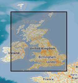
Spatial extent
N
S
E
W
Provided by

Associated resources
Not available