 NERC Data Catalogue Service
Temperature Maps of the British Coalfields
Simple
- Date (Creation)
- 2020-11
0115 936 3276
0115 936 3276
- Maintenance and update frequency
- notPlanned Not planned
- GEMET - INSPIRE themes, version 1.0
- BGS Thesaurus of Geosciences
-
- UK Location (INSPIRE)
- Energy
- Carboniferous
- Coal
- Coal fields
- Mine waters
- Temperature
- dataCentre
- Keywords
-
- NERC_DDC
- Access constraints
- otherRestrictions Other restrictions
- Other constraints
- licenceOGL
- Use constraints
- otherRestrictions Other restrictions
- Other constraints
- The copyright of materials derived from the British Geological Survey's work is vested in the Natural Environment Research Council [NERC]. No part of this work may be reproduced or transmitted in any form or by any means, or stored in a retrieval system of any nature, without the prior permission of the copyright holder, via the BGS Intellectual Property Rights Manager. Use by customers of information provided by the BGS, is at the customer's own risk. In view of the disparate sources of information at BGS's disposal, including such material donated to BGS, that BGS accepts in good faith as being accurate, the Natural Environment Research Council (NERC) gives no warranty, expressed or implied, as to the quality or accuracy of the information supplied, or to the information's suitability for any use. NERC/BGS accepts no liability whatever in respect of loss, damage, injury or other occurence however caused.
- Other constraints
- Available under the Open Government Licence subject to the following acknowledgement accompanying the reproduced NERC materials "Contains NERC materials ©NERC [year]"
- Spatial representation type
- vector Vector
- Metadata language
- EnglishEnglish
- Topic category
-
- Geoscientific information
- Geographic identifier
-
GBN
- Date (Revision)
- 2009
- Geographic identifier
-
GREAT BRITAIN [id=139600]
- Date (Creation)
- 1979
))
- End date
- 2020-11-16 Before
- Unique resource identifier
- OSGB 1936 / British National Grid (EPSG::27700)
- Distribution format
-
-
Geopackage
()
-
Shapefile
()
-
Geopackage
()
0115 936 3276
- OnLine resource
- Published Paper
- OnLine resource
- Data view
- OnLine resource
- Data
- OnLine resource
- Digital Object Identifier (DOI)
- OnLine resource
-
Temperature Maps of the British Coalfields
(
OGC:WMS-1.3.0-http-get-capabilities
)
This dataset provides the first map and synthesis of the temperature of Britain's coalfields. It was created to support low-temperature heat recovery, cooling and storage schemes using mine water in abandoned workings. This baseline spatial mapping and synthesis of coalfield temperatures offers significant benefit to those planning, designing and regulating heat recovery and storage in Britain's abandoned coalfields. The data has been developed jointly by the Coal Authority and the British Geological Survey. It is delivered as a hexgrid representing mine water blocks, identifying equilibrium mine temperatures at 10 depth intervals (100m - 1000m) and pumped mine temperatures at 6 depth intervals (100m - 600m).
- Hierarchy level
- dataset Dataset
- Other
- dataset
Conformance result
- Date (Publication)
- 2011
- Explanation
- See the referenced specification
- Pass
- No
Conformance result
- Date (Publication)
- 2010-12-08
- Explanation
- See http://eur-lex.europa.eu/LexUriServ/LexUriServ.do?uri=OJ:L:2010:323:0011:0102:EN:PDF
- Pass
- No
- Statement
- This map has been produced using Coal Authority ‘mine water blocks’ which illustrate the best known hydrological divisions in coalfields. The boundaries have been hexagonised to reflect uncertainty in their margins. Data from three sources were used to estimate temperatures including (1) Coal Authority downhole temperature profiles, from boreholes and shafts that intercept flooded workings; (2) the BGS UK Geothermal Catalogue (UKGC) including data from the National Coal Board, hydrocarbon boreholes and other investigative boreholes, representing both mined and unmined areas of the coalfields; (3) historical in situ strata temperatures measured directly in coal seams within operational coal mines.
- File identifier
- d962189b-e7ed-2998-e054-002128a47908 XML
- Metadata language
- EnglishEnglish
- Hierarchy level
- dataset Dataset
- Date stamp
- 2025-11-13
- Metadata standard name
- UK GEMINI
- Metadata standard version
- 2.3
- Dataset URI
- http://data.bgs.ac.uk/id/dataHolding/13607914
Overviews
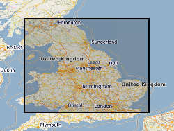
Spatial extent
Provided by
