 NERC Data Catalogue Service
Marine Aggregate Sustainability Fund (MALSF) Geology and Geophysics Survey Data (2003 to 2010)
Simple
- Date (Creation)
- 2003
0115 936 3276
0115 936 3276
0115 936 3276
0115 936 3276
- Maintenance and update frequency
- notPlanned Not planned
- GEMET - INSPIRE themes, version 1.0
- BGS Thesaurus of Geosciences
-
- Geological surveys
- Geophysical data
- Marine geology
- Marine geophysics
- Marine seismic surveys
- Geology
- Geophysics
- Geophysical surveys
- Magnetic data
- Sampling
- Bathymetry
- Sea floor
- Core drilling
- Gravity surveys
- Magnetic surveys
- Seismic surveys
- Geological data
- Gravity data
- Marine gravity surveys
- Marine magnetic surveys
- Marine surveys
- Seismic data
- Seismic reflection surveys
- MEDIN
- UK Location (INSPIRE)
- dataCentre
- Keywords
-
- NERC_DDC
- Access constraints
- otherRestrictions Other restrictions
- Other constraints
- licenceOGL
- Use constraints
- otherRestrictions Other restrictions
- Other constraints
- The copyright of materials derived from the British Geological Survey's work is vested in the Natural Environment Research Council [NERC]. No part of this work may be reproduced or transmitted in any form or by any means, or stored in a retrieval system of any nature, without the prior permission of the copyright holder, via the BGS Intellectual Property Rights Manager. Use by customers of information provided by the BGS, is at the customer's own risk. In view of the disparate sources of information at BGS's disposal, including such material donated to BGS, that BGS accepts in good faith as being accurate, the Natural Environment Research Council (NERC) gives no warranty, expressed or implied, as to the quality or accuracy of the information supplied, or to the information's suitability for any use. NERC/BGS accepts no liability whatever in respect of loss, damage, injury or other occurence however caused.
- Other constraints
- Available under the Open Government Licence subject to the following acknowledgement accompanying the reproduced NERC materials "Contains NERC materials ©NERC [year]"
- Denominator
- 50000
- Metadata language
- EnglishEnglish
- Topic category
-
- Geoscientific information
- Geographic identifier
-
BRISTOL CHANNEL [id=2001350]
- Date (Revision)
- 2010
- Geographic identifier
-
CELTIC SEA [id=2001353]
- Date (Revision)
- 2010
- Geographic identifier
-
DOVER STRAIT [id=2001363]
- Date (Revision)
- 2010
- Geographic identifier
-
ENGLISH CHANNEL [id=2001401]
- Date (Revision)
- 2010
- Geographic identifier
-
NORTH ATLANTIC OCEAN [id=2002262]
- Date (Revision)
- 2010
- Geographic identifier
-
NORTH SEA [id=2001452]
- Date (Revision)
- 2010
- Geographic identifier
-
NORTHEAST ATLANTIC OCEAN (40W) [id=2001453]
- Date (Revision)
- 2010
- Geographic identifier
-
NORTHWEST EUROPEAN CONTINENTAL SHELF [id=121700]
- Date (Creation)
- 1979
- Geographic identifier
-
UK CONTINENTAL SHELF [id=121701]
- Date (Creation)
- 1979
))
- Begin date
- 2003
- End date
- 2010
- Unique resource identifier
- WGS 84 (EPSG::4326)
- Distribution format
-
-
Varies by survey depending on data type. Standard data exchange formats are used.
()
-
Varies by survey depending on data type. Standard data exchange formats are used.
()
0115 936 3276
- OnLine resource
-
GeoIndex Offshore
(
WWW:LINK-1.0-http--link
)
BGS GeoIndex is a web tool for professional users who need to access BGS data as part of their business requirements. The map viewer is free to use and is designed to work on desktop and mobile devices.
- OnLine resource
-
GeoIndex_Offshore_offshore_data
(
OGC:WMS
)
One or more layers for the dataset is provided through this OGC WMS (view) service. This URL is the service end-point and is intended for consumption by software clients that understand the WMS API.
- Hierarchy level
- dataset Dataset
- Other
- dataset
Conformance result
- Date (Publication)
- 2011
- Explanation
- See the referenced specification
- Pass
- No
Conformance result
- Date (Publication)
- 2010-12-08
- Explanation
- See http://eur-lex.europa.eu/LexUriServ/LexUriServ.do?uri=OJ:L:2010:323:0011:0102:EN:PDF
- Pass
- No
- Statement
- The Regional Environmental Characterisations (RECs) were conducted by various organisations in the following areas - South Coast (2007 - 2010) Outer Thames (2007-2009) East Coast (2008 - 2011) Humber (2008 - 2011). A number of surveys were conducted for each REC project for biological, geological, sediment characterization. Data, collected using various techniques, was interpreted and final reports and seabed maps produced (available at www.marinealsf.org.uk). Data were provided to the MEDIN Data Archive Centres including BGS, DASSH and UKHO for long term archiving and are available from these.
- File identifier
- c4291735-b029-3e0e-e044-0003ba9b0d98 XML
- Metadata language
- EnglishEnglish
- Hierarchy level
- dataset Dataset
- Date stamp
- 2025-11-13
- Metadata standard name
- UK GEMINI
- Metadata standard version
- 2.3
- Dataset URI
- http://data.bgs.ac.uk/id/dataHolding/13605658
Overviews
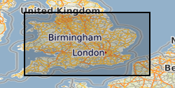
Spatial extent
Provided by
