 NERC Data Catalogue Service
Marine geotechnical data from around the UK (1975 onwards)
Simple
- Date (Creation)
- 1975
0115 936 3276
0115 936 3276
- Maintenance and update frequency
- irregular Irregular
- GEMET - INSPIRE themes, version 1.0
- BGS Thesaurus of Geosciences
-
- Geology
- EGDI
- Marine geology
- Marine sediments
- Marine surveys
- Sea floor sediments
- MEDIN
- Core drilling
- Boreholes
- UK Location (INSPIRE)
- Bottom sampling
- Marine geotechnical assessment
- dataCentre
- Keywords
-
- NERC_DDC
- Access constraints
- otherRestrictions Other restrictions
- Use constraints
- otherRestrictions Other restrictions
- Other constraints
- The copyright of materials derived from the British Geological Survey's work is vested in the Natural Environment Research Council [NERC]. No part of this work may be reproduced or transmitted in any form or by any means, or stored in a retrieval system of any nature, without the prior permission of the copyright holder, via the BGS Intellectual Property Rights Manager. Use by customers of information provided by the BGS, is at the customer's own risk. In view of the disparate sources of information at BGS's disposal, including such material donated to BGS, that BGS accepts in good faith as being accurate, the Natural Environment Research Council (NERC) gives no warranty, expressed or implied, as to the quality or accuracy of the information supplied, or to the information's suitability for any use. NERC/BGS accepts no liability whatever in respect of loss, damage, injury or other occurence however caused.
- Other constraints
- Available under the Open Government Licence subject to the following acknowledgement accompanying the reproduced NERC materials "Contains NERC materials ©NERC [year]"
- Spatial representation type
- vector Vector
- Denominator
- 250000
- Metadata language
- EnglishEnglish
- Topic category
-
- Geoscientific information
- Geographic identifier
-
INNER SEAS OFF THE WEST COAST OF SCOTLAND [id=2001428]
- Date (Revision)
- 2010
- Geographic identifier
-
NORTH SEA [id=2001452]
- Date (Revision)
- 2010
- Geographic identifier
-
NORTHEAST ATLANTIC OCEAN (40W) [id=2001453]
- Date (Revision)
- 2010
- Geographic identifier
-
UK CONTINENTAL SHELF [id=121701]
- Date (Creation)
- 1979
))
- Begin date
- 1975 Before
- Unique resource identifier
- ED50 (EPSG::4230)
- Unique resource identifier
- WGS 84 (EPSG::4326)
- Distribution format
-
-
Vector GIS data
()
-
PDF file (.pdf)
()
-
CSV file (.csv)
()
-
Vector GIS data
()
0115 936 3276
- OnLine resource
-
GeoIndex Offshore
(
WWW:LINK-1.0-http--link
)
BGS GeoIndex is a web tool for professional users who need to access BGS data as part of their business requirements. The map viewer is free to use and is designed to work on desktop and mobile devices.
- OnLine resource
-
GeoIndex_Offshore_offshore_data
(
OGC:WMS
)
One or more layers for the dataset is provided through this OGC WMS (view) service. This URL is the service end-point and is intended for consumption by software clients that understand the WMS API.
- Hierarchy level
- dataset Dataset
- Other
- dataset
Conformance result
- Date (Publication)
- 2011
- Explanation
- See the referenced specification
- Pass
- No
Conformance result
- Date (Publication)
- 2010-12-08
- Explanation
- See http://eur-lex.europa.eu/LexUriServ/LexUriServ.do?uri=OJ:L:2010:323:0011:0102:EN:PDF
- Pass
- No
- Statement
- Borehole and shallow core material were collected by BGS during offshore surveys using various sampling techniques such as vibrocore, gravity core and wireline drilling. Geotechnical tests were carried out using hand-held test equipment (penetrometers and shear vanes). This dataset has been managed by BGS over a considerable period of time. Legacy paper records have undergone selective scanning and transcription to digital formats, with ongoing QC of the information captured, and addition to the BGS database. More recent data are captured digitally and, where appropriate, loaded to the database. Data are stored as part of the National Geoscience Data Centre (NGDC) and information is delivered via the BGS website and BGS GeoIndex.
- File identifier
- c35e3405-9dae-6d8b-e044-0003ba9b0d98 XML
- Metadata language
- EnglishEnglish
- Hierarchy level
- dataset Dataset
- Date stamp
- 2025-11-13
- Metadata standard name
- UK GEMINI
- Metadata standard version
- 2.3
- Dataset URI
- http://data.bgs.ac.uk/id/dataHolding/13605644
Overviews
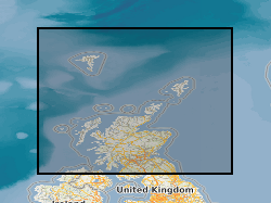
Spatial extent
Provided by
