 NERC Data Catalogue Service
Hydrogeological Maps of Scotland version 2
The BGS Hydrogeological Maps of Scotland data product is comprised of three datasets: Bedrock Aquifer Productivity (Scotland); Superficial Aquifer Productivity (Scotland); and Groundwater Vulnerability (Scotland). Aquifer productivity is a measure of the potential of aquifers to sustain a borehole water supply. The Aquifer Productivity (Scotland) datasets indicate the location and productivity of bedrock and superficial aquifers across Scotland, and their groundwater flow characteristics. The Groundwater Vulnerability (Scotland) dataset shows the relative vulnerability of groundwater to contamination across Scotland. The BGS Hydrogeological Maps of Scotland data product is developed as a tool to support groundwater resource management. It may be useful to anyone interested in learning more about, assessing or managing groundwater resources across Scotland. The datasets within the product are delivered at 1: 100 000 scale.
Simple
- Date (Creation)
- 2015-10-20
Distributor
British Geological Survey
-
Enquiries
0115 936 3276
The Lyell Centre, Research Avenue South
,
EDINBURGH
,
LOTHIAN
,
EH14 4AP
,
United Kingdom
0115 936 3142
0115 936 3276
Point of contact
British Geological Survey
-
Enquiries
0115 936 3276
The Lyell Centre, Research Avenue South
,
EDINBURGH
,
LOTHIAN
,
EH14 4AP
,
United Kingdom
0115 936 3142
0115 936 3276
- Maintenance and update frequency
- unknown Unknown
- GEMET - INSPIRE themes, version 1.0
- BGS Thesaurus of Geosciences
-
- Aquifers
- Bed rock
- GIS
- UK Location (INSPIRE)
- Scottish SDI
- Groundwater
- Surficial geology
- dataCentre
- Keywords
-
- NERC_DDC
- Access constraints
- otherRestrictions Other restrictions
- Other constraints
- license
- Use constraints
- otherRestrictions Other restrictions
- Other constraints
- The copyright of materials derived from the British Geological Survey's work is vested in the Natural Environment Research Council [NERC]. No part of this work may be reproduced or transmitted in any form or by any means, or stored in a retrieval system of any nature, without the prior permission of the copyright holder, via the BGS Intellectual Property Rights Manager. Use by customers of information provided by the BGS, is at the customer's own risk. In view of the disparate sources of information at BGS's disposal, including such material donated to BGS, that BGS accepts in good faith as being accurate, the Natural Environment Research Council (NERC) gives no warranty, expressed or implied, as to the quality or accuracy of the information supplied, or to the information's suitability for any use. NERC/BGS accepts no liability whatever in respect of loss, damage, injury or other occurence however caused.
- Other constraints
- The dataset is made available to external clients under BGS Digital Data Licence terms and conditions. Revert to the IPR Section (iprdigital@bgs.ac.uk ) if further advice is required with regard to permitted usage.
- Spatial representation type
- vector Vector
- Metadata language
- EnglishEnglish
- Topic category
-
- Geoscientific information
- Geographic identifier
-
SCOTLAND [id=140000]
- Date (Creation)
- 1979
- Geographic identifier
-
SCT
- Date (Revision)
- 2009
N
S
E
W
))
- End date
- 2015-10-20 Before
- Unique resource identifier
- OSGB 1936 / British National Grid (EPSG::27700)
- Distribution format
-
-
ESRI Shapefiles
(
Nor entered
)
-
ESRI Shapefiles
(
Nor entered
)
Distributor
British Geological Survey
-
Enquiries
0115 936 3276
The Lyell Centre, Research Avenue South
,
EDINBURGH
,
LOTHIAN
,
EH14 4AP
,
United Kingdom
0115 936 3142
0115 936 3276
- OnLine resource
- https://www.bgs.ac.uk/datasets/hydrogeological-maps-of-scotland/
- OnLine resource
- Digital Object Identifier (DOI)
- Hierarchy level
- dataset Dataset
- Other
- dataset
Conformance result
- Date (Publication)
- 2011
- Explanation
- See the referenced specification
- Pass
- No
Conformance result
- Date (Publication)
- 2010-12-08
- Explanation
- See http://eur-lex.europa.eu/LexUriServ/LexUriServ.do?uri=OJ:L:2010:323:0011:0102:EN:PDF
- Pass
- No
- Statement
- The aquifer productivity data was developed in ArcGIS using BGS digital geology linework at a scale of 1:50,000: DiGMapGB-50, Version 5.18. Each of the geological formations in the 1:50 000-scale DiGMap superficial deposits geology map was classified according to the likely aquifer productivity. For a small number of map sheets, 1:50 000 scale superficial deposits mapping has not yet been done, and in these cases, superficial deposits linework and attribute data at other scales, including 1:625 000 scale, were merged in. Each of the geological formations in the 1:50,000 scale DiGMap bedrock geology was classified according to two criteria: (1) the predominant groundwater flow type (2) the estimated aquifer productivity of the formation. Input datsets include: BGS Geology 50K (formerly known as DiGMapGB-50 (Digital Geological Map of Great Britain at 1:50 000)) (Bedrock) Version 5.18 Permeability Dataset for Great Britain (Superficial) Version 6.0 (British Geological Survey 2010). The groundwater vulnerability dataset was produced in ArcGIS by combining a range of environmental datasets using a rule-based method to define a vulnerability classification. Groundwater vulnerability is described by one of five relative classes ranging from 1 (lowest vulnerability) to 5 (highest vulnerability). Input datasets include: BGS Geology 50K (formerly known as DiGMapGB-50 (Digital Geological Map of Great Britain at 1:50 000)) (Bedrock) Version 5.18 Permeability Dataset for Great Britain (Superficial) Version 6.0 (British Geological Survey 2010) Depth to groundwater level in superficial deposits (BGS) Depth to groundwater level in bedrock aquifers (BGS) HOST (Hydrology of Soil Types) Class from the James Hutton Institute (formerly the Macaulay Institute) Superficial deposits thickness (BGS)
- File identifier
- b6922388-672e-7390-e054-002128a47908 XML
- Metadata language
- EnglishEnglish
- Hierarchy level
- dataset Dataset
- Date stamp
- 2025-11-13
- Metadata standard name
- UK GEMINI
- Metadata standard version
- 2.3
Point of contact
British Geological Survey
The Lyell Centre, Research Avenue South
,
EDINBURGH
,
LOTHIAN
,
EH14 4AP
,
United Kingdom
+44 131 667 1000
- Dataset URI
- http://data.bgs.ac.uk/id/dataHolding/13607695
Overviews
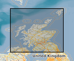
Spatial extent
N
S
E
W
Provided by

Associated resources
Not available