 NERC Data Catalogue Service
BGS Mineral Resources Wales version 2
Simple
- Date (Creation)
- 2020
0115 936 3276
0115 936 3276
- Maintenance and update frequency
- asNeeded As needed
- GEMET - INSPIRE themes, version 1.0
- BGS Thesaurus of Geosciences
-
- Mineral resource maps
- Mineral resources
- Minerals
- UK Location (INSPIRE)
- Planning
- dataCentre
- Keywords
-
- NERC_DDC
- Access constraints
- otherRestrictions Other restrictions
- Other constraints
- license
- Use constraints
- otherRestrictions Other restrictions
- Other constraints
- The copyright of materials derived from the British Geological Survey's work is vested in the Natural Environment Research Council [NERC]. No part of this work may be reproduced or transmitted in any form or by any means, or stored in a retrieval system of any nature, without the prior permission of the copyright holder, via the BGS Intellectual Property Rights Manager. Use by customers of information provided by the BGS, is at the customer's own risk. In view of the disparate sources of information at BGS's disposal, including such material donated to BGS, that BGS accepts in good faith as being accurate, the Natural Environment Research Council (NERC) gives no warranty, expressed or implied, as to the quality or accuracy of the information supplied, or to the information's suitability for any use. NERC/BGS accepts no liability whatever in respect of loss, damage, injury or other occurence however caused.
- Other constraints
- The dataset is made available to external clients under BGS Digital Data Licence terms and conditions. Revert to the IPR Section (iprdigital@bgs.ac.uk ) if further advice is required with regard to permitted usage.
- Spatial representation type
- vector Vector
- Denominator
- 50000
- Metadata language
- EnglishEnglish
- Topic category
-
- Geoscientific information
- Geographic identifier
-
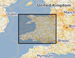
WALES [id=170000]
- Date (Creation)
- 1979
- Geographic identifier
-
WLS
- Date (Revision)
- 2009
))
- End date
- 2020-11 Before
- Unique resource identifier
- OSGB 1936 / British National Grid (EPSG::27700)
- Distribution format
-
-
GIS polygon data. (ESRI, MapInfo, others available by request)
()
-
GIS polygon data. (ESRI, MapInfo, others available by request)
()
0115 936 3276
- OnLine resource
-
DOI - BGS Mineral Resources Wales version 2
(
WWW:LINK-1.0-http--related
)
British Geological Survey (2021): BGS Mineral Resources Wales version 2. British Geological Survey. (Dataset). https://doi.org/10.5285/83c4e31f-237d-4fa7-a345-7648315f4d22
- OnLine resource
-
Mineral resources
(
WWW:LINK-1.0-http--link
)
This dataset contains the geological distribution of all onshore mineral resources.
- Hierarchy level
- dataset Dataset
- Other
- dataset
Conformance result
- Date (Publication)
- 2011
- Explanation
- See the referenced specification
- Pass
- No
Conformance result
- Date (Publication)
- 2010-12-08
- Explanation
- See http://eur-lex.europa.eu/LexUriServ/LexUriServ.do?uri=OJ:L:2010:323:0011:0102:EN:PDF
- Pass
- No
- Statement
- [1] BGS DiGMapGB-50 version 5 geology polygons were clipped to the county boundary. [2] A list and map of the geological lithologies for each county were supplied to the Economic Geologist for interpretation of which bedrock and superficial geological formations might now, or in the foreseeable future, be of economic value. [3] Interpretations are then extracted from the derived from DiGMapGB-50 version 5 and given a mineral resource attribute and colour. [4] Maps were re-supplied to the Economic Geologist for correction. Small areas of resources were deleted when considered to be uneconomic/unworkable. [5] Drafts of the finished maps taken to stakeholders for comment. [6] Maps approved and digital data, collated for each map, sent to GIS specialist for dataset preparation and cleaning. [7] Data produced for each map was merged together to produce regional files based on resource commodity. [8] Mineral commodity and name attributes are correctly assigned using the legend supplied by Economic Geologist. [9] Polygons dissolved based on name attribute, removing all county boundaries. [10] Remove sliver polygons (created as a result of geological sheet boundaries) where possible and re-dissolve. [11] Multipart to single part operation conducted on each dataset. [12] Redundant attributes removed. [13] Repair geometry operation to clean the dataset. [14] Economic Geologist approves final resource dataset. The British Geological Survey (BGS) was awarded a grant from the Welsh Assembly Government Aggregates Levy Fund in 2009 to provide a comprehensive, relevant and accessible information base to enhance the sustainability of mineral resources for Wales. BGS co-funded this project through its Sustainable Mineral Solutions project. This work was completed in 2010. In 2020 minor revisions to geometry and attributes were made in in response to minor corrections that were required. The paper maps were not re-released with these data updates. Point data for mineral occurrence and mine site data has not been included in this revision as these data are superseded by other BGS datasets, such as the BGS BritPits database of mines and quarries.
- File identifier
- b3c3cf14-9b38-60b7-e054-002128a47908 XML
- Metadata language
- EnglishEnglish
- Hierarchy level
- dataset Dataset
- Date stamp
- 2025-11-13
- Metadata standard name
- UK GEMINI
- Metadata standard version
- 2.3
- Dataset URI
- http://data.bgs.ac.uk/id/dataHolding/13607683
Overviews
Spatial extent
Provided by
