 NERC Data Catalogue Service
Marine Hard Substrate Dataset
The Marine Hard Substrate dataset maps areas of rock or hard substrate outcropping or within 0.5m of the sea-bed. For the purpose of this dataset, Hard Substrate was defined as the presence of either rock or clasts >64 mm (boulders or cobbles) within 0.5 m of the seabed. This definition includes sediment veneer overlying hard substrate in some areas. This is used in order to include both infaunal and epifaunal communities and is considered beneficial for habitat mappers. The interpretation was based on a variety of data sourced from within the British Geological Survey and externally. Data consulted includes archive sample and seismic records, side scan sonar, multibeam bathymetry and Olex datasets. The distribution of hard substrate at the seabed, or within 0.5 m of the seabed, is important in dictating the benthic assemblages found in certain areas. Therefore, an understanding of the distribution of these substrates is of primary importance in marine planning and designation of Marine Conservation Zones (MCZs) under the Marine and Coastal Access Act, 2009. In addition, a number of other users will value these data, including marine renewable companies, aggregate companies, the fishing and oil and gas industries. In order to address this issue it was necessary to update British Geological Survey sea-bed mapping to delineate areas where rock, boulders or cobbles are present at, or within 0.5 m of the sea-bed surface. A polygon shape file showing areas of rock or hard substrate at, or within 0.5m of the sea-bed has been developed. The dataset has been created as vector polygons and are available in a range of GIS formats, including ESRI shapefile (.shp) and OGC GeoPackage (.gpkg). More specialised formats may be available but may incur additional processing costs. This dataset has been developed in collaboration with external partners and the methodology used is detailed in the report MB0103 for DEFRA: Developing the necessary data layers for Marine Conservation Zone selection - Distribution of rock/hard substrate on the UK Continental Shelf MB0103 (Gafeira et al., 2010). This dataset was produced for use at 1:250 000 scale. However, in many cases, the detail of the mapping is far greater than expected for this scale as hard substrate delineation was done based on the best available data. This data should not be relied on for local or site-specific geology. Contact BGS Digital Data
(digitaldata@bgs.ac.uk
) for more information on this dataset.
Simple
- Alternate title
- DiGHardSubstrate250k
- Date (Creation)
- 2011-04-01
- Maintenance and update frequency
- irregular Irregular
- GEMET - INSPIRE themes, version 1.0
- BGS Thesaurus of Geosciences
-
- Hardness
- UK Location (INSPIRE)
- Scottish SDI
- Offshore resources
- Reefs
- MEDIN
- Rock structures
- Sea floor sediments
- Geological environment
- Surveys
- Marine geology
- dataCentre
- Keywords
-
- NERC_DDC
- Access constraints
- otherRestrictions Other restrictions
- Other constraints
- no limitations
- Other constraints
- The dataset is made freely available for access, e.g. via the Internet. Either no third party data / information is contained in the dataset or BGS has secured written permission from the owner(s) of any third party data / information contained in the dataset to make the dataset freely accessible.
- Use constraints
- otherRestrictions Other restrictions
- Other constraints
- The copyright of materials derived from the British Geological Survey's work is vested in the Natural Environment Research Council [NERC]. No part of this work may be reproduced or transmitted in any form or by any means, or stored in a retrieval system of any nature, without the prior permission of the copyright holder, via the BGS Intellectual Property Rights Manager. Use by customers of information provided by the BGS, is at the customer's own risk. In view of the disparate sources of information at BGS's disposal, including such material donated to BGS, that BGS accepts in good faith as being accurate, the Natural Environment Research Council (NERC) gives no warranty, expressed or implied, as to the quality or accuracy of the information supplied, or to the information's suitability for any use. NERC/BGS accepts no liability whatever in respect of loss, damage, injury or other occurence however caused.
- Other constraints
- Available under the Open Government Licence subject to the following acknowledgement accompanying the reproduced NERC materials "Contains NERC materials ©NERC [year]"
- Spatial representation type
- vector Vector
- Denominator
- 250000
- Metadata language
- EnglishEnglish
- Topic category
-
- Geoscientific information
- Geographic identifier
-
UK CONTINENTAL SHELF [id=121701]
- Date (Creation)
- 1979
N
S
E
W
))
- Begin date
- 2011 Before
- End date
- 2011
- Unique resource identifier
- WGS 84 (EPSG::4326)
- Distribution format
-
-
ESRI Shapefile (.shp)
()
-
ESRI Shapefile (.shp)
()
- OnLine resource
-
BGS Datasets - Seabed sediments 250k Homepage
This page provides further information about the BGS Seabed Sediments 250k dataset, including a user guide, details about licensing and sample data. The Marine Hard Substrate Dataset may be downloaded from this page.
- Hierarchy level
- dataset Dataset
- Other
- dataset
Conformance result
- Date (Publication)
- 2011
- Explanation
- See the referenced specification
- Pass
- No
Conformance result
- Date (Publication)
- 2010-12-08
- Explanation
- See http://eur-lex.europa.eu/LexUriServ/LexUriServ.do?uri=OJ:L:2010:323:0011:0102:EN:PDF
- Pass
- No
- Statement
- A vector GIS dataset showing the potential extent of rock and hard substrate at, or near (0.5 m), the seabed surface. This has been developed from the rock point data. Additional data and information included available multibeam, side scan, admiralty charts and video/photo.
- File identifier
- 9e32312c-b028-521b-e044-0003ba9b0d98 XML
- Metadata language
- EnglishEnglish
- Hierarchy level
- dataset Dataset
- Date stamp
- 2025-11-13
- Metadata standard name
- UK GEMINI
- Metadata standard version
- 2.3
- Dataset URI
- http://data.bgs.ac.uk/id/dataHolding/13605550
Overviews
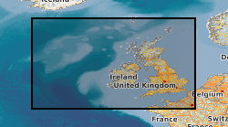
Spatial extent
N
S
E
W
Provided by

Associated resources
Not available