 NERC Data Catalogue Service
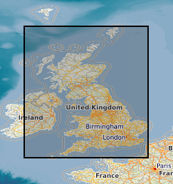
Geotechnical Database
The National Geotechnical Properties Database contains information about site investigation reports, boreholes and samples. It contains geotechnical measurements taken over borehole intervals and on samples. Some of the data are obtained digitally from AGS files (Association of Geotechnical and Geoenvironmental Specialists - File Transfer Format), some are obtained manually from site investigation reports stored in the National Geoscience Data Centre (NGDC). The database currently contains geotechnical data from over 450 000 laboratory test samples and core descriptions, borehole observations and in-situ tests from over 96 000 boreholes extracted from over 4800 site investigation reports. The database underpins BGS geo-engineering properties and processes research and is an important information resource for answering enquiries and providing for the data needs of external customers. The distribution of data often follows major UK infrastructure developments and the coverage of BGS research, including UK rocks and soils engineering geology studies or the areas covered by ground information for sustainable development and geohazards projects. Much of the data are from site investigations for major trunk road construction schemes, often provided by Highways England (formerly the Highways Agency) and other major engineering projects. A small proportion of the data is from BGS laboratory test results. The final investigation data and information are supplied to BGS by clients, consultants and contractors either as final paper records or as Association of Geotechnical and Geoenvironmental Specialists (AGS) digital data transfer format files. AGS digital data transfer format files (.ags) are the preferred method of receiving data because they can be added to the database much more quickly and accurately than adding data by hand from paper records.
Simple
- Alternate title
- National Geotechnical Properties Database
- Date (Creation)
- 1995
Distributor
British Geological Survey
-
Enquiries
0115 936 3276
Environmental Science Centre, Nicker Hill, Keyworth
,
NOTTINGHAM
,
NOTTINGHAMSHIRE
,
NG12 5GG
,
United Kingdom
0115 936 3143
0115 936 3276
Point of contact
British Geological Survey
-
Enquiries
0115 936 3276
Environmental Science Centre, Nicker Hill, Keyworth
,
NOTTINGHAM
,
NOTTINGHAMSHIRE
,
NG12 5GG
,
United Kingdom
0115 936 3143
0115 936 3276
- Maintenance and update frequency
- asNeeded As needed
- GEMET - INSPIRE themes, version 1.0
- BGS Thesaurus of Geosciences
-
- AGS
- Engineering geology
- UK Location (INSPIRE)
- Sampling
- Boreholes
- Geotechnical data
- dataCentre
- Keywords
-
- NERC_DDC
- Access constraints
- otherRestrictions Other restrictions
- Use constraints
- otherRestrictions Other restrictions
- Other constraints
- The copyright of materials derived from the British Geological Survey's work is vested in the Natural Environment Research Council [NERC]. No part of this work may be reproduced or transmitted in any form or by any means, or stored in a retrieval system of any nature, without the prior permission of the copyright holder, via the BGS Intellectual Property Rights Manager. Use by customers of information provided by the BGS, is at the customer's own risk. In view of the disparate sources of information at BGS's disposal, including such material donated to BGS, that BGS accepts in good faith as being accurate, the Natural Environment Research Council (NERC) gives no warranty, expressed or implied, as to the quality or accuracy of the information supplied, or to the information's suitability for any use. NERC/BGS accepts no liability whatever in respect of loss, damage, injury or other occurence however caused.
- Other constraints
- Either: (i) the dataset is made freely available, e.g. via the Internet, for a restricted category of use (e.g. educational use only); or (ii) the dataset has not been formally approved by BGS for access and use by external clients under licence, but its use may be permitted under alternative formal arrangements; or (iii) the dataset contains 3rd party data or information obtained by BGS under terms and conditions that must be consulted in order to determine the permitted usage of the dataset. Refer to the BGS staff member responsible for the creation of the dataset if further advice is required. He / she should be familiar with the composition of the dataset, particularly with regard to 3rd party IPR contained in it, and any resultant use restrictions. This staff member should revert to the IPR Section (ipr@bgs.ac.uk ) for advice, should the position not be clear.
- Spatial representation type
- vector Vector
- Metadata language
- EnglishEnglish
- Topic category
-
- Geoscientific information
- Geographic identifier
-
GB
- Date (Revision)
- 2009
- Geographic identifier
-
UK [id=139300]
- Date (Creation)
- 1979
- Geographic identifier
-
UKM
- Date (Revision)
- 2009
N
S
E
W
))
- Begin date
- 1875
- Unique resource identifier
- OSGB 1936 / British National Grid (EPSG::27700)
- Distribution format
-
-
Text file (TXT)
()
-
Text file (TXT)
()
Distributor
British Geological Survey
-
Enquiries
0115 936 3276
Environmental Science Centre, Nicker Hill, Keyworth
,
NOTTINGHAM
,
NOTTINGHAMSHIRE
,
NG12 5GG
,
United Kingdom
0115 936 3143
0115 936 3276
- OnLine resource
- National Geotechnical Properties Database
- Hierarchy level
- dataset Dataset
- Other
- dataset
Conformance result
- Date (Publication)
- 2011
- Explanation
- See the referenced specification
- Pass
- No
Conformance result
- Date (Publication)
- 2010-12-08
- Explanation
- See http://eur-lex.europa.eu/LexUriServ/LexUriServ.do?uri=OJ:L:2010:323:0011:0102:EN:PDF
- Pass
- No
- Statement
- The database is an aggregate of data from various sources collected over time. Data sources include: digitised data from site investigation reports obtained from external contractors; data collected or digitised from BGS projects such as Applied Geology Mapping (1980s) and the Engineering Geology of UK Rocks and Soils Programme (1990 and 1991); digital data received from external contractors in AGS (Association of Geotechnical and Geoenvironmental Specialists) format. For further information on data provenance, refer to: Self, Suzanne; Entwisle, David; Northmore, Kevin. 2012 The structure and operation of the BGS National Geotechnical Properties Database. Version 2. Nottingham, UK, British Geological Survey, 68pp. (IR/12/056) https://nora.nerc.ac.uk/id/eprint/20815/
- File identifier
- 9df8df52-d7b5-37a8-e044-0003ba9b0d98 XML
- Metadata language
- EnglishEnglish
- Hierarchy level
- dataset Dataset
- Date stamp
- 2025-12-11
- Metadata standard name
- UK GEMINI
- Metadata standard version
- 2.3
Point of contact
British Geological Survey
Environmental Science Centre, Keyworth
,
NOTTINGHAM
,
NOTTINGHAMSHIRE
,
NG12 5GG
,
United Kingdom
+44 115 936 3100
- Dataset URI
- http://data.bgs.ac.uk/id/dataHolding/13480242
Overviews
Spatial extent
N
S
E
W
Provided by

Associated resources
Not available