 NERC Data Catalogue Service
UK continental shelf seabed sediments (1:1 million scale)
UK continental shelf seabed sediment data at 1:1 million scale. This data layer is the BGS contribution to the OneGeology project, providing UK onshore geological data at 1:625 000 scale and UK continental shelf seabed sediment data at 1:1 million scale.
Simple
- Alternate title
- UKCoShelf_BGS_1M_SBS
- Date (Creation)
- 1995
- Maintenance and update frequency
- asNeeded As needed
- GEMET - INSPIRE themes, version 1.0
- BGS Thesaurus of Geosciences
-
- Maps
- Scottish SDI
- Geology
- Data
- Geological age
- UK Location (INSPIRE)
- GIS
- Digital maps
- dataCentre
- Keywords
-
- NERC_DDC
- Access constraints
- otherRestrictions Other restrictions
- Other constraints
- licenceOGL
- Use constraints
- otherRestrictions Other restrictions
- Other constraints
- The copyright of materials derived from the British Geological Survey's work is vested in the Natural Environment Research Council [NERC]. No part of this work may be reproduced or transmitted in any form or by any means, or stored in a retrieval system of any nature, without the prior permission of the copyright holder, via the BGS Intellectual Property Rights Manager. Use by customers of information provided by the BGS, is at the customer's own risk. In view of the disparate sources of information at BGS's disposal, including such material donated to BGS, that BGS accepts in good faith as being accurate, the Natural Environment Research Council (NERC) gives no warranty, expressed or implied, as to the quality or accuracy of the information supplied, or to the information's suitability for any use. NERC/BGS accepts no liability whatever in respect of loss, damage, injury or other occurence however caused.
- Other constraints
- Available under the Open Government Licence subject to the following acknowledgement accompanying the reproduced NERC materials "Contains NERC materials ©NERC [year]"
- Spatial representation type
- vector Vector
- Denominator
- 1000000
- Metadata language
- EnglishEnglish
- Topic category
-
- Geoscientific information
- Geographic identifier
-
UK CONTINENTAL SHELF [id=121701]
- Date (Creation)
- 1979
N
S
E
W
))
N
S
E
W
))
N
S
E
W
))
- Begin date
- 2005-08-04
- End date
- 2008-07-11
- Unique resource identifier
- OSGB 1936 / British National Grid (EPSG::27700)
- Distribution format
-
-
ESRI Shapefile
()
-
ESRI Shapefile
()
- OnLine resource
-
BGS Geology 625K and 1:1 million offshore sediments WMS
(
WWW:LINK-1.0-http--link
)
Information about the Web Map service
- OnLine resource
- BGS Bedrock and Superficial geology ( OGC:WMS-1.3.0-http-get-capabilities )
- Hierarchy level
- dataset Dataset
- Other
- dataset
Conformance result
- Date (Publication)
- 2011
- Explanation
- See the referenced specification
- Pass
- No
Conformance result
- Date (Publication)
- 2010-12-08
- Explanation
- See http://eur-lex.europa.eu/LexUriServ/LexUriServ.do?uri=OJ:L:2010:323:0011:0102:EN:PDF
- Pass
- No
- Statement
- The data shows polygonal and selected linear geological information, sourced from published BGS 1:625 000 scale maps.
- File identifier
- 9df8df52-d786-37a8-e044-0003ba9b0d98 XML
- Metadata language
- EnglishEnglish
- Hierarchy level
- dataset Dataset
- Date stamp
- 2025-11-13
- Metadata standard name
- UK GEMINI
- Metadata standard version
- 2.3
Point of contact
British Geological Survey
Environmental Science Centre, Keyworth
,
NOTTINGHAM
,
NOTTINGHAMSHIRE
,
NG12 5GG
,
United Kingdom
+44 115 936 3100
- Dataset URI
- http://data.bgs.ac.uk/id/dataHolding/13605382
Overviews
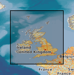
Spatial extent
N
S
E
W
N
S
E
W
N
S
E
W
Provided by

Associated resources
Not available