 NERC Data Catalogue Service
The BGS collection of archived video recordings
The BGS collection of downhole CCTV (Closed Circuit Television) recordings and backup tapes for worldwide SKYLAB satellite imagery. CCTV recordings carried out down boreholes, mainly drilled for water, were undertaken by BGS for specific commercial contracts in Great Britain, and may also have associated geophysical data. The collection started in 1997, and the present holdings are 138 videos, with infrequent additions. Video recordings on other topics may be added.
Simple
- Date (Creation)
- 1998
Distributor
British Geological Survey
-
Enquiries
0115 936 3276
The Lyell Centre, Research Avenue South
,
EDINBURGH
,
LOTHIAN
,
EH14 4AP
,
United Kingdom
0115 936 3142
0115 936 3276
Point of contact
British Geological Survey
-
Enquiries
0115 936 3276
The Lyell Centre, Research Avenue South
,
EDINBURGH
,
LOTHIAN
,
EH14 4AP
,
United Kingdom
0115 936 3142
0115 936 3276
Distributor
British Geological Survey
-
Enquiries
0115 936 3276
Environmental Science Centre, Nicker Hill, Keyworth
,
NOTTINGHAM
,
NOTTINGHAMSHIRE
,
NG12 5GG
,
United Kingdom
0115 936 3143
0115 936 3276
Custodian
British Geological Survey
-
Enquiries
0115 936 3276
Environmental Science Centre, Nicker Hill, Keyworth
,
NOTTINGHAM
,
NOTTINGHAMSHIRE
,
NG12 5GG
,
United Kingdom
0115 936 3143
0115 936 3276
- Maintenance and update frequency
- irregular Irregular
- GEMET - INSPIRE themes, version 1.0
- BGS Thesaurus of Geosciences
-
- Mine shafts
- UK Location (INSPIRE)
- Wells
- Boreholes
- Satellite imagery
- dataCentre
- Keywords
-
- NERC_DDC
- Access constraints
- otherRestrictions Other restrictions
- Other constraints
- Subject to usual BGS terms and conditions. Copyright and other commercial restrictions may apply.
- Use constraints
- otherRestrictions Other restrictions
- Other constraints
- The copyright of materials derived from the British Geological Survey's work is vested in the Natural Environment Research Council [NERC]. No part of this work may be reproduced or transmitted in any form or by any means, or stored in a retrieval system of any nature, without the prior permission of the copyright holder, via the BGS Intellectual Property Rights Manager. Use by customers of information provided by the BGS, is at the customer's own risk. In view of the disparate sources of information at BGS's disposal, including such material donated to BGS, that BGS accepts in good faith as being accurate, the Natural Environment Research Council (NERC) gives no warranty, expressed or implied, as to the quality or accuracy of the information supplied, or to the information's suitability for any use. NERC/BGS accepts no liability whatever in respect of loss, damage, injury or other occurence however caused.
- Other constraints
- Either: (i) the dataset is made freely available, e.g. via the Internet, for a restricted category of use (e.g. educational use only); or (ii) the dataset has not been formally approved by BGS for access and use by external clients under licence, but its use may be permitted under alternative formal arrangements; or (iii) the dataset contains 3rd party data or information obtained by BGS under terms and conditions that must be consulted in order to determine the permitted usage of the dataset. Refer to the BGS staff member responsible for the creation of the dataset if further advice is required. He / she should be familiar with the composition of the dataset, particularly with regard to 3rd party IPR contained in it, and any resultant use restrictions. This staff member should revert to the IPR Section (ipr@bgs.ac.uk ) for advice, should the position not be clear.
- Denominator
- 10000
- Metadata language
- EnglishEnglish
- Topic category
-
- Geoscientific information
- Geographic identifier
-
GBN
- Date (Revision)
- 2009
- Geographic identifier
-
GREAT BRITAIN [id=139600]
- Date (Creation)
- 1979
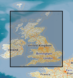
N
S
E
W
))
- Begin date
- 1997
- Supplemental Information
- The collection is complete for all registered videos. The level of spatial detail is complete and accurate to 10 metres for boreholes and 1km for satellite images.
- Unique resource identifier
- OSGB 1936 / British National Grid (EPSG::27700)
- Distribution format
-
-
VIDEO TAPE - Video tape collection.
()
-
VIDEO TAPE - Video tape collection.
()
Distributor
British Geological Survey
-
Enquiries
0115 936 3276
The Lyell Centre, Research Avenue South
,
EDINBURGH
,
LOTHIAN
,
EH14 4AP
,
United Kingdom
0115 936 3142
0115 936 3276
Distributor
British Geological Survey
-
Enquiries
0115 936 3276
Environmental Science Centre, Nicker Hill, Keyworth
,
NOTTINGHAM
,
NOTTINGHAMSHIRE
,
NG12 5GG
,
United Kingdom
0115 936 3143
0115 936 3276
- OnLine resource
- National Geoscience Data Centre (NGDC) ( WWW:LINK-1.0-http--link )
- Hierarchy level
- dataset Dataset
- Other
- dataset
Conformance result
- Date (Publication)
- 2011
- Explanation
- See the referenced specification
- Pass
- No
Conformance result
- Date (Publication)
- 2010-12-08
- Explanation
- See http://eur-lex.europa.eu/LexUriServ/LexUriServ.do?uri=OJ:L:2010:323:0011:0102:EN:PDF
- Pass
- No
- Statement
- Data collected by BGS as a result of commercial contracts.
- File identifier
- 9df8df52-d77b-37a8-e044-0003ba9b0d98 XML
- Metadata language
- EnglishEnglish
- Hierarchy level
- dataset Dataset
- Date stamp
- 2025-11-13
- Metadata standard name
- UK GEMINI
- Metadata standard version
- 2.3
Point of contact
British Geological Survey
The Lyell Centre, Research Avenue South
,
EDINBURGH
,
LOTHIAN
,
EH14 4AP
,
United Kingdom
+44 131 667 1000
- Dataset URI
- http://data.bgs.ac.uk/id/dataHolding/13480357
Overviews
Spatial extent
N
S
E
W
Provided by

Associated resources
Not available