 NERC Data Catalogue Service
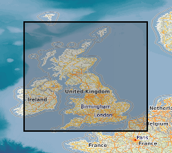
Historic Maps Collection
This dataset comprises two collections of maps. The facsmile collection contains all the marginalia information from the original map as well as the map itself, while the georectified collection contains just the map with an associated index for locating them. Each collection comprises approximately 101 000 monochrome images at 6-inch (1:10560) scale. Each image is supplied in TIFF format with appropriate ArcView and MapInfo world files, and shows the topography for all areas of England, Wales and Scotland as either quarter or, in some cases, full sheets. The images will cover the approximate epochs 1880's, 1900's, 1910's, 1920's and 1930's, but note that coverage is not countrywide for each epoch. The data was purchased by BGS from Sitescope, who obtained it from three sources - Royal Geographical Society, Trinity College Dublin and the Ordnance Survey. The data is for internal use by BGS staff on projects, and is available via a customised application created for the network GDI enabling users to search for and load the maps of their choice. The dataset will have many uses across all the geoscientific disciplines across which BGS operates, and should be viewed as a valuable addition to the BGS archive. There has been a considerable amount of work done during 2005, 2006 and 2007 to improve the accuracy of the OS Historic Map Collection. All maps should now be located to +- 50m or better. This is the best that can be achieved cost effectively. There are a number of reasons why the maps are inaccurate. Firstly, the original maps are paper and many are over 100 years old. They have not been stored in perfect condition. The paper has become distorted to varying degrees over time. The maps were therefore not accurate before scanning. Secondly, different generations of maps will have used different surveying methods and different spatial referencing systems. The same geographical object will not necessarily be in the same spatial location on subsequent editions. Thirdly, we are discussing maps, not plans. There will be cartographic generalisations which will affect the spatial representation and location of geographic objects. Finally, the georectification was not done in BGS but by the company from whom we purchased the maps. The company no longer exists. We do not know the methodology used for georectification.
Simple
- Date (Creation)
- 2000
Distributor
British Geological Survey
-
Enquiries
0115 936 3276
Environmental Science Centre, Nicker Hill, Keyworth
,
NOTTINGHAM
,
NOTTINGHAMSHIRE
,
NG12 5GG
,
United Kingdom
0115 936 3143
0115 936 3276
Originator
British Geological Survey
-
Enquiries
0115 936 3276
Environmental Science Centre, Nicker Hill, Keyworth
,
NOTTINGHAM
,
NOTTINGHAMSHIRE
,
NG12 5GG
,
United Kingdom
0115 936 3143
0115 936 3276
Point of contact
British Geological Survey
-
Enquiries
0115 936 3276
Environmental Science Centre, Nicker Hill, Keyworth
,
NOTTINGHAM
,
NOTTINGHAMSHIRE
,
NG12 5GG
,
United Kingdom
0115 936 3143
0115 936 3276
Custodian
British Geological Survey
-
Enquiries
0115 936 3276
Environmental Science Centre, Nicker Hill, Keyworth
,
NOTTINGHAM
,
NOTTINGHAMSHIRE
,
NG12 5GG
,
United Kingdom
0115 936 3143
0115 936 3276
- Maintenance and update frequency
- notPlanned Not planned
- GEMET - INSPIRE themes, version 1.0
- BGS Thesaurus of Geosciences
-
- Maps
- UK Location (INSPIRE)
- Topography
- dataCentre
- Keywords
-
- NERC_DDC
- Access constraints
- otherRestrictions Other restrictions
- Other constraints
- Internal BGS use/access only at present
- Use constraints
- otherRestrictions Other restrictions
- Other constraints
- The copyright of materials derived from the British Geological Survey's work is vested in the Natural Environment Research Council [NERC]. No part of this work may be reproduced or transmitted in any form or by any means, or stored in a retrieval system of any nature, without the prior permission of the copyright holder, via the BGS Intellectual Property Rights Manager. Use by customers of information provided by the BGS, is at the customer's own risk. In view of the disparate sources of information at BGS's disposal, including such material donated to BGS, that BGS accepts in good faith as being accurate, the Natural Environment Research Council (NERC) gives no warranty, expressed or implied, as to the quality or accuracy of the information supplied, or to the information's suitability for any use. NERC/BGS accepts no liability whatever in respect of loss, damage, injury or other occurence however caused.
- Other constraints
- Either: (i) the dataset is made freely available, e.g. via the Internet, for a restricted category of use (e.g. educational use only); or (ii) the dataset has not been formally approved by BGS for access and use by external clients under licence, but its use may be permitted under alternative formal arrangements; or (iii) the dataset contains 3rd party data or information obtained by BGS under terms and conditions that must be consulted in order to determine the permitted usage of the dataset. Refer to the BGS staff member responsible for the creation of the dataset if further advice is required. He / she should be familiar with the composition of the dataset, particularly with regard to 3rd party IPR contained in it, and any resultant use restrictions. This staff member should revert to the IPR Section (ipr@bgs.ac.uk ) for advice, should the position not be clear.
- Denominator
- 10000
- Metadata language
- EnglishEnglish
- Topic category
-
- Geoscientific information
- Geographic identifier
-
ENG
- Date (Revision)
- 2009
- Geographic identifier
-
ENGLAND [id=150000]
- Date (Creation)
- 1979
- Geographic identifier
-
SCOTLAND [id=140000]
- Date (Creation)
- 1979
- Geographic identifier
-
SCT
- Date (Revision)
- 2009
- Geographic identifier
-
WALES [id=170000]
- Date (Creation)
- 1979
- Geographic identifier
-
WLS
- Date (Revision)
- 2009
N
S
E
W
))
- Begin date
- 1880
- End date
- 1940 Before
- Supplemental Information
- Dataset is a discrete collection. Future updates unknown. Coverage is not country wide for each series. Consistent within each revision period but inconsitencies may exist between revision periods. Third Party Dataset The images were registered to British National Grid by a methodology that we suspect did not involve a projective transformation from the original Cassini projection.
- Unique resource identifier
- OSGB 1936 / British National Grid (EPSG::27700)
- Distribution format
-
-
Image (GeoTIFF)
()
-
Image (GeoTIFF)
()
Distributor
British Geological Survey
-
Enquiries
0115 936 3276
Environmental Science Centre, Nicker Hill, Keyworth
,
NOTTINGHAM
,
NOTTINGHAMSHIRE
,
NG12 5GG
,
United Kingdom
0115 936 3143
0115 936 3276
- OnLine resource
-
BGS Homepage
(
WWW:LINK-1.0-http--link
)
The BGS Homepage is an entry point to the BGS data services.
- Hierarchy level
- dataset Dataset
- Other
- dataset
Conformance result
- Date (Publication)
- 2011
- Explanation
- See the referenced specification
- Pass
- No
Conformance result
- Date (Publication)
- 2010-12-08
- Explanation
- See http://eur-lex.europa.eu/LexUriServ/LexUriServ.do?uri=OJ:L:2010:323:0011:0102:EN:PDF
- Pass
- No
- Statement
- The data was received from Sitescope on a Firewire disk, loaded onto the Keyworth Cilor server, examined, processed appropriately and a suitable BGS index created. The dataset is available via the network GDI.
- File identifier
- 9df8df51-6409-37a8-e044-0003ba9b0d98 XML
- Metadata language
- EnglishEnglish
- Hierarchy level
- dataset Dataset
- Date stamp
- 2025-12-11
- Metadata standard name
- UK GEMINI
- Metadata standard version
- 2.3
Point of contact
British Geological Survey
Environmental Science Centre, Keyworth
,
NOTTINGHAM
,
NOTTINGHAMSHIRE
,
NG12 5GG
,
United Kingdom
+44 115 936 3100
- Dataset URI
- http://data.bgs.ac.uk/id/dataHolding/13480472
Overviews
Spatial extent
N
S
E
W
Provided by

Associated resources
Not available