 NERC Data Catalogue Service
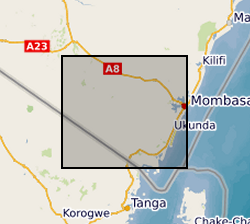
Gro for GooD Rainfall Data from 23 Manual Rain Gauges, Kwale County, Kenya (NERC grant NE/M008894/1)
The dataset consists of daily rainfall data for 23 manual rain gauge stations installed by Gro for GooD project within and about the study area. The installed stations covering four river catchments name Ramisi River, Mukurumudzi River, Mtawa River and Mwachema River in Kwale County. The dataset period is from January 2016 to November 2018. Gro for GooD: Groundwater Risk Management for Growth and Development
Simple
- Date (Creation)
- 2019-08-07
Principal investigator
University of Oxford
-
Dr R A Hope
(
School of Geography and the Environment
)
Oxford
,
OX1 3QY
,
Point of contact
University of Oxford
-
Nancy Gladstone
(
Smith School of Enterprise and the Environment
)
Oxford
,
OX1 3QY
,
- Maintenance and update frequency
- notApplicable notApplicable
- GEMET - INSPIRE themes, version 1.0
- BGS Thesaurus of Geosciences
-
- Rainfall
- NGDC Deposited Data
- Surface waters
- Groundwater
- Water
- dataCentre
- Keywords
-
- NERC_DDC
- Access constraints
- otherRestrictions Other restrictions
- Other constraints
- no limitations
- Other constraints
- The dataset is made freely available for access, e.g. via the Internet. Either no third party data / information is contained in the dataset or BGS has secured written permission from the owner(s) of any third party data / information contained in the dataset to make the dataset freely accessible.
- Use constraints
- otherRestrictions Other restrictions
- Other constraints
- The copyright of materials derived from the British Geological Survey's work is vested in the Natural Environment Research Council [NERC]. No part of this work may be reproduced or transmitted in any form or by any means, or stored in a retrieval system of any nature, without the prior permission of the copyright holder, via the BGS Intellectual Property Rights Manager. Use by customers of information provided by the BGS, is at the customer's own risk. In view of the disparate sources of information at BGS's disposal, including such material donated to BGS, that BGS accepts in good faith as being accurate, the Natural Environment Research Council (NERC) gives no warranty, expressed or implied, as to the quality or accuracy of the information supplied, or to the information's suitability for any use. NERC/BGS accepts no liability whatever in respect of loss, damage, injury or other occurence however caused.
- Other constraints
- Available under the Open Government Licence subject to the following acknowledgement accompanying the reproduced NERC materials "Contains NERC materials ©NERC [year]"
- Metadata language
- EnglishEnglish
- Topic category
-
- Geoscientific information
- Geographic identifier
-
KE
- Date (Revision)
- 2009
- Geographic identifier
-
KEN
- Date (Revision)
- 2009
- Geographic identifier
-
KENYA [id=687000]
- Date (Creation)
- 1979
N
S
E
W
))
- Begin date
- 2015-12-31
- End date
- 2018-11-30
- Unique resource identifier
- Arc 1960 / UTM zone 37S (EPSG::21037)
- Distribution format
-
-
MS Excel
()
-
MS Excel
()
- Hierarchy level
- dataset Dataset
- Other
- dataset
Conformance result
- Date (Publication)
- 2011
- Explanation
- See the referenced specification
- Pass
- No
Conformance result
- Date (Publication)
- 2010-12-08
- Explanation
- See http://eur-lex.europa.eu/LexUriServ/LexUriServ.do?uri=OJ:L:2010:323:0011:0102:EN:PDF
- Pass
- No
- Statement
- : Stations were instrumented with CM1016 manual plastic rain gauges (climemet.com) - funnel diameter of 100mm and internal measuring cylinder calibrated at 0.5mm, capacity 25mm. External cylinder maximum capacity 225mm. The gauges are mounted on posts with collector rim at 0.7m above ground level. Instruments were installed in collaboration with Kenya Meteorological Department (KMD) under Ministry of Water, Environment and Natural Resources. Field Monitors were recruited and trained to take readings at 9:00 am daily by both Rural Focus Ltd and KMD and record data in KMD rainfall data format. Rainfall record sheet were collected monthly and quarterly analysed for quality (homogeneity and consistency based on Double Mass Curve techniques and visual inspection compared to nearby stations. Missing data is denoted with -99. A clear distinction is made between day of record and day of rain.
- File identifier
- 9037d64b-ee16-1d62-e054-002128a47908 XML
- Metadata language
- EnglishEnglish
- Hierarchy level
- dataset Dataset
- Date stamp
- 2025-11-13
- Metadata standard name
- UK GEMINI
- Metadata standard version
- 2.3
Point of contact
British Geological Survey
Environmental Science Centre,Keyworth
,
NOTTINGHAM
,
NOTTINGHAMSHIRE
,
NG12 5GG
,
United Kingdom
+44 115 936 3100
- Dataset URI
- http://data.bgs.ac.uk/id/dataHolding/13607496
Overviews
Spatial extent
N
S
E
W
Provided by

Associated resources
Not available