 NERC Data Catalogue Service
RATE Lo-RISE Terrestrial Dataset 1 (NERC grant NE/L000547/1)
Data collected as part of the NERC funded Radioactivity and the Environment (RATE), Long-lived Radionuclides in the Surface Environment (Lo-RISE), research consortium.This data comes from the terrestrial workstream group based at the University of Manchester. The data consists of radionuclide measurements of environmental and biological samples including uranium (238), thorium (232) and radium (226), and soil subsurface and surface biota bioprospecting (plants and AM fungi). The data from this first dataset has been published in the following publication: Davies et al. (2018) Multiple environmental factors influence 238U, 232Th and 226Ra bioaccumulation in arbuscular mycorrhizal-associated plants. Science of the Total Environment 640-641:921-934.
Simple
- Date (Creation)
- 2018-08-16
Originator
University of Manchester
-
Dr Jon Pittman
(
School of Earth and Environmental Sciences
)
Michael Smith Building, Oxford Road
,
Manchester
,
M13 9PT
,
Principal investigator
University of Manchester
-
Prof Francis Livens
(
Earth Atmospheric and Env Sciences
)
Manchester
,
M13 9PL
,
- Maintenance and update frequency
- notApplicable notApplicable
- GEMET - INSPIRE themes, version 1.0
- BGS Thesaurus of Geosciences
-
- NGDC Deposited Data
- Uranium
- Radium
- Fungi
- Radioactive isotopes
- Soil sampling
- Thorium
- dataCentre
- Keywords
-
- NERC_DDC
- Access constraints
- otherRestrictions Other restrictions
- Other constraints
- no limitations
- Other constraints
- The dataset is made freely available for access, e.g. via the Internet. Either no third party data / information is contained in the dataset or BGS has secured written permission from the owner(s) of any third party data / information contained in the dataset to make the dataset freely accessible.
- Use constraints
- otherRestrictions Other restrictions
- Other constraints
- The copyright of materials derived from the British Geological Survey's work is vested in the Natural Environment Research Council [NERC]. No part of this work may be reproduced or transmitted in any form or by any means, or stored in a retrieval system of any nature, without the prior permission of the copyright holder, via the BGS Intellectual Property Rights Manager. Use by customers of information provided by the BGS, is at the customer's own risk. In view of the disparate sources of information at BGS's disposal, including such material donated to BGS, that BGS accepts in good faith as being accurate, the Natural Environment Research Council (NERC) gives no warranty, expressed or implied, as to the quality or accuracy of the information supplied, or to the information's suitability for any use. NERC/BGS accepts no liability whatever in respect of loss, damage, injury or other occurence however caused.
- Other constraints
- Available under the Open Government Licence subject to the following acknowledgement accompanying the reproduced NERC materials "Contains NERC materials ©NERC [year]"
- Metadata language
- EnglishEnglish
- Topic category
-
- Geoscientific information
N
S
E
W
))
N
S
E
W
))
- Begin date
- 2013-10-01
- End date
- 2018-07-31
Reference System Information
No information provided.
- Distribution format
-
-
MS Excel
()
-
pdf
()
-
jpg
()
-
MS Excel
()
- Hierarchy level
- dataset Dataset
- Other
- dataset
Conformance result
- Date (Publication)
- 2011
- Explanation
- See the referenced specification
- Pass
- No
Conformance result
- Date (Publication)
- 2010-12-08
- Explanation
- See http://eur-lex.europa.eu/LexUriServ/LexUriServ.do?uri=OJ:L:2010:323:0011:0102:EN:PDF
- Pass
- No
- Statement
- Field sampling at study sites at South Terras in Cornwall and Needle's Eye in Scotland in May 2014 to collect and identify dominant plant samples, isolate surrounding rhizosphere soil samples; measurement of soil pH, TIC, TOC, nutrients, radionuclides and selected elements by gas analysis, ion chromatography, ICP-AES, ICP-MS and gamma spectroscopy, and measurement of plant radionuclides and selected elements by ICP-AES, ICP-MS, gamma spectroscopy and autoradiography. Plant identification by DNA sequencing, and AM fungi quantification by light microscopy and DNA sequencing.
- File identifier
- 74173743-1d69-2ebd-e054-002128a47908 XML
- Metadata language
- EnglishEnglish
- Hierarchy level
- dataset Dataset
- Date stamp
- 2025-11-13
- Metadata standard name
- UK GEMINI
- Metadata standard version
- 2.3
Point of contact
British Geological Survey
Environmental Science Centre,Keyworth
,
NOTTINGHAM
,
NOTTINGHAMSHIRE
,
NG12 5GG
,
United Kingdom
+44 115 936 3100
- Dataset URI
- http://data.bgs.ac.uk/id/dataHolding/13607371
Overviews
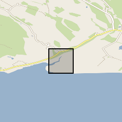
Spatial extent
N
S
E
W
N
S
E
W
Provided by

Associated resources
Not available