 NERC Data Catalogue Service
SRTM (Shuttle Radar Topographic Mission) 90m Digital Elevation Model (DEM) Data for Kwale County, Kenya produced by the Gro for GooD project. (NERC Grant NE/M008894/1)
This dataset contains digital terrain data that describes the topography of the area under study at 90m resolution based on SRTM 90m Digital Elevation Data from the CGIAR-CSI (Consultative Group on International Agricultural Research - Consortium for Spatial Information). Gro for GooD: Groundwater Risk Management for Growth and Development,
https://upgro.org/consortium/gro-for-good/
Simple
- Date (Creation)
- 2017-10-19
Principal investigator
University of Oxford
-
Dr R A Hope
(
School of Geography and the Environment
)
Oxford
,
OX1 3QY
,
Point of contact
University of Oxford
-
Nancy Gladstone
(
Smith School of Enterprise and the Environment
)
Oxford
,
OX1 3QY
,
- Maintenance and update frequency
- notApplicable notApplicable
- GEMET - INSPIRE themes, version 1.0
- BGS Thesaurus of Geosciences
-
- DEM
- NGDC Deposited Data
- dataCentre
- Keywords
-
- NERC_DDC
- Access constraints
- otherRestrictions Other restrictions
- Other constraints
- no limitations
- Other constraints
- The dataset is made freely available for access, e.g. via the Internet. Either no third party data / information is contained in the dataset or BGS has secured written permission from the owner(s) of any third party data / information contained in the dataset to make the dataset freely accessible.
- Use constraints
- otherRestrictions Other restrictions
- Other constraints
- The copyright of materials derived from the British Geological Survey's work is vested in the Natural Environment Research Council [NERC]. No part of this work may be reproduced or transmitted in any form or by any means, or stored in a retrieval system of any nature, without the prior permission of the copyright holder, via the BGS Intellectual Property Rights Manager. Use by customers of information provided by the BGS, is at the customer's own risk. In view of the disparate sources of information at BGS's disposal, including such material donated to BGS, that BGS accepts in good faith as being accurate, the Natural Environment Research Council (NERC) gives no warranty, expressed or implied, as to the quality or accuracy of the information supplied, or to the information's suitability for any use. NERC/BGS accepts no liability whatever in respect of loss, damage, injury or other occurence however caused.
- Other constraints
- Available under the Open Government Licence subject to the following acknowledgement accompanying the reproduced NERC materials "Contains NERC materials ©NERC [year]"
- Metadata language
- EnglishEnglish
- Topic category
-
- Geoscientific information
- Geographic identifier
-
KE
- Date (Revision)
- 2009
- Geographic identifier
-
KEN
- Date (Revision)
- 2009
- Geographic identifier
-
KENYA [id=687000]
- Date (Creation)
- 1979
N
S
E
W
))
- Begin date
- 2008-01-01
- End date
- 2008-12-31
- Supplemental Information
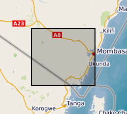
- xMin,yMin 47869.9695, 9491995.1231 : xMax,yMax 567375.2423, 9547808.6490 UTM X/Y Arc1960 (Kwale County, Kenya)
- Unique resource identifier
- Arc 1960 / UTM zone 37S (EPSG::21037)
- Distribution format
-
- OnLine resource
- Gro for GooD: Groundwater Risk Management for Growth and Development ( WWW:LINK-1.0-http--link )
- OnLine resource
- http://reshare.ukdataservice.ac.uk/853667/
- OnLine resource
- Data ( WWW:DOWNLOAD-1.0-http--download )
- Hierarchy level
- dataset Dataset
- Other
- dataset
Conformance result
- Date (Publication)
- 2011
- Explanation
- See the referenced specification
- Pass
- No
Conformance result
- Date (Publication)
- 2010-12-08
- Explanation
- See http://eur-lex.europa.eu/LexUriServ/LexUriServ.do?uri=OJ:L:2010:323:0011:0102:EN:PDF
- Pass
- No
- Statement
- Shuttle Radar Topography Mission (SRTM) 90m Digital Elevation Data was originally produced by National Aeronautics and Space Administration (NASA). The NASA Shuttle Radar Topographic Mission (SRTM) has provided digital elevation data (DEMs) for over 80% of the globe covering all of the countries of the world. The SRTM 90m DEM's have a resolution of 90m at the equator, and are provided in mosaiced 5 deg x 5 deg tiles for easy download and use. All are produced from a seamless dataset to allow easy mosaicing. The SRTM 90m DEM's data was downloaded from CGIAR-SCI GeoPortal website, http://srtm.csi.cgiar.org/ The DEM data was further processed in Arc GIS environment with a new projection into Arc 1960 datum and used for catchment delineation in the study area. It was used as primary elevation data for subsequent hydrological and hydrogeological analysis and modelling work in the project. Based on Jarvis A., H.I. Reuter, A. Nelson, E. Guevara, 2008, Hole-filled seamless SRTM data V4, International Centre for Tropical Agriculture (CIAT), available from http://srtm.csi.cgiar.org.
- File identifier
- 5c845806-f6ec-10c7-e054-002128a47908 XML
- Metadata language
- EnglishEnglish
- Hierarchy level
- dataset Dataset
- Date stamp
- 2025-12-11
- Metadata standard name
- UK GEMINI
- Metadata standard version
- 2.3
Point of contact
British Geological Survey
Environmental Science Centre,Keyworth
,
NOTTINGHAM
,
NOTTINGHAMSHIRE
,
NG12 5GG
,
United Kingdom
+44 115 936 3100
- Dataset URI
- http://data.bgs.ac.uk/id/dataHolding/13607216
Overviews
Spatial extent
N
S
E
W
Provided by

Associated resources
Not available