 NERC Data Catalogue Service
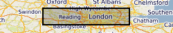
BGS GeoSure Shrink Swell 3D for London and Thames Valley
The BGS GeoSure Shrink Swell 3D data is a regional hazard susceptibility map that identifies areas of potential shrink–swell hazard, in three dimensional space, at intervals down to 20m in the London and Thames Valley area. Shrinking and swelling clays can change volume due to variation in moisture, which can cause ground movement that may affect many foundations. The data provides an indication of variation in Volume Change Potential (VCP) of shrink-swell clays and is classified on an A-E (low to high) range of hazard susceptibility. BGS GeoSure Shrink Swell 3D for London is part of the BGS GeoSure range of natural subsidence products. It is derived from the BGS Geology 50k data, the BGS London Lithoframe 3D model and the GeoSure v7 Shrink-Swell layer.
Simple
- Date (Creation)
- 2017-01
Distributor
British Geological Survey
-
Enquiries
0115 936 3276
Environmental Science Centre, Nicker Hill, Keyworth
,
NOTTINGHAM
,
NOTTINGHAMSHIRE
,
NG12 5GG
,
United Kingdom
0115 936 3143
0115 936 3276
Point of contact
British Geological Survey
-
Enquiries
0115 936 3276
Environmental Science Centre, Nicker Hill, Keyworth
,
NOTTINGHAM
,
NOTTINGHAMSHIRE
,
NG12 5GG
,
United Kingdom
0115 936 3143
0115 936 3276
- Maintenance and update frequency
- asNeeded As needed
- GEMET - INSPIRE themes, version 1.0
- BGS Thesaurus of Geosciences
-
- data.gov.uk (non-INSPIRE)
- Geohazards
- Three dimensional models
- dataCentre
- Keywords
-
- NERC_DDC
- Access constraints
- otherRestrictions Other restrictions
- Other constraints
- license
- Use constraints
- otherRestrictions Other restrictions
- Other constraints
- The copyright of materials derived from the British Geological Survey's work is vested in the Natural Environment Research Council [NERC]. No part of this work may be reproduced or transmitted in any form or by any means, or stored in a retrieval system of any nature, without the prior permission of the copyright holder, via the BGS Intellectual Property Rights Manager. Use by customers of information provided by the BGS, is at the customer's own risk. In view of the disparate sources of information at BGS's disposal, including such material donated to BGS, that BGS accepts in good faith as being accurate, the Natural Environment Research Council (NERC) gives no warranty, expressed or implied, as to the quality or accuracy of the information supplied, or to the information's suitability for any use. NERC/BGS accepts no liability whatever in respect of loss, damage, injury or other occurence however caused.
- Other constraints
- The dataset is made available to external clients under BGS Digital Data Licence terms and conditions. Revert to the IPR Section (iprdigital@bgs.ac.uk ) if further advice is required with regard to permitted usage.
- Spatial representation type
- vector Vector
- Metadata language
- EnglishEnglish
- Topic category
-
- Geoscientific information
- Geographic identifier
-
Greater London Authority [id=41441]
- Date (Revision)
- 2009
N
S
E
W
))
- End date
- 2017-01 Before
- Unique resource identifier
- OSGB 1936 / British National Grid (EPSG::27700)
- Distribution format
-
Distributor
British Geological Survey
-
Enquiries
0115 936 3276
Environmental Science Centre, Nicker Hill, Keyworth
,
NOTTINGHAM
,
NOTTINGHAMSHIRE
,
NG12 5GG
,
United Kingdom
0115 936 3143
0115 936 3276
- OnLine resource
- BGS GeoSure shrink–swell 3D for London and Thames Valley ( WWW:LINK-1.0-http--link )
- Hierarchy level
- dataset Dataset
- Other
- dataset
Conformance result
- Date (Publication)
- 2011
- Explanation
- See the referenced specification
- Pass
- No
Conformance result
- Date (Publication)
- 2010-12-08
- Explanation
- See http://eur-lex.europa.eu/LexUriServ/LexUriServ.do?uri=OJ:L:2010:323:0011:0102:EN:PDF
- Pass
- No
- Statement
- The dataset was derived from the London Lithoframe 3D model. Depths to each of the formations used in the model were extracted across the model extent at a resolution of 50x50m. This data was then further processed to produce an attributed feature class showing which formation was present at specific depths. The depths used are 0, 1, 2, 3, 4, 5, 10, 15 and 20m. Each of the formations was given a VCP value and VCP range. A further processing stage ensured consistency with the DIGMAP 50k surface geology.
- File identifier
- 4930ac62-0d72-1269-e054-002128a47908 XML
- Metadata language
- EnglishEnglish
- Hierarchy level
- dataset Dataset
- Date stamp
- 2025-12-11
- Metadata standard name
- UK GEMINI
- Metadata standard version
- 2.3
Point of contact
British Geological Survey
Environmental Science Centre,Keyworth
,
NOTTINGHAM
,
NOTTINGHAMSHIRE
,
NG12 5GG
,
United Kingdom
+44 115 936 3100
- Dataset URI
- http://data.bgs.ac.uk/id/dataHolding/13607109
Overviews
Spatial extent
N
S
E
W
Provided by

Associated resources
Not available