 NERC Data Catalogue Service
newGeoSure Insurance Product version 7 2015.1
Simple
- Alternate title
- newGIP v7 2015
- Date (Creation)
- 2015-05-22
0115 936 3276
0115 936 3276
- Maintenance and update frequency
- biannually Biannually
- GEMET - INSPIRE themes, version 1.0
- BGS Thesaurus of Geosciences
-
- UK Location (INSPIRE)
- Natural hazards
- dataCentre
- Keywords
-
- NERC_DDC
- Access constraints
- otherRestrictions Other restrictions
- Use constraints
- otherRestrictions Other restrictions
- Other constraints
- The copyright of materials derived from the British Geological Survey's work is vested in the Natural Environment Research Council [NERC]. No part of this work may be reproduced or transmitted in any form or by any means, or stored in a retrieval system of any nature, without the prior permission of the copyright holder, via the BGS Intellectual Property Rights Manager. Use by customers of information provided by the BGS, is at the customer's own risk. In view of the disparate sources of information at BGS's disposal, including such material donated to BGS, that BGS accepts in good faith as being accurate, the Natural Environment Research Council (NERC) gives no warranty, expressed or implied, as to the quality or accuracy of the information supplied, or to the information's suitability for any use. NERC/BGS accepts no liability whatever in respect of loss, damage, injury or other occurence however caused.
- Other constraints
- The dataset is made available to external clients under BGS Digital Data Licence terms and conditions. Revert to the IPR Section (iprdigital@bgs.ac.uk ) if further advice is required with regard to permitted usage.
- Spatial representation type
- vector Vector
- Denominator
- 50000
- Metadata language
- EnglishEnglish
- Topic category
-
- Geoscientific information
- Geographic identifier
-
ENG
- Date (Revision)
- 2009
- Geographic identifier
-
ENGLAND [id=150000]
- Date (Creation)
- 1979
- Geographic identifier
-
SCOTLAND [id=140000]
- Date (Creation)
- 1979
- Geographic identifier
-
SCT
- Date (Revision)
- 2009
- Geographic identifier
-
WALES [id=170000]
- Date (Creation)
- 1979
- Geographic identifier
-
WLS
- Date (Revision)
- 2009
))
- End date
- 2015 Before
- Supplemental Information
- The methodology behind the DPD involves balancing the 6 GeoSure natural ground stability hazards against each other. The GeoSure maps themselves have a fivefold coding (A to E), and the balancing exercise involves comparing each level across the six hazards e.g. comparing a level C shrink-swell clay area with a level C running sand area. The comparison is done by estimating how frequently a ground movement event may occur that could have the potential to damage a property (in particular, low-rise buildings). Each level of each of the hazards is given an 'occurrence factor' (as shown in Table 1 of the user guide), which can then be added together to derive a Total Occurrence Factor at a particular location (e.g. within a given postcode). In 2003, the BGS also published a series of GIS digital maps identifying areas of potential natural ground movement hazard in the UK, called GeoSure. There are six separate hazards considered - shrink-swell clays, slope instability, dissolution of soluble ground, running sand, compressible ground and collapsible ground. These maps were derived by combining the rock classification scheme (RCS) information from DiGMapGB-50 with a series of other factors which may cause the geological hazards (e.g. steep slopes, groundwater). In 2007, the BGS used the GeoSure maps to make an interpretation of subsidence insurance risk for the UK property insurance industry, released as the new GeoSure Insurance Product. This represents the combined effects of the 6 GeoSure hazards on (low-rise) buildings in a postcode database - the Derived Postcode Database, which can be accompanied by GIS maps showing the most significant hazard areas. The combined hazard is represented numerically in the Derived Postcode Database as the Total Occurrence Factor, with a breakdown into the component hazards, as described in more detail below. GeoSure Derived Postcode Database (DPD) The DPD is a stand-alone database, which can be provided separately to the visualisation layers in the Full GeoSure Insurance Product.
- Unique resource identifier
- OSGB 1936 / British National Grid (EPSG::27700)
- Distribution format
-
-
Postcode Database
(
Current BGS version
)
-
ESRI Shapefile
(
Current BGS version
)
-
Map Info File
(
Current BGS version
)
-
Postcode Database
(
Current BGS version
)
0115 936 3276
- OnLine resource
-
GeoSure insurance and lenders product
(
WWW:LINK-1.0-http--link
)
The BGS GeoSure insurance and lenders product gives an index-level assessment of the potential for a geological deposit to create financial insurance loss due to natural ground movement.
- Hierarchy level
- dataset Dataset
- Other
- dataset
Conformance result
- Date (Publication)
- 2011
- Explanation
- See the referenced specification
- Pass
- No
Conformance result
- Date (Publication)
- 2010-12-08
- Explanation
- See http://eur-lex.europa.eu/LexUriServ/LexUriServ.do?uri=OJ:L:2010:323:0011:0102:EN:PDF
- Pass
- No
- Statement
- In detail, the methodology behind producing the DPD is as follows: 1. The postcode centroids layer, as supplied by Ordnance Survey, is buffered using a value of 300 metres. This value takes into account the variability in size of postcodes (250 metres) and the 50 metres cartographic precision of the Digital Geological Map of Great Britain at the 1:50,000 scale (DiGMapGB-50) data that is used as the geological basis for the GeoSure hazard layers. 2. An 'occurrence rating' is then assigned to each of the A-E levels of each master GeoSure hazard layer. These occurrence ratings represent how frequently a ground movement event may occur that could have the potential to damage a property (in particular, low-rise buildings). The occurrence ratings are then multiplied by a nominal score (100) in order to derive a series of 'unified ratings'. Before use in the DPD, these unified rating values in the table are then multiplied by 10 allow the use of integer values. For example a class 'D' shrink-swell pixel will have a value of 10 x 10 = 100. 3. Zonal statistics are then calculated using the buffered postcode layer from above in conjunction with each of the six GeoSure hazard grids (25m pixel size). This process considers each hazard in turn and calculates the average of the pixel values that occur within each of the buffered postcodes (circular areas). As each pixel covers the same area the resultant average represents the area-weighted average of the hazard values within the circular area. These average values for each hazard are added to the output Derived Postcode Database as 'occurrence factors'. 4. The six hazard occurrence factors for each postcode are summed and added to the DPD as column Total_of (Postcode Total Occurrence Factor, PTOF). 5. The Total_of column is classified into 5 classes divided into 5 equal categories as shown in table 3 of the newGeoSure Insurance Product: Methodology report. (IR/12/074). This classification is added as column Class5 with values of 1-10. This, and the Class5 split, is done in order to allow easier interpretation and visualisation of the total hazard if required (for example, Class5 can be used to colour up the postcode centroid in the GIS to show how the total hazard varies across an area).
- File identifier
- 16f8a3dc-9ea3-333e-e054-002128a47908 XML
- Metadata language
- EnglishEnglish
- Hierarchy level
- dataset Dataset
- Date stamp
- 2025-11-13
- Metadata standard name
- UK GEMINI
- Metadata standard version
- 2.3
- Dataset URI
- http://data.bgs.ac.uk/id/dataHolding/13606634
Overviews
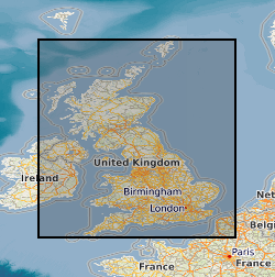
Spatial extent
Provided by
