 NERC Data Catalogue Service
Bedrock summary lithologies across the UK Continental Shelf (2014 Version)
Simple
- Date (Creation)
- 2014-03-31
0115 936 3276
0115 936 3276
- Maintenance and update frequency
- notPlanned Not planned
- GEMET - INSPIRE themes, version 1.0
- BGS Thesaurus of Geosciences
-
- Marine geology
- Lithology
- Bed rock
- Continental shelf
- UK Location (INSPIRE)
- dataCentre
- Keywords
-
- NERC_DDC
- Access constraints
- otherRestrictions Other restrictions
- Other constraints
- no limitations
- Other constraints
- The dataset is made freely available for access, e.g. via the Internet. Either no third party data / information is contained in the dataset or BGS has secured written permission from the owner(s) of any third party data / information contained in the dataset to make the dataset freely accessible.
- Use constraints
- otherRestrictions Other restrictions
- Other constraints
- The copyright of materials derived from the British Geological Survey's work is vested in the Natural Environment Research Council [NERC]. No part of this work may be reproduced or transmitted in any form or by any means, or stored in a retrieval system of any nature, without the prior permission of the copyright holder, via the BGS Intellectual Property Rights Manager. Use by customers of information provided by the BGS, is at the customer's own risk. In view of the disparate sources of information at BGS's disposal, including such material donated to BGS, that BGS accepts in good faith as being accurate, the Natural Environment Research Council (NERC) gives no warranty, expressed or implied, as to the quality or accuracy of the information supplied, or to the information's suitability for any use. NERC/BGS accepts no liability whatever in respect of loss, damage, injury or other occurence however caused.
- Other constraints
- Available under the Open Government Licence subject to the following acknowledgement accompanying the reproduced NERC materials "Contains NERC materials ©NERC [year]"
- Spatial representation type
- vector Vector
- Denominator
- 250000
- Metadata language
- EnglishEnglish
- Topic category
-
- Geoscientific information
- Geographic identifier
-
UK CONTINENTAL SHELF [id=121701]
- Date (Creation)
- 1979
))
- Begin date
- 1966
- End date
- 2013
- Unique resource identifier
- WGS 84 (EPSG::4326)
- Distribution format
-
-
ESRI Shapefile (.shp)
()
-
ESRI Shapefile (.shp)
()
0115 936 3276
- OnLine resource
-
DOI - Bedrock summary lithologies across the UK Continental Shelf (2014 Version)
(
WWW:LINK-1.0-http--related
)
British Geological Survey. (2022). Bedrock summary lithologies across the UK Continental Shelf (2014 Version). NERC EDS National Geoscience Data Centre. (Dataset). https://doi.org/10.5285/0f755bcb-8291-4c43-8ad3-4032fa8aca2f
- OnLine resource
-
DATA - Bedrock summary lithologies across the UK Continental Shelf (2014 Version)
(
WWW:DOWNLOAD-1.0-http--download
)
The Bedrock summary lithologies dataset is digital geological map across the bulk of the UK Continental Shelf (UKCS), for areas up to a water depth of 200m, which groups the bedrock lithologies (rock types) into classes based on similar engineering geology characteristics. The map is derived from the 1:250,000 scale digital bedrock map of the UKCS, called DiGRock250k, which is available separately from the BGS. The map was produced in 2014 in collaboration with, and co-funded by, The Crown Estate as part of a wider commissioned project to assess seabed geological constraints on engineering infrastructure across the UKCS. The data are held by the BGS as an ESRI ArcGIS Shapefile.
- Hierarchy level
- dataset Dataset
- Other
- dataset
Conformance result
- Date (Publication)
- 2011
- Explanation
- See the referenced specification
- Pass
- No
Conformance result
- Date (Publication)
- 2010-12-08
- Explanation
- See http://eur-lex.europa.eu/LexUriServ/LexUriServ.do?uri=OJ:L:2010:323:0011:0102:EN:PDF
- Pass
- No
- Statement
- The Bedrock Summary Lithology Factor Map has been derived from BGS Offshore Bedrock 250k (DiGRock250k) by grouping bedrock lithologies into the following categories: Class1 - Igneous, Class 2 - Tertiary Sandstone and Limestone, Class 2.5 - Tertiary Sandstone and Limestone Interbedded, Class 3 - Tertiary Mudstone, Class 4 - Mesozoic Sandstone and Limestone, Class 4.5 - Mesozoic Sandstone and Limestone Interbedded, Class 5 - Mesozoic Mudstone, Class 6 - Chalk, Class 7 - Metamorphic, Class 8 - Palaeozoic Sedimentary. Class 1 was chosen to cover any igneous rock (granite, lava). These are frequently very strong and anisotropic in their physical properties. This class excludes tuffs as these are considered sedimentary rocks. There are no time constraints on this class as granites of Tertiary age have comparable properties to those emplaced during the Palaeozoic. Some igneous rocks such as lavas may have weathered horizons often reflecting environmental conditions when the rocks were created. Class 2 covers sands and sandstones and only a few limestones (e.g. Bembridge Limestone). Class 6 comprises chalks. This bioclastic product was separated out from other sedimentary rocks due to its easy recognition, its extensive occurrence offshore and the difficulties it has posed to pile driving for monopile wind turbines. The class occurs within both the Mesozoic and Tertiary time zones No attempt has been made to subdivide the chalk areas based on their likelihood to have flints. Experience suggests that flints can impose a constraint on foundation installation and these vary depending on basin and age. Some sediments in DigRock are described as Permo-Trias sandstones and mudstone and therefore would straddle Classes 4.5 and 8. As the classification scheme is intended as rapid attempt to summarise the strength of the rocks it was decided that such sediments are closer to the Mesozoic than most of the Palaeozoic and classes 4, 4.5 and 5 should be considered for rocks that are described as Permo-Trias. In the light of that, DigRock class PUND-MDGYAN was also moved into Class 4. It was noted that there was inconsistency in the descriptions of offshore extensions of the country rock north and south of the Cornubian peninsular. To the south the sediments are described as slates whereas to the north they are described as Sandstones and mudstones. Hence they fall into differing categories, the former as class 7 metamorphic and the latter as class 8 Palaeozoic sedimentary.
- File identifier
- 166c7ca4-0bfd-1f2d-e054-002128a47908 XML
- Metadata language
- EnglishEnglish
- Hierarchy level
- dataset Dataset
- Date stamp
- 2025-11-13
- Metadata standard name
- UK GEMINI
- Metadata standard version
- 2.3
- Dataset URI
- http://data.bgs.ac.uk/id/dataHolding/13606629
Overviews
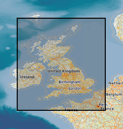
Spatial extent
Provided by
