 NERC Data Catalogue Service
Groundwater Levels
Simple
- Date (Publication)
- 2015-05-01
0115 936 3276
0115 936 3276
01491 692345
01491 692345
- Maintenance and update frequency
- asNeeded As needed
- GEMET - INSPIRE themes, version 1.0
- BGS Thesaurus of Geosciences
-
- data.gov.uk (non-INSPIRE)
- Groundwater
- dataCentre
- Keywords
-
- NERC_DDC
- Access constraints
- otherRestrictions Other restrictions
- Use constraints
- otherRestrictions Other restrictions
- Other constraints
- The copyright of materials derived from the British Geological Survey's work is vested in the Natural Environment Research Council [NERC]. No part of this work may be reproduced or transmitted in any form or by any means, or stored in a retrieval system of any nature, without the prior permission of the copyright holder, via the BGS Intellectual Property Rights Manager. Use by customers of information provided by the BGS, is at the customer's own risk. In view of the disparate sources of information at BGS's disposal, including such material donated to BGS, that BGS accepts in good faith as being accurate, the Natural Environment Research Council (NERC) gives no warranty, expressed or implied, as to the quality or accuracy of the information supplied, or to the information's suitability for any use. NERC/BGS accepts no liability whatever in respect of loss, damage, injury or other occurence however caused.
- Other constraints
- Either: (i) the dataset is made freely available, e.g. via the Internet, for a restricted category of use (e.g. educational use only); or (ii) the dataset has not been formally approved by BGS for access and use by external clients under licence, but its use may be permitted under alternative formal arrangements; or (iii) the dataset contains 3rd party data or information obtained by BGS under terms and conditions that must be consulted in order to determine the permitted usage of the dataset. Refer to the BGS staff member responsible for the creation of the dataset if further advice is required. He / she should be familiar with the composition of the dataset, particularly with regard to 3rd party IPR contained in it, and any resultant use restrictions. This staff member should revert to the IPR Section (ipr@bgs.ac.uk ) for advice, should the position not be clear.
- Spatial representation type
- vector Vector
- Denominator
- 50000
- Metadata language
- EnglishEnglish
- Topic category
-
- Geoscientific information
- Geographic identifier
-
ENG
- Date (Revision)
- 2009
- Geographic identifier
-
ENGLAND [id=150000]
- Date (Creation)
- 1979
- Geographic identifier
-
SCOTLAND [id=140000]
- Date (Creation)
- 1979
- Geographic identifier
-
SCT
- Date (Revision)
- 2009
- Geographic identifier
-
WALES [id=170000]
- Date (Creation)
- 1979
- Geographic identifier
-
WLS
- Date (Revision)
- 2009
))
- End date
- 2015-05-01 Before
- Supplemental Information
- The groundwater level data consists of two data layers in Geographical Information System (GIS) format. The main data layer consists of a gridded depth to groundwater, and a supplementary dataset that identifies areas where extra care is needed in use of the depth to groundwater dataset.
- Unique resource identifier
- OSGB 1936 / British National Grid (EPSG::27700)
- Distribution format
-
-
ESRI Shapefile
(
Current BGS version
)
-
ESRI Shapefile
(
Current BGS version
)
0115 936 3276
01491 692345
- OnLine resource
-
Depth to groundwater
(
WWW:LINK-1.0-http--link
)
The depth to groundwater dataset is a gridded interpolation of depth to groundwater. The dataset is a raster grid, with 50 × 50 m pixels holding values that represent the probable maximum depth in metres to the phreatic water table.
- Hierarchy level
- dataset Dataset
Conformance result
- Date (Publication)
- 2011
- Explanation
- See the referenced specification
- Pass
- No
Conformance result
- Date (Publication)
- 2010-12-08
- Explanation
- See http://eur-lex.europa.eu/LexUriServ/LexUriServ.do?uri=OJ:L:2010:323:0011:0102:EN:PDF
- Pass
- No
- Statement
- Methodology devised by the Environmental Modelling Directorate. Latest version and earlier versions are held in project files.
- File identifier
- 15f64a19-82d7-1c9a-e054-002128a47908 XML
- Metadata language
- EnglishEnglish
- Hierarchy level
- dataset Dataset
- Date stamp
- 2025-11-13
- Metadata standard name
- UK GEMINI
- Metadata standard version
- 2.3
- Dataset URI
- http://data.bgs.ac.uk/id/dataHolding/13606628
Overviews
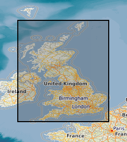
Spatial extent
Provided by
