 NERC Data Catalogue Service
BGS Geology - 625k (DiGMapGB-625) Linear (Faults) version 5
Simple
- Date (Publication)
- 2008
0115 936 3276
0115 936 3276
0115 936 3276
- Maintenance and update frequency
- irregular Irregular
- GEMET - INSPIRE themes, version 1.0
- BGS Thesaurus of Geosciences
-
- EGDI
- Geology
- Maps
- Data
- Digital maps
- GIS
- UK Location (INSPIRE)
- dataCentre
- Keywords
-
- NERC_DDC
- Access constraints
- otherRestrictions Other restrictions
- Other constraints
- no limitations
- Other constraints
- The dataset is made freely available for access, e.g. via the Internet. Either no third party data / information is contained in the dataset or BGS has secured written permission from the owner(s) of any third party data / information contained in the dataset to make the dataset freely accessible.
- Use constraints
- otherRestrictions Other restrictions
- Other constraints
- The copyright of materials derived from the British Geological Survey's work is vested in the Natural Environment Research Council [NERC]. No part of this work may be reproduced or transmitted in any form or by any means, or stored in a retrieval system of any nature, without the prior permission of the copyright holder, via the BGS Intellectual Property Rights Manager. Use by customers of information provided by the BGS, is at the customer's own risk. In view of the disparate sources of information at BGS's disposal, including such material donated to BGS, that BGS accepts in good faith as being accurate, the Natural Environment Research Council (NERC) gives no warranty, expressed or implied, as to the quality or accuracy of the information supplied, or to the information's suitability for any use. NERC/BGS accepts no liability whatever in respect of loss, damage, injury or other occurence however caused.
- Other constraints
- Available under the Open Government Licence subject to the following acknowledgement accompanying the reproduced NERC materials "Contains NERC materials ©NERC [year]"
- Spatial representation type
- vector Vector
- Denominator
- 625000
- Metadata language
- EnglishEnglish
- Topic category
-
- Geoscientific information
- Geographic identifier
-
GB
- Date (Revision)
- 2009
- Geographic identifier
-
UK [id=139300]
- Date (Creation)
- 1979
- Geographic identifier
-
UKM
- Date (Revision)
- 2009
))
- End date
- 2008
- Unique resource identifier
- OSGB 1936 / British National Grid (EPSG::27700)
- Unique resource identifier
- WGS 84 (EPSG::4326)
- Distribution format
-
-
GeoPackage (.gpkg)
()
-
ESRI Shapefile (.shp)
()
-
GeoPackage (.gpkg)
()
0115 936 3276
- OnLine resource
- BGS Geology 625K ( WWW:LINK-1.0-http--link )
- OnLine resource
-
DOI - Digital Geological Map Data of Great Britain - 625k (DiGMapGB-625) Linear version 5
(
WWW:LINK-1.0-http--related
)
Digital Geological Map Data of Great Britain - 625k (DiGMapGB-625) Linear version 5 British Geological Survey 2008
- OnLine resource
-
BGS Geology: onshore digital geological map of Great Britain data
(
WWW:LINK-1.0-http--link
)
The BGS Geology datasets are digital geological maps of Great Britain based on the different series of published BGS geological maps.
- Hierarchy level
- dataset Dataset
- Other
- dataset
Conformance result
- Date (Publication)
- 2011
- Explanation
- See the referenced specification
- Pass
- No
Conformance result
- Date (Publication)
- 2010-12-08
- Explanation
- See http://eur-lex.europa.eu/LexUriServ/LexUriServ.do?uri=OJ:L:2010:323:0011:0102:EN:PDF
- Pass
- No
- Statement
- Version 5 of the 1:625 000 linear features data was created primarily from the 1:50 000 scale Digital Geological Map of Great Britain (DiGMapGB-50) version 3 dataset (released in 2006) by generalisation involving cartographic selection, modification, simplification or exaggeration and matches that shown on the BGS poster maps of the UK (North and South) published in 2008. The attributes and nomenclature used follow those on the printed maps. The linear features were fitted to a relevant topographic base at the time of production.
- File identifier
- 057370e3-c7ca-49f4-e054-002128a47908 XML
- Metadata language
- EnglishEnglish
- Hierarchy level
- dataset Dataset
- Date stamp
- 2025-11-13
- Metadata standard name
- UK GEMINI
- Metadata standard version
- 2.3
- Dataset URI
- http://data.bgs.ac.uk/id/dataHolding/13606338
Overviews
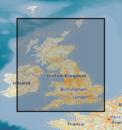
Spatial extent
Provided by
