TNO
Type of resources
Available actions
Topics
Keywords
Contact for the resource
Provided by
Years
Formats
Representation types
Update frequencies
-

The Borzęcin natural gas reservoir has been producing gas since the 1970s. The natural gas reservoir is located in the Zielona Góra basin, in the Polish part of the European Permian Basin. The reservoir is within the Rotligend sandstones and Zechstein carbonates and is capped by the Zechstein evaporites. Gas generation is proposed to be from the Carboniferous organic deposits with later migration into the Permian In May 2019, 2 wells at the Borcezin site were sampled for methane gas analyses. The following analyses were conducted: - Gas composition (C1-C5, CO2, N2, H2S, Ar) and and stable isotope analyses (methane δ13C and δD, CO2 δ13C, δ15N) - Methane clumped isotope analyses (Δ13CD and ΔDD) The dataset was created within SECURe project (Subsurface Evaluation of CCS and Unconventional Risks) - https://www.securegeoenergy.eu/. This project has received funding from the European Union’s Horizon 2020 research and innovation programme under grant agreement No 764531
-

During the drilling of an exploration well in the 1960s, an underground blowout occurred near Sleen, The Netherlands. During approximately 25 months, near-continuous leakage of large amounts of natural gas was released into the subsurface. After the blowout, the local drinking water production company installed a network of groundwater monitoring wells to monitor for possible adverse effects on groundwater quality at the blowout site. Today, more than 50 years after the blowout, the groundwater is still impaired. Data has been correlated with previously published data by Schout et al. (2018) covering description of geology and well depths. During two fieldtrips (November 2019 & October 2020) water samples were collected from several wells covering: - Bulk gas compositions (methane, ethane, propane, oxygen, nitrogen, CO2, Argon). Bulk isotope compositions of methane (δ13C & δH), carbon dioxide (δ13C) and nitrogen (δ15N). - Methane clumped isotope compositions (ΔCD & ΔDD). - Inorganic parameters (hydrocarbons, anions, cations, DOC, alkalinity, nitrate and ammonium). The dataset was created within SECURe project (Subsurface Evaluation of CCS and Unconventional Risks) - https://www.securegeoenergy.eu/. This project has received funding from the European Union’s Horizon 2020 research and innovation programme under grant agreement No 764531.
-

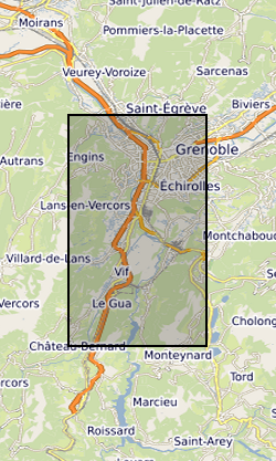
The Fontaine Ardente (FA) and Rochasson (ROC) natural gas seepage sites are located southwest (FA) and east (ROC) of Grenoble, France. For both field sites, gas is thought to originate from buried Middle Jurassic mudstones and argillaceous limestones and thought to migrate upward along small faults. At FA, the site located along a small seepage close to the river bed of a small creek. The gas seepage site at ROC is located along the flank of a thalweg and is linked to a small landslide in clayey horizons. New methane clumped isotope data is correlated to previously published data by Gal et al (2017) and recent isotopic data acquired within SECURe deliverable 3.4. During October 2019, 5 samples were collected from the FA and ROC sites and the following analyses were conducted: - Gas composition (C1-C5, CO2, N2, H2S, Ar) and and stable isotope analyses (methane δ13C and δD, CO2 δ13C, δ15N) - Methane clumped isotope analyses (Δ13CD and ΔDD) The dataset was created within SECURe project (Subsurface Evaluation of CCS and Unconventional Risks) - https://www.securegeoenergy.eu/. This project has received funding from the European Union’s Horizon 2020 research and innovation programme under grant agreement No 764531
-
The data set comprises a diverse collection of physical, chemical and biological measurements, encompassing over 1000 parameters. There are data from over 1650 conductivity-temperature-depth (CTD)/rosette stations, over 300 core profiles, over 370 sediment trap samples and much, much more. Most of this effort was directed at the region of the east Atlantic margin between La Chapelle Bank and the Goban Spur (between France and Ireland). In addition, there were two secondary areas of interest: the Norwegian Shelf Break just off Tromso and the Iberian Margin, either off Vigo or in the vicinity of the Tagus estuary. Measurements were collected from April 1993 until the end of December 1995 during 55 research cruise legs. Data were collected using a variety of equipment and techniques, including expendable bathythermography (XBTs), CTDs and oceanographic undulators with auxiliary sensors. These hydrographic profiles were accompanied by net hauls, plankton recorder deployments, sediment cores and comprehensive water and air sampling programmes during which a wide variety of chemical and biological parameters were measured. The station data were supplemented by underway measurements of oceanographic and meteorological properties. Results from production and trace metal experiments are also included in the dataset, as are bathymetric data from the British Oceanographic Data Centre (BODC) GEBCO digital Atlas, air-sea flux measurements and data from moored instruments and benthic landers that were deployed for periods from a few weeks to a year. The dataset also includes imagery from satellites, water column and seabed photography, scanning electron micrographs and X-ray photographs. FORTRAN source code for biogeochemical models developed during OMEX I is also included. The aim of the project was to study biogeochemical processes at the shelf break and to quantify the fluxes of material between the shelf and the open ocean. OMEX I involved scientists from 30 institutions in 10 countries. BODC is assembling the data sets collected during OMEX I into its database system and the data are also available on CD-ROM.
 NERC Data Catalogue Service