
Site investigations
Type of resources
Available actions
Topics
Keywords
Contact for the resource
Provided by
Years
Formats
Representation types
Update frequencies
Service types
Scale
Resolution
-
[This metadata record has been superseded, see http://data.bgs.ac.uk/id/dataHolding/13480403]. Index to reports of site investigations produced by external organisations carried out for all forms of site investigation. The Oracle index was setup in 1988 and covers the whole of Great Britain, all site investigation reports are indexed but the level of detail in the index for each record may vary. The reports date back to the 1950's and may contain information on boreholes, trial pits, laboratory tests and chemical analyses etc.
-

This Web service provides a spatial index into the ground investigation (also known as site investigation) reports collection held by the British Geological Survey (BGS) in the National Geoscience Data Centre (NGDC). Because of the long history and composite nature of this collection, and the different methodologies which have been used to locate and spatially reference the reports, the accuracy of report areas varies within the collection. Some reports have been scanned, and where available, a download link to the scan is provided.
-

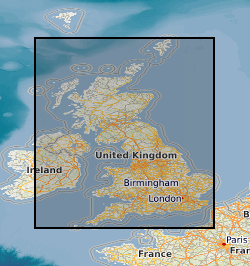
Reports of ground investigations (also known as site investigations) produced by external organisations carried out for all forms of site investigation. The reports date back to the 1950s and may contain information on boreholes, trial pits, laboratory tests and chemical analyses etc. The collection covers the whole of Great Britain with concentrations around urban areas and transportation routes. The interpretive parts of the reports are not available to public. Reports from onshore Great Britain (or near shore) site investigations are held in the National Geoscience Data Centre in paper, microfilm or digital format. The entire collections at BGS Edinburgh has been scanned, but in BGS Keyworth currently only reports received since 2002 have been scanned. Scanning started in 2002 and is ongoing with new records being scanned and added to the collection. Images are stored in TIFF format and are indexed in the Site Investigation Database and Detailed Accessions Database. The boreholes within the report, and any associated images, are linked to the Single Onshore Borehole Index.
-

A coherent series of flat-file geotechnical datasets generated during the applied geology mapping of Exeter, Deeside, Coventry, Nottingham, Bath, Castleford/Pontefract, and the Black Country, and mapping of the Thame 1:50k sheet. For each of these projects, data were abstracted from the available site investigations within the mapping area. The structure of the datasets is limited, in that all geological and geotechnical data are attributed to 'samples' at discrete depths. The datasets include the more common geotechnical parameters, although some are entered as only class intervals, rather than in detail. All the datasets are held as paper coding sheets, with minor variations between projects. Most were digitised in Smartware and/or Statgraphics software and may not be readily accessible.
-

Site investigation and geotechnical data received by BGS from 3rd party organisations in AGS file format. When received by BGS the data is validated against predefined rules, processed and stored in the BGS AGS agnostic store. This data is delivered as received e.g. no interpretative values or observations are added to the data by the BGS. For more details about the Association of Geotechnical & Geoenvironmental Specialists (AGS) see: https://www.ags.org.uk For more details on depositing AGS data with BGS see: http://www.bgs.ac.uk/data/ags To access AGS data held by BGS: http://mapapps2.bgs.ac.uk/geoindex/home.html?layer=AGSBoreholes
-
The collection of over 19,000 site investigation reports for Scotland and Northern England consists of records of boreholes, trial pits, geotechnical results and interpretative reports acquired from various sources. The collection started c.1960 to cater for the increasing amount of post-war shallow drilling for building and road construction which was kept separately by the Survey from the Borehole Journal collection reserved for deeper geologist examined mineral bores. The site investigation reports are available for consultation on microfilm. Only the factual parts of reports are available for public inspection. Reports for Northern England are held in the Shallow Borehole File (SB), now no longer added to. All site investigation reports (except SB files) are indexed on the Land Survey Record Index (LSRI) and all boreholes and trial pits contained in the reports (those with adequate site plans) are indexed on the Single Onshore Borehole Index (SOBI).
-

Surface and borehole information for a nuclear waste site investigation programme at Altnabreac, Northern Scotland. Dataset includes geological mapping, surface geophysics, borehole information, borehole geophysics and spring survey geochemistry.
-
The Land Survey Record Index was set up c.1988 to provide a digital database index to records and archives held by the Land Survey in Scotland and Northern England and contains over 46,600 records. Finding aid to the following record groups/data sets, is provided through a application query interface: Site Investigation Records (SE); Land Survey Archives (LSA); Land Survey Records (LSR); Mineral Resource Records (MR); Additional Information Files (AI); Enquiry Record Files (EE; EN); Opencast Coal Sites (OC).
-
This is the collection of cores and samples held by BGS for the sea areas around the UK. It includes material collected by BGS during its mapping projects and material donated to BGS by other organisations. The main core and sample types are grab samples (sea-bed), gravity cores, vibrocores and rock-drill cores (up to 6m in length), and borehole cores (up to 274m in length). The sea-bed grab samples are Holocene sediments present at the sea-bed and are stored in plastic jars. Where possible, sub-sample material has been retained after analysis. The bulk of the cores consist of Holocene and Pleistocene material. The rest are of bedrock ranging in age from Neogene to Pre-Cambrian. A lot of the core was collected in plastic liner tubing and the unlithified cores have been split vertically. The bulk of the material was collected in the late 1960s, 1970s and 1980s and early 1990's with ongoing additions of new sample and cores each year. The distribution is very variable, but, in general, there are grab samples and/or shallow cores spaced about every 5 - 10km across the entire UK Continental Shelf. In some localised areas the sampling density is much higher. The samples and cores are applicable to a wide range of uses including environmental, geotechnical and geological studies.
-
Site investigation and geotechnical data received by the Geological Survey of Northern Ireland (GSNI) from 3rd party organisations in AGS file format. This data has been collected under the Northern Ireland Pan Government Collaborative Framework Agreement (www.bgs.ac.uk/gsni/ags/). Once received by GSNI, the data is validated against predefined rules, processed and stored in the AGS agnostic database store. This data is then delivered as received e.g. no interpretative values or observations are added to the data by the GSNI. For more details about the Association of Geotechnical & Geoenvironmental Specialists (AGS) see: https://www.ags.org.uk