
Seismic data
Type of resources
Available actions
Topics
Keywords
Contact for the resource
Provided by
Years
Formats
Representation types
Update frequencies
Service types
Scale
-

This is a subset of the seismic GI gun data recorded on the CHIMNEY JC152 cruise in 2017 (further information and nomenclature in Bull et al. 2018). Data were recorded on Ocean Bottom Seismic Receivers 1 and 19, and shots were selected to maintain offsets of approximately 200m, with a wide but uneven azimuth distribution. This was done to study azimuthal attenuation anisotropy for near-vertically travelling P-waves. The data are in SEGY format, with file names in the form: Rec*_**_***_nmo.sgy where * is receiver number ** is GI for the GI gun source and Dura for the surface sparker source *** is X for X component, Y for Y component, Z for Z component and H for hydrophone. Reference: Bull, J. M. (2018). Cruise Report – RRS James Cook JC152: CHIMNEY - Characterisation of Major Overburden Pathways above Sub-seafloor CO2 Storage Reservoirs in the North Sea Scanner and Challenger Pockmark Complexes,University of Southampton, 55 pp. Available at: https://eprints.soton.ac.uk/420257/ NERC Grant - Characterization of major overburden leakage pathways above sub-seafloor CO2 storage reservoirs in the North Sea (CHIMNEY)
-
Scanned images of seismic phase data sheets containing phase readings, phase arrival times, amplitude data, magnitude data and derived source information like hypocentres (locations), fault plane solutions etc for earthquakes recorded by BGS seismic stations. The data is in the format used by the location program HYPO71 (Lee & Lahr, 1975) which was the most used program for local earthquakes.
-
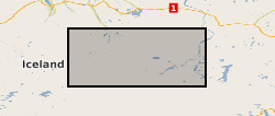
This is continuous raw data from 3-component broad-band (30 sec to 100 Hz) Guralp 6TD seismometer deployments around Askja in the central region of Iceland.
-
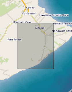
The data is from four three-component broadband seismometers deployed along the lower east rift zone during the 2018 Kilauea eruption for four months. The instruments were deployed towards the end of July before the eruption ceased, and were placed in locations that would complement the existing USGS seismic network.
-

This dataset comprises broadband seismic data from the Askja Caldera, Iceland, which consists of ~12 months of continuous recording from August 2023-August 2024. A total of 23 Guralp 6TD and Certimus seismometers were deployed in and around the ~8km diameter caldera, with sampling rates set to 100sps. Each seismometer was buried ~30cm below the surface, and attached to a power supply consisting of 3 100Amp-hour batteries and 100 W solar panels mounted on a wooden frame. The batteries were placed in a box that sat on the supports of the solar panel frame to act as ballast, and wrapped in a plastic sheet. A Gps unit was mounted on the solar panel frame. Access to most stations is by foot, and installation was undertaken either by carrying the equipment on foot or by helicopter. The dataset provided is in standard miniseed format, and has an accompanying dataless file for each instrument type in xml format. The miniseed data is archived in day files under the directories "2023" and "2024", while the xml file is located in the directory "dataless". The data is of good quality, with both local earthquakes and teleseisms easily detected. The data were collected for the purposes of tracking microseismic activity associated with the recent reinflation event at Aska, and to help facilitate seismic imaging beneath the caldera using both body and surface wave tomography. The data may be of use to other scientists with an interest in earthquake seismology, imaging, and characterisation of geothermal areas near active volcanoes. The data were collected by the University of Iceland and University of Cambridge, both of who are responsible for interpretation of the data. The archive is complete as it currently stands. The data were converted into miniseed using a standard format that is consistent with archives stored at the IRIS DMC.
-

This is a set of data points for constructing a seismic hazard map of the UK, plotting the intensity (EMS) with a return period of 475 years, equivalent to a 90% probability of not being exceeded in 50 years. Individual data points should NOT be used.
-

This dataset contains broadband seismic data collected between May 2018 and January 2019 as part of the Unsettled Earth project funded by the University of Bristol's Brigstow Institute. The seismic station was deployed in one of the turrets of the Wills Memorial Building Tower, Bristol.
-

The UK Onshore Geophysical Library was established in 1994 in conjunction with the Department of Trade and Industry (DTI) and the UK Onshore Operators Group (UKOOG). The Library manages the archive and official release of seismic data recorded over landward areas of the UK. By agreement with the DTI and HMSO, the Library operates as a registered charity, funded by revenues raised from data sales and donations, with the long term objective of bringing all available UK onshore digital seismic data into secure archival storage, whilst providing efficient access to all interested parties. BGS has access to the data at cost of copying only for science budget work. Data index on the BGS Geoscience Data Index.
-
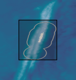
Broadband seismic data collected as part of the Macquarie Ridge experiment from 2020-2021. OBSs were deployed around Macquarie Island, while terrestrial stations were deployed on Macquaire Island itself. The data sources are as follows: (1) 3-component broadband data from 10 IGGCAS stations with 60s corner period, plus hydrophone data. (2) 3-component broadband data from 5 Guralp Libre stations with 60s corner period, plus hydrophone data. (3) 3-component broadband data from 5 Guralp Certimus stations located on Macquarie Island. Four instruments only recorded for ~2 months, while the remaining instrument managed about 8 months of recording. Further details on the experiment can be found in Tkalčić, H., C. Eakin, M. F. Coffin, N. Rawlinson, and J. Stock (2021), Deploying a submarine seismic observatory in the Furious Fifties, Eos, 102, https://doi.org/10.1029/2021EO159537.
-

This dataset contains data from two seismic and one infrasound array deployed at Mt. Etna during the late part of the 2020-2021 eruptive crises (May-November 2021). The arrays were composed as follow: 1) a 7-element array of 3-component, broadband (Trillium T120 compact) seismometers; 2) a 5-element array of 3-component short-period (Lennartz LE-3Dlite-MkII); 3) a 6-element array of broadband infrasound microphones (IST2018). All data were recorded with a sampling rate of 100 Hz and 24-bit resolution using Digos Datacube3 digitizers. The data were collected through a collaboration between the University of Liverpool, UK, and the Istituto Nazionale di Geofisica e Vulcanologia (INGV), Italy, with the purpose of characterizing pre- and syn-eruption tremor signals at Etna, and their links to the timing, style and intensity of paroxysmal eruptive activity at the volcano. The dataset contains records of different examples of paroxysmal activity (i.e., intense episodes of sustained Strombolian explosions accompanied by emission of ash at the vent) as well signals associated with as explosive degassing at the summit vent. Data recovery rates for this experiment were high; there are only very minor gaps in the data owing to periods of scheduled maintenance and data download during the deployment period.