Sea floor
Type of resources
Topics
Keywords
Contact for the resource
Provided by
Years
Formats
Representation types
Update frequencies
Scale
-
Data from Marine Conservation Zone (MCZ) surveys are archived in the MEDIN Data Archive Centre (DAC) for Geology and Geophysics at the British Geological Survey. This includes geology (Particle Size Analysis) data and multibeam backscatter data. Data are delivered via the BGS Offshore GeoIndex. Additional data are available on request enquiries@bgs.ac.uk. Other data types are archived with the other MEDIN DACs as appropriate (UKHO DAC for bathymetry data and DASSH DAC for biological data). https://www.gov.uk/government/collections/marine-conservation-zone-designations-in-england.
-

The BGS Seabed Geology: Offshore East Anglia digital map provides detailed and accurate characterisation of the seabed geology, based on seabed and shallow-subsurface data. This dataset incorporates three complementary map components (Substrate Geology, Structural Geology, and Geomorphology), provided as discrete layers for viewing within a Geographic Information System (GIS). The bedrock geology of the mapped area comprises Cretaceous age Chalk Group sedimentary rocks. These rocks crop out extensively at seabed across the southern and central parts of the dataset forming an extensive bedrock platform and Europe’s largest known offshore chalk reef. This reef has been designated the Cromer Shoal Chalk Beds Marine Conservation Zone (MCZ) owing to the range of unique floral and faunal habitats that it supports. The Chalk Group is covered across the central (partly) and southern parts of the dataset by natural superficial deposits that accreted during the Quaternary. These include preglacial delta bottom-set (Westkapelle Ground Formation) and delta top-set (Yarmouth Roads Formation); and glacial sediments and landforms that were deposited and formed during at least two separate phases of glaciation that inundated parts of the southern North Sea and adjacent East Anglia during the Middle Pleistocene (Anglian / Elsterian) and Late Pleistocene (Late Devensian / Late Weichselian). Collective geological evidence includes extensive areas of out-cropping subglacial till; the presence of largely concealed and infilled over-deepened (>100 m deep) subglacial tunnel valleys, ice-marginal moraines, and a glacially disrupted chalk surface that includes the development of incised meltwater channels, detached and transported glacitectonic bedrock rafts and megablocks. Post-glacial environments from the Late-Pleistocene – Holocene (prior to marine inundation) included fluvial and estuarine deposition, that together with variable infill of late-glacial valleys are included within the Botney Cut Formation. Holocene marine transgression flooded the region, with shallow marine sedimentation active through modern times resulting in the variable cover of unconsolidated marine sediments, as well as the distribution of extensive current-induced bedforms, e.g., sediment banks, sediment waves and fields of mega ripples which are recorded within the Seabed Geomorphology dataset. Each theme is provided as distinct layers for viewing within a Geographic Information System (GIS). The “Substrate Geology” layer shows the distribution of bedrock and unlithified superficial deposits present at the seabed (below a thin veneer of seabed sediments, ‘one-metre principle’ described below) as a series of polygons; The “Structural Geology” layer represents the structural features observed at rockhead as a polylines layer, and “Geomorphology” theme consists of points, polylines, and polygons layers to portray the main seabed morphological and geomorphological features.
-
Scanned geophysical records, reports and track charts from Tarmac (previously Lafarge Tarmac) aggregate industry marine surveys 1989 to 2004. The geophysical records include boomer seismic and side scan sonar data of varying quality. All records from 44 boxes of paper records have been scanned at BGS and are delivered online along with any additional digital file such as reports or data files. The data are stored as part of the National Geoscience Data Centre (NGDC) and the Marine Environmental Data and Information Network (MEDIN) Data Archive Centre (DAC) for Geology and Geophysics.
-

This is a 1:10,000 scale Bedrock geological map for some 800 km2 of the seabed across Weymouth Bay in Dorset. It joins seamlessly to the onshore BGS 1:10,000 scale Digital Geological Mapping (DiGMapGB-10) and therefore shows the coastal geology in detail. It comprises bedrock polygons, faults and limestone bed lines. The map was produced in 2015-16 by digitising against a seamless on- to offshore-shore elevation surface generated from high (1 m bin) resolution bathymetry and coastal Lidar data, collected as part of the Dorset Integrated Seabed Survey (DORIS) project and the Regional Coastal Monitoring Programme of England, made available by the Channel Coastal Observatory under the Open Government Licence. The map can be veiwed using the map viewer at www.bgs.ac.uk/research/marine/doris.html. This map has been produced under the auspices of the Marine Environmental Mapping Programme (MAREMAP), in collaboration between the BGS and the University of Southampton. The map itself should be referred to as: Westhead, R K, Sanderson, D J, Dix, J K. 2016. Bedrock map for the offshore Weymouth Bay area, with seamless coastal joint to BGS onshore (DiGMapGB-10) mapping. Bedrock Geology. 1:10 000 (Marine Environmental Mapping Programme, MAREMAP)
-
The Marine Photographs Archive held by BGS includes photographs of hydrocarbon well and (non-hydrocarbon) marine boreholes, cores and other samples. There are also photographs of the seabed and survey operations. The photos are primarily for the UKCS (United Kingdom Continental Shelf) and surrounding areas and date from the 1970s onwards. The photographs, which are a mix of prints, negatives and digital are applicable to a wide range of uses including environmental, geotechnical and geological studies. There are also some x-rays of cores.
-
WESTLINE was acquired by BIRPS (the British Institutions Reflection Profiling Syndicate). The seismic data image the faulted conjugate margins of the Rockall Trough and the intrabasinal sediments. The seismic data were shot to 18 s two-way time along a single 450 km-long transect.
-
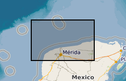
BIRPS (the British Institutions Reflection Profiling Syndicate) acquired almost 650 km of offshore seismic data and 300 km of onshore seismic data over the Chicxulub impact crater. The data were recorded to 18 s two-way time.
-
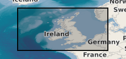
BGS has drilled almost 600 boreholes to prove seismic interpretations of the marine Quaternary geology and bedrock from the UK Continental Shelf (UKCS). The collection also includes additional third party data and has assisted in the creation of BGS Marine Geology Maps. The boreholes penetrate beneath the sea bed to depths ranging from about 10m to over 300m depending on the target depth or technical problems associated with drilling the borehole. The data includes descriptive geological core logs and data which has been captured from these and in some cases natural gamma logs. A variety of analyses has been conducted on the core material such as Particle Size Analysis, micropalaeontological, geotechnical, palaeomagnetic and age dating. Core material are managed as part of the BGS Materials collection and are available for examination and subsampling. The data are stored as part of the National Geoscience Data Centre (NGDC) and the Marine Environmental Data and Information Network (MEDIN) Data Archive Centre (DAC) for Geology and Geophysics. Data are delivered via the BGS Offshore GeoIndex http://www.bgs.ac.uk/GeoIndex/offshore.htm. The activity and scan layers contains location information, metadata and links to scanned borehole logs, and the geological data layers contain observations and/or measurements as digital values. The data are applicable to a wide range of uses including environmental, geotechnical and geological studies. Reference: Fannin, NGT. (1989) Offshore Investigations 1966-87 British Geological Survey Technical Report WB/89/02, British Geological Survey.
 NERC Data Catalogue Service