
Rock samples
Type of resources
Available actions
Topics
Keywords
Contact for the resource
Provided by
Years
Formats
Representation types
Update frequencies
Service types
-

Major and trace element composition, and stable isotope data for whole-rock samples from alkaline rocks of the Chilwa Province. Samples collected between 2011-2021 in the Chilwa Alkaline Province, Malawi
-

This dataset consists of EBSD (electron backscatter diffraction), AMS (anisotropy of magnetic susceptibility) and AARM (anhysteretic anisotropy of remanent magnetisation) files, and magnetic carrier characterisation information, for samples collected from the Whin Sill ,northern England. Described in the paper Unravelling the complex record of magma flow and solidification in sills (Williams et al. 2025 - accepted into the Journal of the Geological Society May 2025). This work was completed at the University of Liverpool. Samples were collected and named WS01, WS02, WQC1C, WQC2C and WQC3C. The dataset includes .ctf files from the samples, which contain crystal orientation data from thin sections, .ran files which include the AMS and AARM fabric information for each sample, and .cur files of magnetic susceptibility data, hysteresis data from VFTB.
-
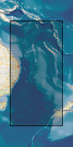
These data are derived from a voyage on Australia’s R/V Investigator, IN2019_v04, ‘Hotspot dynamics in the Coral Sea: connections between the Australian plate and the deep Earth’. The voyage surveyed the Tasmantid and Lord Howe Seamounts in the Tasman and Coral Seas, together with the Louisiade Plateau in the Coral Sea, sailing from Cairns on 7 Aug 2019 and arriving in Brisbane on 3 Sep 2019. The voyage summary is available at https://www.marine.csiro.au/data/reporting/get_file.cfm?eov_pub_id=1443. This directory includes datasets derived from ship samples and data as part of NERC grant NE/S01067X/1 (e.g., XRF and ICP-MS geochemistry data). Post voyage analyses by Australian collaborators are not included. More details are available in the README file.
-

A spatial database of over 30 000 point localities which have been noted on geological field slips and their associated field note record cards or notebooks during the course of survey activity. The data cover areas surveyed from the early 1980s onwards, and contain a reference to the field slip, the version number of the field slip, the number of the locality point and a spatial location. The index contains only the locations of locality points. The textual descriptions of field localities are held on hard-copy field note record cards, which are held within the National Geoscience Data Centre (NGDC) and are accessible on request to BGS Enquiries. A high-level index of available field note record cards in Scotland is available via the NGDC Deposited Data Search: https://webapps.bgs.ac.uk/services/ngdc/accessions/index.html?simpleText=field%20note%20card#. Data were entered into the database by BGS staff from 1997 onwards. For more information, refer to: Kilpatrick, K., 1999. Users' Guide: Data Entry and Editing for the BGS Field Notebook Database. British Geological Survey technical report WO/99/6R. Kilpatrick, K., 1999. Users' Guide: Data Retrieval for the BGS Field Notebook Database. British Geological Survey technical report WO/99/7R.
-

This Web service provides a spatial index into the BGS collection of onshore borehole materials in the UK and the Isle of Man, including drillcore, bulk specimens, washed and unwashed cuttings and processed material. The boreholes have been drilled by BGS, or by commercial or public bodies. The name of the borehole, its unique reference code and number (BGS_ID) and the type of material is provided. For some boreholes, multiple types of material are available. Details of the collection are held in the Borehole Materials Database, and may be accessed via the BGS website.
-

These data are derived from a voyage on Australia’s R/V Investigator, IN2019_v04, ‘Hotspot dynamics in the Coral Sea: connections between the Australian plate and the deep Earth’. The voyage surveyed the Tasmantid and Lord Howe Seamounts in the Tasman and Coral Seas, together with the Louisiade Plateau in the Coral Sea, sailing from Cairns on 7 Aug 2019 and arriving in Brisbane on 3 Sep 2019. The voyage summary is available at https://www.marine.csiro.au/data/reporting/get_file.cfm?eov_pub_id=1443. This directory includes the ship data, in some cases with initial onshore processing done by CSIRO technical staff (e.g., the underway data). More details are available in the README file.
-
The British Geological Survey onshore borehole collection database of core and sample types and depths contains records of over 15 000 onshore boreholes drilled in the UK by BGS, commercial and public bodies. Material types include continuous drillcore, core samples, individual hand specimens, bulk samples, unwashed cuttings, washed and dried cuttings, plugs, powders and bulk samples. The physical collection and database was developed as part of the British Geological Survey's responsibility to establish and maintain a national borehole collection. Details of the collection are held in the Borehole Materials Database, and may be accessed via the BGS website. The collection was initiated in 1968, and the database is updated daily by the addition of new data and by modification of existing data. Most material is stored at the facility in BGS Keyworth. Some material is held at BGS Edinburgh. The majority of borehole cores and samples are available for study and sub-sampling by bona fide academics and commercial companies. Commercial companies are charged for access; academics will need to complete an academic waiver form. Some boreholes, especially recent hydrocarbon wells, are confidential, and depths and sample details may not be given. If you require further information about these boreholes, contact kwcorestore@bgs.ac.uk for details of the owner. In a few cases, the precise map references are also confidential.