 NERC Data Catalogue Service
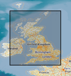
Oil wells
Type of resources
Topics
Keywords
Contact for the resource
Provided by
Years
Formats
Update frequencies
-

Marine geophysical survey of the NE BRazil and French Guiana continental margin onboard RRS Discovery (D275). The Amazon Cone is a deep-sea fan system that developed on a continental margin approximately 90-100 Myr following a rifting event. Gravity and flexure modelling suggest that the Cone sediments have loaded the margin almost to the limits of its strength. The investigators propose to carry out the first seismic refraction experiment to determine the structure of the crust and mantle that has been deformed by the Cone load. The experiment will provide new constraints on the structure, the nature of the ocean-continental boundary, the thermal and mechanical properties, and the resource potential of deep-water continental margins.
-
Data from onshore wells provided to BGS as part of an agreement with NSTA/OGA/DECC Digital data (includes, well logs, well reports and downhole data) for oil and gas exploration and appraisal wells drilled in the UK and held on behalf of the North Sea Transitory Authority (formerly the Oil & Gas Authority, formerly the Department of Energy and Climate Change). External data therefore BGS has no control on quality. Provided to OGA/DECC/BGS by oil companies as part of their obligations under licensing regulations, PON 9b regulations notice.
-

This 'oilfield in a box' dataset contains all of the raw data available from the Hutton hydrocarbon field in the northern North Sea (quadrant 211), provided to BGS (British Geological Survey) through the National Hydrocarbon Data Archive. Petroleum licences issued by the Oil and Gas Authority (OGA) require that all hydrocarbon data from the UK continental shelf (UKCS) are preserved in perpetuity and in usable condition. Historically, a route to end this obligation was achieved by archiving data in the National Hydrocarbon Data Archive (NHDA), which was active from 2003 to 2016. The NHDA, operated by BGS on behalf of the UK Government, was the primary long-term data archive for UK offshore oil and gas exploration and production activity data. During its life the NHDA was used by various operators and organisations to archive a range of UKCS data from one field, 15 licences, 33 seismic surveys and 102 wells. Details on these can be found at the web link: http://www.bgs.ac.uk/nhda/home.html After decommissioning the Hutton Field, the (then) operator Kerr McGee deposited the well and seismic data within the NHDA. The NHDA has taken over management of these data and has now licensed it for academic and non-commercial use. This dataset represents a comprehensive record of the type of information collected over the lifetime of a hydrocarbon field, and comprises: borehole data from 65 wells across the Hutton Field, including wireline logs and reports; a 3D seismic survey; stratigraphic and production data.