 NERC Data Catalogue Service
LiDAR
Type of resources
Available actions
Topics
Keywords
Contact for the resource
Provided by
Years
Formats
Representation types
Update frequencies
Resolution
-
This dataset is comprised of raw data and rotation matrices captured with the NERC-funded Terrestrial Laser Scanner (TLS) instrument. Data was collected across 15 plots in Wytham Woods, UK, in leaf-on and -off conditions for 3 years. For 5 of the plots all ash trees were girdled to simulate death by the fungal pathogen Hymenoscyphus fraxineus ('ash dieback'), 5 of the plots were 'ash-control' where the dominant species were Fraxinus excelsior and the remaining 5 plots were non-ash dominant. TLS data was acquired on the four edges of the plot and the plot centre. For the summer 2020 and winter 2021 acquisitions the scanner was mounted on a pneumatic mast to capture data from different heights (2 m, 4 m, and 6 m), from summer 2021 onwards the scanner was mounted at a height of 2 m. The scanner was set to an angular step of 0.04 degrees. In between each scan position a set of retro-reflective targets were positioned to be used as tie-points between scans. Scan data was coregistered using RiSCAN Pro, the 4x4 rotation transformation matrices to transform the point cloud data into a common reference coordinate system can be found in the "matrix" directory, all acquistions for the same plot were registered to the same coordinate system. For more information on TLS acquisition for this project see Wilkes et al. (2021) and more generally refer to Wilkes et al. (2017) which can be found in the documentation section.
-
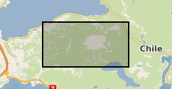
Helicopter borne LiDAR and aerial photo survey of lahar pathways deposited during the April 2015 Volcan Calbuco eruption. Terrestrial Laser Scanning data for July 2015.
-
Data are distances (in cm) to water measured by an experimental near-infrared lidar sensor in six different setups (2017–9). Laboratory tests conducted at Imperial College London include quantifying the effect of (i) distance, (ii) sensor inclination, (iii) turbidity/clarity of the water, and (iv) ambient temperature on measurement bias. Outdoor tests at three locations in London interrogated the effect of varying water surface roughness on the measurements. A dataset of high-frequency measurements is also included, from which the effects of sample autocorrelation were interrogated.
-
This dataset contains LiDAR scans as Faro Scene files of 53 scans which cover 15 different fossiliferous surfaces. The number of scans per surface varies depending on the topology of the bedding plane. These LiDAR scans were made in Newfoundland, Canada, from Mistaken Point Ecological Reserve (10 surfaces), Discovery Geopark (4 surfaces) and Ferryland (1 surface). 45 scans were made in July 2022 and 8 in September 2022. The scans were made in order to enable the mapping of fossil specimens within their communities so that spatial analyses can be used to infer the underlying biological and ecological processes than govern Ediacaran eco-evolutionary dynamics. The dataset is complete to reconstruct the bedding surfaces accurately.
-
This dataset contains inputs for wildfire simulations in Fire Dynamics Simulator (FDS) in forest environments. It includes five segmented point clouds in LAS format, representing different fuel classes from a forest plot, each with an associated BDF (Bulk Density Files) file. The forest plot consists of a 40 x 40 m Pinus ponderosa plot scanned with a Riegl-VZ400i in Sycan Marsh, Oregon, USA, during the summer of 2019. The dataset also contains Fire Dynamics Simulator (FDS) input files detailing the configuration for three separate simulations. These resources support modelling and simulation efforts to better understand fire behaviour in forest ecosystems. Full details about this dataset can be found at https://doi.org/10.5285/467a735f-b03c-4c30-8781-82f0e11aec28
-
The Airborne Research & Survey Facility (ARSF, formerly Airborne Remote Sensing Facility) is managed by NERC Scientific Services and Programme Management. It provides the UK environmental science community, and other potential users, with the means to obtain remotely-sensed data in the form of synoptic analogue and digital imagery for use in research, survey and monitoring programmes. Data offered by the facility includes: 1) Aerial photography data collected with an analogue camera, the Wild RC-10 visible NIR, in conjunction with CASI and ATM instruments. 2) Airborne Thematic Mapper (ATM): ARSF has flown two ATM instruments over the period 1982 - 2008: the Daedalus 1268 was operated from 1982 until 1998. Since 1996 and until 2008 an upgraded version - the Azimuth Systems AZ-16 was used, along with an improved data acquisition system. 3) LiDAR (Light Detection and Ranging) data from an Optech ALTM 3033 instrument. The sensor is on loan to the ARSF only for some periods of the year from the Unit of Landscape Modelling (ULM) at Cambridge University. 4) High spectral and spatial resolution data from the Compact Airborne Spectrographic Imager (CASI 2). The CASI 2, produced by Itres Research of Canada, is a two-dimensional CCD array-based pushbroom imaging spectrograph operated by ARSF until 2007 5) High spectral and spatial resolution data from the AISA Eagle and Hawk hyperspectral sensors (since 2007). The AISA Eagle is a 12 bit, pushbroom, hyperspectral sensor with a 1000 pixel swath width, covering the visible and near infra-red spectrum 400 - 970nm. The AISA Hawk is a 14 bit sensor able to capture short wave infrared wavelengths, 970 - 2450nm. The ARSF currently uses a Dornier 228 aircraft. This extensively modified aircraft is not only capable of accommodating the current ARSF core instrumentation, as well as additional experimental optical and geophysical sensors, but is also configured to deploy a range of atmospheric instrumentation and samplers. Such a comprehensive data service cannot be easily achieved by other survey techniques. The operational flying season generally spans from early March until early October. Three elements determine this period: weather, solar zenith angle and vegetation state; maintenance on the aircraft; sensor maintenance as this is performed by the manufacturers between November and January. Every day during this season, the ARSF has to make difficult decisions on whether or not to attempt flying based on weather forecasts, and to prioritise the most important projects based on many parameters. Flying schedule is available from the ARSF website. The NEODC holds the entire archive of Airborne Thematic Mapper (ATM) and Compact Airborne Spectrographic Imager (CASI) data acquired by the NERC ARSF. High-resolution scanned digital versions of the entire collection of analogue photographs are now also available as well as selected LiDAR-derived elevation and terrain models for selected sites flown using the sensor.
-
This dataset comprises co-aligned hyperspectral and LiDAR data collected of European beech (Fagus sylvatica) forest within core protected areas of the UNESCO Rhӧn Biosphere Reserve, Germany. Data was collected using the Headwall Hyperspec Nano sensor flown from a unmanned aerial vehicle (UAV) in September 2020. The dataset comprises image and LiDAR data of four sites, each approximately 8ha in size. The study forests were subject to the extreme drought event that impacted central Europe in 2018/2019 and this project sought to collect data to enable individual tree and stand level assessment of the response (canopy damage and defoliation) of European beech trees to extreme drought events. The hyperspectral images available in this dataset have approx. 5cm pixel size with an associated LiDAR dataset and are suitable for identifying individual trees and the degree of canopy damage (defoliation, discolouration, and mortality) sustained by individuals/stands within the forest. The work was supported by the Natural Environment Research Council (Grant NE/V00929X/1). Full details about this dataset can be found at https://doi.org/10.5285/23d6a61c-c1cf-4c1b-a65c-f3fe42fc0e76
-
The dataset contains top-of-canopy height before and after the 2015-15 El Niño Southern Oscillation (ENSO) event across a human-modified tropical landscape in Malaysian Borneo. The derived changes in top-of-canopy height from 36,655 repeated measurements were investigated. Data were obtained from airborne LiDAR in November 2014 and April 2016. Topographic Position Index and distance from oil palm plantations are also included to investigate the effects of topography and fragmentation on the canopy height change during the ENSO event. Each observation (pixel) contains the coordinates to assess the spatial effects on canopy changes. Full details about this dataset can be found at https://doi.org/10.5285/534838c8-0e1f-4a04-a837-2e19a4e93797
-
This dataset contains LiDAR and aerial photograph data for the Sabie, Olifants and Letaba rivers in the Kruger National Park, South Africa. The LiDAR and aerial photograph data were collected for the NERC funded project (NE/K001132/1) 'Evaluating and modelling the impact of extreme events on South African dryland rivers: Cyclone Dando (January 2012)'. Southern Mapping Geospatial were commissioned in South Africa to undertake the LiDAR flights for the NERC-funded project. Processed data of point cloud, processed contours, and aerial image files were provided. Data were retrieved using an Optech Orion M200 LiDAR which scanned the ground at 70 kHz, and a Rollei AIC with 60 megapixel P65+ and Phase One digital CCD, flown at 1100m from a Cessna 206. The survey concentrated on three 50 km reaches of the Olifants, Sabie and Letaba rivers surveyed on 30th May 2012, nearly 5 months after a large Cyclone driven flood in January 2012. The folders include: 1) Index - contains a .dgn file to position data in ArcMap, 2) Points - contains sub-folders with the raw LiDAR point cloud data; ground points and vegetation at different heights indicated by the folder label 3) Report - summary report provided by Southern mapping who we commissioned to fly the LiDAR 4) Contour data in dgn and dwg format, 5) Image tiles
-
A colour LiDAR (Light Detection And Ranging) dataset was obtained at the cliffs at Happisburgh, Norfolk, UK, over a period of 9 months (April 6, 2019 to December 23, 2019). The scans were taken daily for 90% of the study period using a FARO S350 TLS (Terrestrial LiDAR Scanner). Scans were carried out from two locations consecutively, positioned at around 40 m from the cliffs. The full scans are also split into smaller subsets: "slices", 1 m wide bands oriented perpendicular to the shoreline, and "grids", smaller areas of the beach, to assist analysis. The numerical model SWAN (Simulated Waves Nearshore) (v41.31a), run in non-stationary mode, was used to simulate hourly sea states at the study site to aid in the context of environmental conditions. Wind parameters from the ERA5 reanalysis and bathymetry from the OceanWise 1 arc second digital elevation model (DEM) were used to force the SWAN model, and obtained wave parameters in 4x6 km rectangular grid around the scanning site, with a 10m interval, and a 26x26 km square grid encompassing the smaller grid, with a 100 m interval. The LiDAR scans were also projected into both colour and intensity images, viewing the shoreline from above. This research was funded by the UK Natural Environment Research Council (NE/M004996/1; BLUE-coast project). The on-location LiDAR Scanning and Technical R&D operated by ScanLAB Projects Ltd was funded by Innovate UK's Audience of the Future Program (Multiscale 3D Scanning with Framerate for TV and Immersive Applications project). The first 6 months of LiDAR scans (April to September 2019) were funded by Innovate UK, and this project was continued by the NERC BLUE-coast funding for the last 3 months (October to December 2019).