 NERC Data Catalogue Service
Gravel
Type of resources
Available actions
Topics
Keywords
Contact for the resource
Provided by
Years
Formats
Representation types
Update frequencies
Scale
-
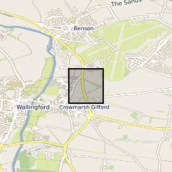
The borehole is located at the UK Centre for Ecology and Hydrology (UKCEH), screened between 2 and 4.5 m in the Thames gravels, and drilled to a total depth of 4.8m. It is located on an actively managed grass verge with popular and sycamore trees within 10 m. The stilling well is positioned 420 m west of the borehole in the River Thames. Both stage and groundwater level were monitored at 1-minutre frequency to investigate hydrological fractal scaling of high frequency data between 2012 and 2016. An automatic weather station is present between the borehole and stilling well and the data are available separately from UKCEH (stetur@ceh.ac.uk). Further site description is provided in: Habib, A. et al. 2017. Journal of Hydrology, 549, 715-730. Habib, A. et al. 2022. Hydrological Sciences Journal
-

The UK Sand and Gravel Database was compiled during the production of the Industrial Mineral Assessment Reports. The Department of the Environment commissioned this Report series from the British Geological Survey. Data collection extended from the first IMAU report in 1969 to the last report in 1990. The dataset is complete and is derived from reports with some additional boreholes that were never published. Standard procedures were adopted for whole project. Each report studied the sand and gravel resources of an area of between one hundred and two hundred square kilometres. Specially commissioned boreholes on a one kilometre grid basis were used in conjunction with existing geological knowledge to make a resource level assessment of the volume and quality of sand and gravel resource available. A total of 12,563 boreholes were drilled, 53,721 Lithological units described and 54,128 samples collected and graded. This information is presented in the appendixes of the individual reports and as a single database. Data collection is complete. Only factual corrections to the data are occasionally made. The dataset includes the borehole location, total depth, unit thickness, unit lithologies, and grading information.
-
'Archive' collection of c.3,000 records of the former Industrial Minerals Assessment Unit (IMAU) relating to sand and gravel assessment projects in Scotland, 1978-88. Includes borehole and trial pit records, grading and resource assessment data and aggregate tests.
-

This dataset includes raw point cloud data from repeat terrestrial laser scans (TLS) for measuring early-stage protodunes developing, migrating and eroding on a gravel surface in the Helga's Interdune Area (north), Gobabeb, Namib Desert, Namibia. As well as the TLS data, additional measurements include wind speed with a CSAT 3D sonic anemometer and sediment transport using a Sensit sensor.
-

Information from the Scottish quarries database has now been incorporated into the BritPits (British Pits) database Contains the site and rock type information of working and disused hard rock quarries in Scotland, covering all mainland Scotland and major Scottish islands. Database was initiated in the spring of 1997. Various stages of completeness in the dataset according to information received, quarries not documented will not be recorded. Quarry site data is given as point data (centre 2D XY data), at the point there is a quarry, areal extent is not recorded.
-
This dataset shows the geographic extents of Mineral Assessment Reports covering sand and gravel resources and selected other industrial minerals across the United Kingdom. The index polygons represent the areas surveyed, typically between 100 and 200 square kilometres, for which individual reports and accompanying 1:25 000 scale maps were produced. The sand and gravel resources of the UK were surveyed on a regional basis by the Industrial Minerals Assessment Unit (IMAU) between 1968 and 1990. Each survey area was investigated through drilling and sampling of sand and gravel deposits, borehole logging, and particle-size analysis to determine the proportion of gravel, sand and fines. The accompanying maps categorise resources as exposed, present beneath overburden, or potentially not workable. In addition to sand and gravel, other industrial mineral resources were assessed during the same period, including celestite, limestone and dolomite, conglomerate, and hard rock resources. Selecting individual polygons provides details of the corresponding report, including title, report number, author(s), subtitle and publication date. The Mineral Assessment Report series was commissioned by the Department of the Environment and undertaken by the British Geological Survey.