
Geothermal energy
Type of resources
Available actions
Topics
Keywords
Contact for the resource
Provided by
Years
Formats
Representation types
Update frequencies
Service types
Scale
Resolution
-

These are so-called relaxation datasets for the rate of structural relaxation of glass exposed to high temperatures. The glass is in the form of chips collected during the IDDP-1 drilling project at Krafla Iceland (more below). The chips were generated during drilling in 2011. However, the analysis presented here was developed in 2023 ahead of the ultimate publication in 2024. The data were collected using differential scanning calorimetry, which is a standard method in glass science for measuring the enthalpy of glass relaxation as it is returned to the high temperatures from which it formed. The relaxation rate of the glass from IDDP-1 tells us directly what the rate was at which it cooled. That "cooling rate" in turn allows us to understand what the time available for fragmentation and sintering in geothermal systems is, which has informed this wider project.
-

This vector contour dataset represents the temperature distribution at 5 km depth in the UK. Method described in Busby, J. and Terrington, R., 2017. Assessment of the resource base for engineered geothermal systems in Great Britain. Geothermal Energy, 5, pp.1-18 and were used to calculate the heat-in-place and recoverable heat in EGS systems.
-
Geological model comprising artificial ground and superficial deposits in the city of Cardiff. Undifferentiated bedrock is included beneath the superficial deposits. This model provides a geological framework model and calculated surfaces for the superficial deposits for the city of Cardiff, principally Till, Glaciofluvial deposits, Alluvium and Tidal Flat Deposits.
-

This vector contour dataset represents the temperature distribution at 7 km depth in the UK. Method described in Busby, J. and Terrington, R., 2017. Assessment of the resource base for engineered geothermal systems in Great Britain. Geothermal Energy, 5, pp.1-18 and were used to calculate the heat-in-place and recoverable heat in EGS systems.
-

Global dataset of active volcanoes along with active and potential geothermal sites. The dataset provides geographic coordinates of; 1) active volcanoes that have erupted in the last 10,000 years worldwide for use by Volcanic Ash Advisory Centers (VAAC) as compiled by the Smisthonian Institution (https://volcano.si.edu/projects/vaac-data/) ; 2) Geographic coordinates of active geothermal sites; 3) Geographic coordinates of potential geothermal sites. Both 2) and 3) were compiled by Coro and Trumpy, 2020 (https://doi.org/10.1016/j.jclepro.2020.121874). These data are compiled together in a map in the publication Lavallée et al., 2025 (https://doi.org/10.1017/s1062798724000292). The data compiled here are global datasets and the map was created at LMU Munich. The open-source data from Smisthonian Institution is collected and updated since 2013. All data used by Lavallée et al., 2025 were sourced and compiled in January 2024.The compilation was done using Matlab and a basemap provided by ESRI in 2009 The data were used to show how the potential and safe use of magma energy by geothermal power plants at recently active volcanoes could help with the energy transition.
-
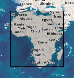
A geographic information system (GIS) containing geo-data for the energy transition across continental Africa created by extracting data from open sources into a series of shapefiles and rasters containing information on culture, geology, geothermal and geophysical data. This data is stored in the World Geodetic System (WGS) 1984 Geographic Projection System.
-

This raster dataset shows the modelled P50 distribution of the theoretical potential 'heat recoverable' (Hrec) across the northern and southern early Carboniferous limestone (ECL) in Great Britain (MW/km2), at a resolution of 2500 m x 2500 m. Hrec is calculated for resource temperatures greater than 50°C, which represents the minimum temperature required for direct use of heat from hot sedimentary aquifer resources. Hrec represents the proportion of accessible heat in an aquifer according to the USGS definition described in e.g. Muffler and Cataldi (1978). Its calculation is part of the research published by D J.R. Jones, T. Randles, T. Kearsey, T.C. Pharaoh, A. Newell (2023). https://doi.org/10.1016/j.geothermics.2023.102649. Areas of high uncertainty are delineated in the published paper and the theoretical potential of the recoverable heat is presented with very high uncertainty.
-

This vector contour dataset represents the distribution of the theoretical potential calculated 'identified resources' (in GJ/m2 or PJ/km2) for the hot sedimentary aquifers in the Sherwood Sandstone Group (SSG) in the East Yorkshire-Lincolnshire, Cheshire, Wessex and Worcester basins, for resource temperatures greater than 40 °C. The theoretical potential for 'identified resources' represents the estimated proportion of the geothermal resource that is available for development. The maps are provided in raster format at a 100 m resolution. For consistency with other legacy estimations, additional columns have been added to the original layers to include the converted value of 'identified resource' to 'recoverable heat' in MW/km2, for equivalence to the method used by D J.R. Jones, T. Randles, T. Kearsey, T.C. Pharaoh, A. Newell (2023). https://doi.org/10.1016/j.geothermics.2023.102649. This dataset is derived from Rollin, K. E., G. A. Kirby, and W. J. Rowley. Atlas of geothermal resources in Europe: UK revision. British Geological Survey technical report WK/95/7, Regional Geophysics Group, 1995: https://webapps.bgs.ac.uk/data/publications/publication.html?id=21735106 and the European Geothermal Atlas (https://op.europa.eu/publication-detail/-/publication/9003d463-03ed-4b0e-87e8-61325a2d4456).
-

This raster dataset shows the modelled P50 distribution of the theoretical potential 'heat-in-place' (HIP) across the combined Upper Devonian Kinnesswood Formation and Stratheden Group in the Midland Valley of Scotland (PJ/km2), at a resolution of 500 m x 500 m x 50 m. The HIP is calculated for resource temperatures greater than 50 °C (> 1400 m depth), which represents minimum temperature required for direct use of heat from hot sedimentary aquifer resources. The HIP represents the heat resource available in an aquifer according to the USGS definition described in e.g. Muffler and Cataldi (1978). Its calculation is part of the research published by Kearsey, T.I., Receveur, M. and Monaghan, A.A., 2024. Modelled hot sedimentary aquifer geothermal potential of Upper Devonian strata in the Midland Valley of Scotland. The model is presented with high uncertainty.
-

This raster dataset provides the maximum temperature in the Upper Devonian formations in the Midland Valley of Scotland. The reservoir temperature is modelled over the extent of the base of the Kinneswood Formation and Stratheden Group, based on an updated geological model created by Kearsey, T.I., Receveur, M. and Monaghan, A.A., 2024. Modelled hot sedimentary aquifer geothermal potential of Upper Devonian strata in the Midland Valley of Scotland. The model is presented with high uncertainty.