
Geological maps
Type of resources
Available actions
Topics
Keywords
Contact for the resource
Provided by
Years
Formats
Representation types
Update frequencies
Service types
Scale
-

Index to BGS geological map 'Standards', manuscript and published maps for Great Britain produced by the Survey on County Series (1:10560) and National Grid (1:10560 & 1:10000) Ordnance Survey base maps. 'Standards' are the best interpretation of the geology at the time they were produced. The Oracle index was set up in 1988, current holdings are over 41,000 maps. There are entries for all registered maps, but not all fields are complete on all entries.
-

Index to manuscript geological maps produced by the Survey geologists or other recognised geologists on County Series (1:10560) and National Grid (1:10560 & 1:10000) Ordnance Survey base maps. The index was set up in 1991. Current holdings for Great Britain are over 35,000. There are entries for all registered maps but the level of detail depends on nature of original Survey, ie not all fields are complete for all entries.
-

This dataset comprises scanned images of the manuscript geological maps produced by the Survey geologists or other recognised geologists on County Series (1:10560) and National Grid (1:10560 and 1:10000) Ordnance Survey base maps. The collection also includes similar maps compiled from other sources. Currently the dataset contains over 35,000 scanned images. Original maps date from the 1860s, and cover surveys in Great Britain, scanning started in 2003.
-
[This metadata record has been superseded, see http://data.bgs.ac.uk/id/dataHolding/13608195] Scanned images of Geological map 'Standards', manuscript and published maps produced by the Survey on County Series (1:10560) and National Grid (1:10560 & 1:10000) Ordnance Survey base maps. Current holdings over 41,000 maps for Great Britain. The majority of maps were scanned in 2004, any new maps produced are scanned and added to the collection.
-
Photographic negatives of Geological map 'Standards', manuscript and published maps produced by the Survey on County Series (1:10560) and National Grid (1:10560 & 1:10000) Ordnance Survey base maps. Current holdings over 41,000 maps for Great Britain. The majority of maps were scanned in 2004, any new maps produced are scanned and added to the collection. This is essentially a back up collection for disaster recovery.
-
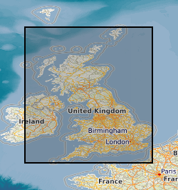
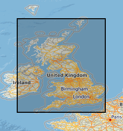
This layer of the map based index (GeoIndex) shows the location of available 1:10000 or 1:10560 series paper geological maps. Since the 1960s the standard large scale map for recording geological information has been the Ordnance Survey (OS) quarter sheet, covering a 5km by 5km area. The maps themselves are supplied in different formats depending on their age and the method of compliation or reproduction used. Only the latest and most up-to-date version is listed.
-

Manuscript geological maps produced by the Survey geologists or other recognised geologists on County Series (1:10560) and National Grid (1:10560 & 1:10000) Ordnance Survey base maps of Great Britain. A small number are produced at larger scale. Similar maps compiled from other sources. Maps produced since the 1850's, current holdings over 35,000 maps, all now scanned and available internally as image files.
-
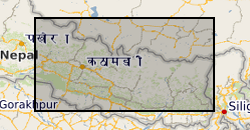
Raster (TIFF) file showing the simplified main bedrock geology units that comprise a ~45,000 km2 region of central-eastern Nepal.
-

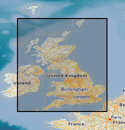
This layer of the GeoIndex shows the availability of 1:25000 scale Classical Areas Geological Maps. The maps themselves show the occurrence, nature and stratigraphic age of rocks. They are available for selected areas of outstanding geological interest in the United Kingdom, and in a number of versions (Solid, or Solid and Drift combined, Bedrock or Superficial). Maps are normally available in both flat and folded format. 1:25000 scale maps are also available for the Channel Islands. To order maps, take note of the map name and use the BGS Internet Shop.
-

Geological map 'Standards', manuscript and published maps of Great Britain produced by the Survey on County Series (1:10560) and National Grid (1:10560 & 1:10000) Ordnance Survey base maps. Maps produced since the 1860's, current holdings over 41,000 maps, all now available internally as image files.