Geochronology
Type of resources
Topics
Keywords
Contact for the resource
Provided by
Years
Formats
Representation types
Update frequencies
-
Macrostrat.org is a live database project collecting geochemical, geospatial, and geochronological data associated with specific rock units within stratigraphic columns with a geographic footprint. The data in Macrostrat is an aggregate of previously reported measurements in the literature. The database is constantly updated, expanded, and improved. Hence, data are archived (5-2-23) in this file for posterity in support of the manuscript titled "Evolution of the crustal phosphorus reservoir" (Walton et al., 2023). In all measurements in the data file: ages are in millions of years (Ma) and elemental compositions are in wt%. Further details of all definitions and standards in Macrostrat data reporting are permanently available at https://macrostrat.org/api/defs. Macrostrat data are useful for weighting geochemical data by the relative areal and volume abundance of the rock units from which they derive, helping to address questions of (over/under) sampling-induced bias. Data in these files represent direct exports from Macrostrat.org via the API root, supplemented with data from Reinhard et al (2017). Unit areal extents for data from Reinhard et al 2017) are approximated with the relevant Eon average from Macrostrat.org. Macrostrat.org is maintained by Shanan Dr Peters, Dr Daven Quinn, and the hard work of many others (https://macrostrat.org/#people).
-
A digital geochronological index to act as a domain constraint for geochronology columns in corporate data tables. It decodes geochronology codes, models pseudo parent-child relationships between intervals (for example, find the epochs within a given period), allows range searches (for example, find the epochs between lower limiting and upper limiting epochs) and provides radiometric ages with ranges of uncertainty. Follows the recommendations of the BGS Stratigraphy Committee. Phanerozoic after Gradstein and Ogg (1996), with the Ordovician scheme of Fortey et al. (1995); Proterozoic after Cowie and Bassett (1989); Archaean after an unpublished decision of the Precambrian Subcommission of the IUGS. Covers the whole of geological time. Geochronological resolution usually to age level. Lower resolution in the Archaean, Proterozoic, Cambrian. Greater resolution in the Caradoc Epoch.
-
This dataset comprises a series of six .xls workbooks which contain the data auxiliary material for the manuscript "Metrology and Traceability of U-Pb Isotope Dilution Geochronology (EARTHTIME Tracer Calibration Part I)" by Daniel Condon, Blair Schoene, Noah McLean, Samuel Bowring and Randall Parrish, submitted to Geochimica et Cosmochimica Acta (June 2014). These data comprise the input measurement data for the EARTHTIME U-Pb Tracer Calibration experiment, the results of which are documented in the manuscript mentioned above. This data set contains isotope ratio data for the manuscript listed above. ts01.xls Amelin and Davis (2006) Pb reference material isotope ratio data ts02.xls CRM 115 U isotope ratio data ts03.xls Gravimetric-Tracer mixture isotope ratio data ts04.xls GDMS elemental concentration data ts05.xls Tracer-blank Pb isotope ratio data ts06.xls U critical mixture isotope ratio data. Link to Published Paper - Metrology and Traceability of U-Pb Isotope Dilution Geochronology (EARTHTIME Tracer Calibration Part I) http://dx.doi.org/10.1016/j.gca.2015.05.026
-
The data are associated with a paper entitled 'Widespread tephra dispersal and ignimbrite emplacement from a subglacial volcano (Torfajökull, Iceland)' by J Moles et al. (2019). See paper for full details. Data types: major element geochemistry; trace element geochemistry; 40Ar/39Ar geochronology. Table DR9 contains EPMA data of proximal lavas and ignimbrite fiamme. Table DR10 contains EPMA data of ash shards. Table DR11 contains EPMA standard data. Table DR12 contains LA-ICP-MS data of proximal lavas and ignimbrite fiamme. Table DR13 contains LA-ICP-MS data of ash shards. Table DR14 contains LA-ICP-MS standard data (raw). Table DR15 contains LA-ICP-MS standard data (corrected). Table DR16 contains 40Ar/39Ar geochronology data.
-
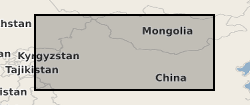
The dataset contains detrital zircon U-Pb ages from a large scale detrital provenance study of modern and recent sand and silt from the Chinese Loess Plateau (CLP) and its proposed sources in the Yellow River, its Tibetan headwaters, and the Taklamakan Desert, which lies upwind from the CLP. (NERC grant NE/I009248/1)
-

This dataset comprises zircon U-Pb data on 11 samples, each containing ~90-150 individual grains. This method was applied to sediment samples from IODP Expedition 374 Site U1521 to the Ross Sea, collected on the RV JOIDES Resolution. Shipboard biostratigraphy and magnetostratigraphy suggests the samples are mainly early Miocene in age (McKay et al., 2019). The uppermost samples do, however, include younger Plio-Pleistocene sediments. Samples were measured using an Agilent 7900 laser ablation inductively-coupled plasma mass spectrometer (LA-ICP-MS) with a 25-35 µm pit diameter in the London Geochronology Centre at University College London.
-

This dataset comprises 40Ar/39Ar dated detrital hornblende grains for 5 samples from IODP Expedition 374 Site U1521 to the Ross Sea, collected on the RV JOIDES Resolution. Shipboard biostratigraphy and magnetostratigraphy suggests the samples are early Miocene in age (McKay et al., 2019, Proceedings of the International Ocean Discovery Program). These data can be compared to terrestrial geochronological data, allowing the changing provenance of the sediments to be traced.
-
Geological fieldwork was carried out in the Falkland Islands in March 2022 to help understand the depositional history and provenance of Late Permian sedimentary rocks of East Falkland. To accurately determine their depositional age and precise provenance we conducted a detailed analysis of zircon geochronology and geochemistry. The files provided here include full analytical details and datasets from the laboratories used for the acquisition of U-Pb zircon geochronology and Lu-Hf isotope geochemistry. The data were collected in the interval November 2023 to July 2024 across a number of laboratories: University College London and Australian National University (U-Pb zircon geochronology); British Geological Survey (Lu-Hf isotopes). The analyses were conducted by Ian Millar (Canberra, British Geological Survey) and Andrew Carter (University College London). The analyses were conducted to examine the provenance and depositional history of the sedimentary successions of the Falkland Islands.
-
High-precision CA-ID-TIMS (Chemical Abrasion Isotope Dilution Thermal Ionization Mass Spectrometry) Uranium-Lead geochronology of zircon, extracted from igneous plutonic and mineralised porphyry intrusions in the Rio Blanco-Los Bronces Cu Porphyry area, Chile. Eleven parent samples cover an age range of ca. 14 Ma to ca. 5 Ma. Sample Identifiers correspond to the NERC Highlight topic consortium project FAMOS (From Arc Magmas to Ores) samples from the Natural History Museum component of the project and Large et al.(2024) J. Pet, where full rock types, geo-references, petrography, and geochemistry of parent samples can be found in addition to zircon Cathodoluminesence and SEM characterization of zircon of samples, and the corresponding zircon trace element analyses (inclusive of U-Pb) by laser ablation ICPMS. This data provides insights into the crystallisation of zircon and timescales of porphyry copper deposits.
-
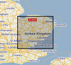
The concentration of both L and D amino acid isomers was determined by HPLC (High-performance liquid chromatography) for multiple amino acids. 30 samples of proboscidean enamel were taken from the collections at BGS. Samples of enamel (~30 mg) was removed from the teeth of proboscideans using a small electric drill. All of the samples were from UK sites dating to the Quaternary. These samples were used to build a regional geochronology based on the extent of racemisation of amino acids from the intra-crystalline fraction (Dickinson, 2018). Thesis http://etheses.whiterose.ac.uk/22261. A published paper 'A new method for enamel amino acid racemization dating: A closed system approach' is also available; https://doi.org/10.1016/j.quageo.2018.11.005
 NERC Data Catalogue Service