Floods
Type of resources
Available actions
Topics
Keywords
Contact for the resource
Provided by
Years
Formats
Representation types
Update frequencies
Scale
-
The BGS Geological Indicators of Flooding (GIF) dataset is a digital map based on the BGS Digital Geological Map of Great Britain at the 1:50,000 scale (DiGMapGB-50, BGS, 2009). Current coverage includes England, Wales and Scotland. It characterises Superficial Deposits on DiGMapGB-50 in terms of their likely susceptibility to flooding, either from coastal inundation or fluvial (inland) water flow. These Superficial Deposits are considered 'recent' in geological terms, most having been formed within the last few tens of thousands of years. Typically they have been laid down by processes of erosion and deposition and they have produced subtle topographical features, resulting in low-lying landforms we call floodplains. The mapping of these landforms, in conjunction with characterisation of deposits that underlie them allows us to determine the extent of the coastal and inland flooding that created them.
-
Ensemble of simulated groundwater levels for Iloilo, Philippines. The simulated time series of data covers the period December 1979 to December 2089 under two Representative Concentration Pathways (RCP2.6 and RCP 8.5). Each ensemble member csv file contains a timeseries of groundwater levels for thirteen locations within the Iloilo region. The textfile included in the folder shows the coordinates for these locations.
-
2 examples of Integrated Water Vapour Transport (IVT) maps generated using a new algorithm produced from the work done under the Grant. This algorithm has been published and the article can be found here: http://onlinelibrary.wiley.com/doi/10.1029/2012JD018027/abstract
-
The groundwater flooding susceptibility data shows the degree to which areas of England, Scotland and Wales are susceptible to groundwater flooding on the basis of geological and hydrogeological conditions. It does not show the likelihood of groundwater flooding occurring, i.e. it is a hazard not risk-based dataset. The data covers Great Britain in a consistent manner. It will be updated periodically (at least bi-annually) as the underlying datasets or the methodology to derive the groundwater flooding susceptibility data are improved. The data is based on data sets with a range of resolutions, but the derived data set has an effective spatial resolution of about 50m by 50m. The susceptibility data is suitable for use for regional or national planning purposes where the groundwater flooding information will be used along with a range of other relevant information to inform land-use planning decisions. It might also be used in conjunction with a large number of other factors, e.g. records of previous incidence of groundwater flooding, rainfall, property type, and land drainage information, to establish relative, but not absolute, risk of groundwater flooding at a resolution of greater than a few hundred metres. In all cases it is strongly recommend the confidence data is used in conjunction with the groundwater flooding susceptibility data. The susceptibility data should not be used on its own to make planning decisions at any scale, and, in particular, should not be used to inform planning decisions at the site scale. The susceptibility data cannot be used on its own to indicate risk of groundwater flooding.
-
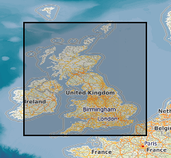
BGS GeoScour provides river scour susceptibility information for Great Britain using a three-tiered data provision allowing increasing levels of understanding at different resolutions from catchment to local (channel/reach) scales. GeoScour includes 11 GIS layers, providing information on the natural characteristics and properties of catchment and riverine environments for the assessment of river scour in Great Britain. The data product fills a gap in current scour modelling, with the input of geological properties. It provides an improved toolkit to more easily assess and raise the profile of scour risk, now and in the future, to help infrastructure providers and funders prioritise resources, identify remedial works to preclude costly and prevent disruptive failures. The data product has broad applications through its adaptation to suit multiple types of asset likely to be affected by fluvial erosion. The GeoScour Data Product is designed to be used by multiple stakeholders with differing needs and therefore, can be interrogated at a number of levels. Tier 1 data provides a summary overview of the catchment characteristics, typical response type, and evolution. It can be used as a high-level overview for incorporation into catchment management plans, national reviews and catchment comparisons. Tier 2 data are available as smaller catchment areas and focusses on providing data for more detailed catchment management, natural flood management and similar uses. It analyses geological properties such as flood accommodation space, catchment run-off potential, and geomorphology types, as well as additional summary statistics of key environmental parameters such as protected sites and urban coverage. Tier 3 data provide the detailed riverine information that is designed to be incorporated into more complex river scour models. It provides the baseline geological context for river scour development and processes and identifies important factors that should be considered in any scour model. Factors such as material mineralogy, strength and density are key properties that can influence a river’s ability to scour. In addition, an assessment of river fall, sinuosity and flood accommodation space is also provided. This data is of use to all users assessing the propensity for river scour for any given reach of a river across Great Britain. Tier 1 and 2 data are available with an OGL, Tier 3 data is licenced.
-
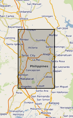
Ensemble of simulated groundwater levels for Central Luzon, Philippines. The simulated time series of data covers the period December 1979 to December 2089 under two Representative Concentration Pathways (RCP2.6 and RCP 8.5). Each ensemble member csv file contains a timeseries of groundwater levels for five locations within the Central Luzon region. The textfile included in the folder shows the coordinates for these locations.
 NERC Data Catalogue Service