Flood plains
Type of resources
Available actions
Topics
Keywords
Contact for the resource
Provided by
Years
Formats
Update frequencies
-
Each contains two columns of data representing the UTM coordinates of the centre line of the Rio Beni in Bolivia. These coordinates were derived by digitising Landsat imagery and aerial photographs (1960 only). The number in the file name after "banks_c" corresponds to the year. Numbers in column 1: UTM Zone 19S Easting Numbers in column 2: UTM Zone 19S Northing
-
Each file contains four columns of data representing: column 1: UTM Zone 19S Easting coordinate for survey location along the Rio Beni, Bolivia. column 2: UTM Zone 19S Northing coordinate for survey location along the Rio Beni, Bolivia. column 3: Measurment range from observer to bank in m column 4: Bank height in m (the difference between bank top and low flow water level) UTM coordinates were measured using a Trimble Global Position System with OmniSTAR HP correction Measurement range and bank height were measured using a GPS supported laser range finder (Impulse 200 LR< Laser Technology inc) Survey 1 was carried out between 15th and 19th September 2011, when the flow discharge within the Beni was in the range 453-530 cumecs Survey 2 was carried out between 20th and 23rd September 2011, when the flow discharge within the Beni was in the range 762-892 cumecs
-
The data in this file represent measurements of the the depth, grain size characteristics and sedimentation rate for sediment cores collected from the floodplain of the Rio Beni in 2011, 2012, and 2013. The age of floodplain sediments was determined from measurements of the Pb-210 activity of floodplain sediments within the cores. The sample collection and laboratory techniques and data analysis procedures used to obtain these data are described in: Aalto, R & Nittrouer, C.A. (2012) Phil. Trans. Royal. Society., vol 370, p 2040-2074. This is an ascii text comma delimited file. Each row in the file represents a sediment core. The file contains 12 columns of data representing: column 1: The core name column 2: The latitude of the core location in digital degrees column 3: The longitude of the core location in digital degrees column 4: The year in which the core was collected column 5: The depth of the floodplain core (in cm) column 6: The age of the oldest sediment in the core (in years) column 7: The depth to the oldest sediment in the core (in cm) column 8: The estimated mean sedimentation rate for the core (in cm per year) column 9: The percentage of the core comprised of clay column 10: The percentage of the core comprised of silt column 11: The percentage of the core comprised of sand column 12: The mean density of sediment in the core (in g per cubic cm)
-
Stable isotope and inorganic chemistry data for samples of groundwater from boreholes and springs in the sandur aquifer; glacial meltwater and river water; and glacier ice, from Virkisjokull glacier observatory. Selected water chemistry and stable isotope data are reported in Ó Dochartaigh, B. É., et al. 2019. Groundwater?- glacier?meltwater interaction in proglacial aquifers, Hydrol. Earth Syst. Sci. https://doi.org/10.5194/hess-2019-120
-
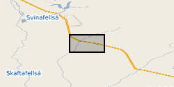
Groundwater level and groundwater temperature data measured in 9 boreholes between August 2012 and August 2018. Groundwater conductivity data measured in 1 of these boreholes from September 2012 to August 2014. Eight of the boreholes are drilled into a sandur (glacial outwash floodplain) aquifer in front of Virkisjokull glacier, SE Iceland, and are between 8.2 and 14.9 m deep. The remaining borehole is drilled into a volcanic rock aquifer between the sandur and glacier and is 5.1 m deep. Selected groundwater monitoring data are reported in Ó Dochartaigh, B. É., et al. 2019. Groundwater?- glacier?meltwater interaction in proglacial aquifers, Hydrol. Earth Syst. Sci. https://doi.org/10.5194/hess-2019-120. Further information on borehole installations and geology can be found in Ó Dochartaigh et al. 2012. Groundwater investigations at Virkisjokull, Iceland: data report 2012. British Geological Survey Open Report OR/12/088, http://nora.nerc.ac.uk/id/eprint/500570/
 NERC Data Catalogue Service