
Droughts
Type of resources
Available actions
Topics
Keywords
Contact for the resource
Provided by
Years
Formats
Representation types
Update frequencies
Resolution
-

Ethiopia experienced severe drought in 2015-16. Many rural communities experienced declines in the performance of their water supply systems. As a result UNICEF commissioned a real-time monitoring and responsive operation and maintenance programme for point source rural water supplies across Central, Northern and Eastern Ethiopia. The water point monitoring survey was coordinated by UNICEF and conducted by World Vision Ethiopia and Oxfam Ethiopia. Data was collected between January and May 2016. Akvo Flow, a mobile survey tool, was used to collect data using questionnaires which were completed by enumerators and uploaded to central servers in near real time. The dataset includes data on functionality, access, usage and water quantity from 5196 rural water points. UNICEF provided the dataset to BGS. BGS reorganised, cleaned, and conducted quality control and analysis of the dataset. A companion paper has been published with more details of the methodology and results of the monitoring survey, https://doi.org/10.1038/s41467-020-14839-3
-
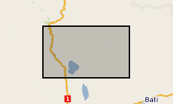
In 1998 the Department for International Development (DFID) funded the project ‘Groundwater drought early warning for vulnerable areas’ as part of the DFID Knowledge and Research (KaR) programme, a collaboration between UK partners BGS and the Overseas Development Institute (ODI), and with the Bureau of Water, Mines and Energy in Amhara Region, Ethiopia. Drawing on village surveys and stakeholder consultations across sectors, this project evolved a broader, more holistic approach to the study of drought and water supply. Rather than focus exclusively on drought and water availability, constraints on household access to and use of water were explored through the lens of water security. This, in turn, highlighted links between the household water economy (across seasons; between good and bad years) and wider livelihood strategies, particularly in relation to inter-dependencies between food and water security.
-

Ensemble of simulated groundwater levels for Iloilo, Philippines. The simulated time series of data covers the period December 1979 to December 2089 under two Representative Concentration Pathways (RCP2.6 and RCP 8.5). Each ensemble member csv file contains a timeseries of groundwater levels for thirteen locations within the Iloilo region. The textfile included in the folder shows the coordinates for these locations.
-
**THIS DATASET HAS BEEN WITHDRAWN** Ethiopia experienced severe drought in 2015-16. Many rural communities experienced declines in the performance of their water supply systems. As a result UNICEF commissioned a real-time monitoring and responsive operation and maintenance programme for point source rural water supplies across Central, Northern and Eastern Ethiopia. The water point monitoring survey was coordinated by UNICEF and conducted by World Vision Ethiopia and Oxfam Ethiopia. Data was collected between January and May 2016. Akvo Flow, a mobile survey tool, was used to collect data using questionnaires which were completed by enumerators and uploaded to central servers in near real time. The dataset includes data on functionality, access, usage and water quantity from 5196 rural water points. UNICEF provided the dataset to BGS. BGS reorganised, cleaned, and conducted quality control and analysis of the dataset. A companion paper has been published with more details of the methodology and results of the monitoring survey, https://doi.org/10.1038/s41467-020-14839-3
-
This dataset is an inventory of reservoir details for the UK. It provides information, including reservoir location, type (impounding or non-impounding), use (water resources, hydro-electric, ecological, flood storage, canal), capacity, planning date, construction date, catchment National River Flow Archive (NRFA) gauge references and membership of a reservoir group, based on current usage within the CEH Monthly Hydrological Summary (https://nrfa.ceh.ac.uk/monthly-hydrological-summary-uk). The dataset comprises 273 individual reservoirs, which amount to approximately 90% of total UK reservoir storage. Data quality has been recorded, using a data flag system and a notes section, with references relevant to each reservoir provided. Full details about this dataset can be found at https://doi.org/10.5285/f5a7d56c-cea0-4f00-b159-c3788a3b2b38
-
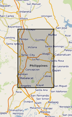
Ensemble of simulated groundwater levels for Central Luzon, Philippines. The simulated time series of data covers the period December 1979 to December 2089 under two Representative Concentration Pathways (RCP2.6 and RCP 8.5). Each ensemble member csv file contains a timeseries of groundwater levels for five locations within the Central Luzon region. The textfile included in the folder shows the coordinates for these locations.
-
2 examples of Integrated Water Vapour Transport (IVT) maps generated using a new algorithm produced from the work done under the Grant. This algorithm has been published and the article can be found here: http://onlinelibrary.wiley.com/doi/10.1029/2012JD018027/abstract
-
Monthly and daily 5km gridded Potential Evapotranspiration (PET) data for the UK. PET was derived using temperature-based equation from McGuinness-Bordne calibrated for the UK (calibration period: 1961-1990). The units are mm/day for daily PET and mm/month for monthly PET. The dataset covers the period from 1891-2015. For both subsets (daily and monthly), a set of performance metrics were calculated, which are provided together with the PET grids. The list of metrics provided is: Mean Absolute Percent Error (MAPE), Nash-Sutcliffe Efficiency (NSE), Kling-Gupta Efficiency (KGE), Correlation Coefficient, Variability Ratio (VR), Bias Ratio and monthly MAPE. Full details about this dataset can be found at https://doi.org/10.5285/17b9c4f7-1c30-4b6f-b2fe-f7780159939c
-
Monthly Standardised Groundwater level Index (SGI) for observation boreholes across the UK from 1891 to 2015, based on reconstructed groundwater level time series (Bloomfield et al., 2018; https://doi.org/10.5285/ccfded8f-c8dc-4a24-8338-5af94dbfcc16). Standardised groundwater levels have been estimated using a non-parametric normal scores transform of groundwater level data for each calendar month. Probability estimates of an SGI being less than 0, -1, -1.5 and -2 are also provided. Full details about this dataset can be found at https://doi.org/10.5285/d92c91ec-2f96-4ab2-8549-37d520dbd5fc
-
This dataset is a model output created using the BGS AquiMod model. It provides monthly groundwater level relative to the Ordnance Datum (maOD) from 1891 to 2015, reconstructed for 54 observation boreholes across the UK. Based on the Generalised Likelihood Uncertainty Estimation (GLUE) methodology, 90th percentile and 10th percentile confidence bounds have been estimated and are given for each of reconstructed groundwater level time series. Full details about this dataset can be found at https://doi.org/10.5285/ccfded8f-c8dc-4a24-8338-5af94dbfcc16