Digital maps
Type of resources
Available actions
Topics
Keywords
Contact for the resource
Provided by
Years
Formats
Representation types
Update frequencies
Service types
Scale
-
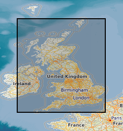
This layer of the GeoIndex shows the location of available 1:25000 scale digital geological maps within Great Britain. The Digital Geological Map of Great Britain project (DiGMapGB) has prepared 1:625 000, 1:250 000 and 1:50 000 scale datasets for England, Wales and Scotland. The datasets themselves are available as vector data in a variety of formats in which they are structured into themes primarily for use in geographical information systems (GIS) where they can be integrated with other types of spatial data for analysis and problem solving in many earth-science-related issues. The DiGMapGB-10 dataset is as yet incomplete, current work is concentrated on extending the geographical cover, especially to cover high priority urban areas.
-
The joint PHE-BGS digital Indicative Atlas of Radon in Great Britain presents an overview of the results of detailed mapping of radon potential, defined as the estimated percentage of homes in an area above the radon Action Level. The Indicative Atlas of Radon in Great Britain presents a simplified version of the Radon Potential Dataset for Great Britain with each 1-km grid square being classed according to the highest radon potential found within it, so is indicative rather than definitive. The joint PHE-BGS digital Radon Potential Dataset for Great Britain provides the current definitive map of radon Affected Areas in Great Britain.
-
BGS soil property data layers including parent material, soil texture, group, grain size, thickness and European Soil Bureau description. These data are delivered under the terms of the Open Government Licence (http://www.nationalarchives.gov.uk/doc/open-government-licence/), subject to the following acknowledgement accompanying the reproduced BGS materials: Contains British Geological Survey materials copyright NERC [year]. Contact us if you create something new and innovative that could benefit others usingbgsdata@bgs.ac.uk.
-
Data from the DiGMap covering the whole of the United Kingdom at a scale of 1:625 000 is available in this OGC WMS service for personal, non-commercial use only. The service is a contribution to the OneGeology-Europe initiative. The layers can be displayed either by age or by lithology. For more information about the digital maps available from the British Geological Survey, please visit https://www.bgs.ac.uk/geological-data/.
-

This service is the BGS contribution to the OneGeology project, providing UK onshore bedrock geological data at 1:625 000 scale. This map data is collected as part of an ongoing BGS project: Digital Geological Map of Great Britain (DiGMapGB). GeoServer software is used to provide this WFS service.
-
The TellusSW project acquired airborne geophysical data for the counties of Cornwall and parts of Devon and Somerset during the second half of 2013. The maps of the geophysical data and their derivatives are provided to facilitate spatial comparison with, and modelling of, the soil, geological and environmental aspects of the data. The survey comprised a high resolution magnetic/magnetic gradient survey combined with a multichannel (256 channel) radiometric survey. The survey was carried out using 200 m (N-S) line separations at a mean elevation of 91 m. The survey provided 60,323 line-km of data.
-
Data identifying landscape areas (shown as polygons) attributed with geological names and rock type descriptions. The scale of the data is 1:10 000 scale providing bedrock geology. Onshore coverage is partial with approximately 30% of England, Scotland and Wales available in this version 2 data release. BGS intend to continue developing coverage at this scale; current focus is to include all large priority urban areas, along with road and rail transport corridors. Bedrock geology describes the main mass of solid rocks forming the earth's crust. Bedrock is present everywhere, whether exposed at surface in outcrops or concealed beneath superficial deposits or water bodies. The bedrock geology of Great Britain is very diverse and includes three broad classes based on their mode of origin: igneous, metamorphic and sedimentary. The data includes attribution to identify each rock type (in varying levels of detail) as described in the BGS Rock Classification Scheme (volumes 1-3). The bedrock has formed over long periods of geological time, from the Archean eon some 7500 million years ago, to the relatively young Pliocene, 58 million years ago. The age of the rocks is identified in the data through their BGS lexicon name (published for each deposit at the time of the original survey or subsequent digital data creation). For stratified rocks i.e. arranged in sequence, this will usually be of a lithostratigraphic type. Other rock types for example intrusive igneous bodies will be of a lithodemic type. More information on the formal naming of UK rocks is available in the BGS Lexicon of Named Rock Units. Geological names are based on the lithostratigraphic or lithodemic hierarchy. The lithostratigraphic scheme arranges rock bodies into units based on rock-type and geological time of formation. Where rock-types do not fit into the lithostratigraphic scheme, for example intrusive, deformed rocks subjected to heat and pressure resulting in new or changed rock types; then their classification is based on their rock-type or lithological composition. This assesses visible features such as texture, structure, mineralogy. The data are available in vector format (containing the geometry of each feature linked to a database record describing their attributes) as ESRI shapefiles and are available under BGS data licence.
-
Data identifying landscape areas (shown as polygons) attributed with geological names and rock type descriptions. The scale of the data is 1:625 000, providing a simplified interpretation of the geology which may be used as a guide at a regional or national level, but should not be relied on for local geology. Onshore coverage is provided for all of England, Wales, Scotland, the Isle of Man and Northern Ireland. Bedrock geology describes the main mass of solid rocks forming the Earth's crust. Bedrock is present everywhere, whether exposed at surface in outcrops or concealed beneath superficial deposits or water bodies. The bedrock geology of the UK is very diverse and includes three broad classes based on their mode of origin: igneous, metamorphic and sedimentary. The data includes attribution to identify each rock type (in varying levels of detail) as described in the BGS Rock Classification Scheme (volumes 1-3). The bedrock has formed over long periods of geological time, from the Archean eon some 3500 million years ago, to the relatively young Pliocene, 58 million years ago. The age of the rocks is identified in the data through their name in the BGS Lexicon of Named Rock Units (published for each deposit at the time of the original survey or subsequent digital data creation). For stratified rocks, i.e. those arranged in sequence, this will usually be of a lithostratigraphic type. Other rock types (for example, intrusive igneous bodies) will be of a lithodemic type. More information on the formal naming of UK rocks is available in the BGS Lexicon of Named Rock Units. Geological names are based on the lithostratigraphic or lithodemic hierarchy. The lithostratigraphic scheme arranges rock bodies into units based on rock type and geological time of formation. Where rock types do not fit into the lithostratigraphic scheme (for example intrusive, deformed rocks subjected to heat and pressure, resulting in new or changed rock types), their classification is based on their rock type or lithological composition using visible features such as texture, structure and mineralogy. The data are available in vector format (containing the geometry of each feature linked to a database record describing their attributes) as an OGC GeoPackage and are delivered free of charge under the terms of the Open Government Licence.
-
Linear features (shown as polylines) represent six classes of geological structural features e.g. faults, folds or landforms e.g. buried channels, glacial drainage channels at the ground or bedrock surface (beneath superficial deposits). Linear features are associated most closely with the bedrock theme either as an intrinsic part of it for example marine bands or affecting it in the case of faults. However landform elements are associated with both bedrock and superficial deposits. The linear features are organised into seven main categories: Alteration area indicating zones of change to the pre-existing rocks due to the application of heat and pressure that can occur round structural features such as faults and dykes. Fault where a body of bedrock has been fractured and displaced by a large scale process affecting the earth's crust. Fold where strata are bent or deformed resulting from changes or movement of the earth's surface creating heat and pressure to reshape and transform the original horizontal strata. Folds appear on all scales, in all rock types and from a variety of causes. Fossil horizons where prolific fossil assemblages occur and can be used to help establish the order in which deposits were laid down (stratigraphy). These horizons allow correlation where sediments of the same age look completely different due to variations in depositional environment. Mineral vein where concentrations of crystallised mineral occur within a rock, they are closely associated with faulting, but may occur independently. Landforms define the landscape by its surface form; these include glacial features such as drumlins, eskers and ice margins. Rock identifies key (marker) beds, recognised as showing distinct physical characteristics or fossil content. Examples include coal seams, gypsum beds and marine bands. The data are available in vector format (containing the geometry of each feature linked to a database record describing their attributes) as ESRI shapefiles and are available under BGS data licence.
-
Data identifying landscape areas (shown as polygons) attributed with geological names and rock type descriptions. The scale of the data is 1:50 000 scale providing bedrock geology. Onshore coverage is provided for all of England, Wales, Scotland and the Isle of Man. Bedrock geology describes the main mass of solid rocks forming the earth's crust. Bedrock is present everywhere, whether exposed at surface in outcrops or concealed beneath superficial deposits or water bodies. The bedrock geology of Great Britain is very diverse and includes three broad classes based on their mode of origin: igneous, metamorphic and sedimentary. The data includes attribution to identify each rock type (in varying levels of detail) as described in the BGS Rock Classification Scheme (volumes 1-3 ). The bedrock has formed over long periods of geological time, from the Archean eon some 7500 million years ago, to the relatively young Pliocene, 58 million years ago. The age of the rocks is identified in the data through their BGS lexicon name (published for each deposit at the time of the original survey or subsequent digital data creation). For stratified rocks i.e. arranged in sequence, this will usually be of a lithostratigraphic type. Other rock types for example intrusive igneous bodies will be of a lithodemic type. More information on the formal naming of UK rocks is available in the BGS Lexicon of Named Rock Units. Geological names are based on the lithostratigraphic or lithodemic hierarchy. The lithostratigraphic scheme arranges rock bodies into units based on rock-type and geological time of formation. Where rock-types do not fit into the lithostratigraphic scheme, for example intrusive, deformed rocks subjected to heat and pressure resulting in new or changed rock types; then their classification is based on their rock-type or lithological composition, using visible features such as texture, structure, mineralogy. The data are available in vector format (containing the geometry of each feature linked to a database record describing their attributes) as ESRI shapefiles and are available under BGS data licence.
 NERC Data Catalogue Service