Chemical analysis
Type of resources
Available actions
Topics
Keywords
Contact for the resource
Provided by
Years
Formats
Representation types
Update frequencies
Scale
-
Geochemical data for the Huainan Basin include Fe speciation data; P speciation data; elemental Al, Fe, P, Mn, Sr data, total organic carbon; C isotope ratios of organic C and carbonates. Geochemical data for the Taoudeni Basin and the Anamikie Basin include Fe speciation data; P speciation data; and elemental P and total organic carbon analyses.
-
Earth is a dynamic planet, for the simple reason that it is still cooling down from the heat of accretion and subsequent decay of radioactive elements. The main mechanism by which it loses heat is plate tectonics, a theory that has been widely accepted since the 1970s. The Earth is formed of a dense metallic core surrounded by a partially molten silicate mantle which itself is capped by a buoyant crust, either continental or oceanic. We live on the continental crust which largely exists above sea level. The ocean crust forms the floors of oceans and is only rarely exposed. The ocean crust forms by mantle melting at mid ocean ridges, such as the mid Atlantic ridge upon which sits the volcanic island of Iceland. New crust is constantly formed, forcing the older crust to spread outwards and oceans to grow larger. As the ocean crust spreads away from the ridge, it cools and becomes denser. Eventually it interacts with a continent, made of less dense material. The ocean crust is driven beneath the continent back into the mantle, a process known as subduction. Volcanoes form along the continental margin above the subduction zone and at least some of this activity results in addition of new continental crust. This may have been the main process responsible for initial formation and subsequent evolution of our continents. It can be observed now around the margin of the Pacific Ocean, where widespread volcanism is known as the "Ring of Fire". However, not all oceans can continue to grow! The Atlantic Ocean has stopped getting bigger as a response to the continued growth of the Pacific. Eventually, an ocean will close completely and the surrounding continents will collide, resulting in a linear mountain chain. A good example is the Himalaya, where India has collided with Asia. This whole process known as plate tectonics has a profound affect on our planet, providing us with land on which to live, seas in which to fish, freshwater to drink and our complex weather patterns. It is also a regulator of our climate since weathering of continental rocks results in drawdown of CO2 to the deep sea where it is stored. Understanding plate tectonics is central to Earth and Environmental Scientists. There are still important details that we know little about, such as how and when it began. This proposal seeks to investigate this by a novel study of critical rocks that characterise plate tectonics, in particular those that result from subduction. When ocean crust is subducted, increasing pressure and temperature change it into denser rock. As the Earth has evolved, the exact pressure and temperature conditions of this "metamorphism" have also changed. We propose to study this by using minerals that form within ocean crust during subduction. The rocks themselves are often destroyed by erosion, but tiny crystals of a robust mineral called rutile (titanium dioxide) can survive to be found in sediments derived from them. By dating these and using their chemical composition as a fingerprint, we can work out the pressure and temperature within the eroded subduction zone. Similarly, the volcanic rocks that form during subduction have changed through time. These are also often destroyed by erosion so that the exposed record may not be representative. Another robust mineral known as zircon (zirconium silicate) often survives the weathering and ends up alongside rutile in the younger sediments. Using similar methods with zircon we can also investigate changing styles of magmatism throughout Earth's history. . Currently the magmatic record implies that modern subduction began around 2500 million years ago, yet the metamorphic record implies a later start of around 700 million years ago. Our novel approach will test this. We will be able to say whether the younger date is correct and the older marks a different kind of plate tectonics, or whether the older date does indeed represent the onset of modern plate tectonics, and the exposed rock record is biased.
-
Major, trace element and REE analyses of muds and mudstones from selected intervals from all of the holes. Location of the drill holes are given in the Exp. 352 cruise report (Reagan et al)
-
These data show images recorded using a variety of methods of a model system of bacterial metal reduction. In all cases the bacteria grew from a pure culture of Geobacter sulfurreducens, and grew undisturbed on thin films of amorphous Fe oxyhydroxide – ferrihydrite. The different imaging methodologies have highlighted different features of this interaction. AFM shows the surface texture of the bacteria and ferrihydrite films; epifluorescence was used to allow counting of the cells at different time points from 0 to 12 days post inoculation (cell counts available in excel spreadsheet); and confocal imaging allow visualisation of the redox patterns surrounding cells and to identify areas of bioreduced Fe(II) (quantification of Fe(II) available in excel spreadsheet). The following data is included: 1. 9 x AFM images of Geobacter sulfurreducens bacteria growing on ferrihydrite films 2. 5 x epifluorescence images of Geobacter sulfurreducens bacteria growing on ferrihydrite films over time 3. spreadsheet bacterial counts associated with epifluorescence images 4. 7 x confocal images of Geobacter sulfurreducens bacteria growing on ferrihydrite films with redox green staining of appendages 5. 5 x example confocal images of Geobacter sulfurreducens bacteria growing on ferrihydrite films with Fe(II) highlighted by RhoNox-1 6. Spreadsheet of quanitfication of RhoNox intensity against bacteria and Fe co-location Data is presented which shows the formation of precious metal nanoparticles on the surface of geobacter sulfurreducens cells. The images were produced by CryoTEM. Full details of the experiment are available in this publication http://onlinelibrary.wiley.com/doi/10.1002/ppsc.201600073/full 7. Powerpoint presentation of TEM images of precious metal nanoparticles formed on the surface of Geobacter cells
-

Concentrations of various elements along with temperature, pH and dissolved oxygen, in hot spring fluids around the world. Bedrock chemistry data for Mars, in situ samples and meteorites, also included. Data from Iceland were partly generated in this study, other data are taken from the literature for comparison. Also included are literature data about associated bedrocks. Sheet 1: concentrations of dissolved elements in hot spring fluids Sheet 2: concentrations of elements in bedrock associated with hot springs Sheet 3: averages of bedrock data Sheet 4: full reference list
-

The data release includes surface and groundwater chemistry data from 99 samples (33 surface water, 60 groundwater, and 6 groundwater duplicates) collected during the baseline water monitoring at the UK Geoenergy Observatories (UKGEOS) Glasgow facility. This release from the British Geological Survey (BGS) covers surface and groundwater samples collected between 22 June 2021 and 28 January 2022 from 6 surface water sites, 5 mine water boreholes, and 5 environmental monitoring boreholes. The samples were then analysed for the concentrations of selected parameters at BGS and other laboratories. It contains a report and 2 data sheets GroundWaterChemData2 and SurfaceWaterChemData3.
-
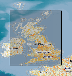
This layer of the map based index (GeoIndex) shows the locations of over 12,500 rock samples from the land area of the United Kingdom gathered as part of the Mineral Reconnaissance Programme (MRP). The Mineral Reconnaissance Programme (MRP), funded by the DTI, carried out baseline mineral exploration in Great Britain between 1972 and 1997. The programme has been subsumed into the new BGS Minerals Programme, also funded by the DTI. The rock samples have been analysed for a variety of major and trace elements, mainly by XRF.
-

The data reported include, percent total organic carbon (%TOC), bulk rock, solvent extracted and water extracted Rock Eval Pyrolysis (Rock Eval) and Isotope Ratio Mass Spectrometry (EA-irMS), optical analyses of kerogen concentrates of bulk rock samples (Kerogen microscopy), and Liquid Chromatography – Organic Carbon Detection (LC-OCD) of sample leachates. The samples were collected by UKGEOS (UK Geoenergy Observatories) Glasgow and provided for laboratory analyses to HWU Edinburgh. Samples from core well GGA01, GGA03r, GGA04, GGA05, GGA06r, GGA07, GGA08, GGA09r, GGB04, GGB05.
-

This dataset contains surface water and groundwater chemistry data of 111 samples - 41 surface waters, 63 groundwater, and 7 groundwater duplicates - collected at the UK Geoenergy Observatory (UKGEOS) in Glasgow, between 20 September 2022 and 12 January 2024 by the British Geological Survey (BGS), as part of the monitoring programme at the Glasgow research facility (https://www.ukgeos.ac.uk/glasgow-observatory). Samples are from 6 surface water sites, 5 mine water boreholes, and 5 environmental monitoring boreholes and were analysed at BGS and other laboratories. It includes the following parameters: field measurements of redox potential (ORP), pH, dissolved oxygen, electrical conductivity, alkalinity and water temperature, as well as chemical analyses of major, minor, and trace elements, non-purgeable organic carbon (NPOC), polycyclic aromatic hydrocarbons (PAH), total petroleum hydrocarbons (TPH), oxygen and deuterium isotopes (δ2H and δ18O), carbon isotopes in dissolved inorganic carbon (DIC) (δ13CDIC), and – limited to the groundwater samples – ammonium (NH4), reduced iron, dissolved sulphide, dissolved gases radon, methane, ethane and carbon dioxide (Rn, CH4, C2H6, CO2) and volatile organic compounds (VOC). The dataset consists of two excel files: GroundWaterChemData3 and SurfaceWaterChemData4, with an accompanying report by Palumbo-Roe et al. (2025).
-

The UK Geoenergy Observatories (UKGEOS) Glasgow baseline surface water chemistry dataset1 released from the BGS comprises an excel file with two spreadsheets. The first spreadsheet contains information on the chemical composition of 98 surface water samples (84 samples and 14 field duplicates) collected monthly for 14 months between February 2019 and March 2020 from six sampling locations. These comprised three on the River Clyde at the UKGEOS Glasgow Cuningar Loop borehole cluster and three from control sites (two on the River Clyde and one on the Tollcross Burn). Field measurements of pH, redox potential, specific electrical conductance, temperature, dissolved oxygen and alkalinity and laboratory chemical data for concentrations of 71 inorganic and 10 organic substances in the surface water samples are presented. The dataset contains locational and descriptive information about the samples also. The analyte name, element chemical symbols, analytical method, units of measurement and long-term limits of detection are recorded in header rows at the top of the spreadsheet. The limits of detection/quantification for each monthly batch of samples are documented in rows at the head of each batch. The dataset includes abbreviations documenting quality control issues such as missing values. A guide to abbreviations used in the dataset is provided in the second excel spreadsheet released with the data. Further details about the dataset can be found in the accompanying report http://nora.nerc.ac.uk/id/eprint/529818.
 NERC Data Catalogue Service