TAB
Type of resources
Available actions
Topics
Keywords
Contact for the resource
Provided by
Years
Formats
Representation types
Update frequencies
Scale
-

Physical properties of four serpentinite and four gabbro samples acquired respectively at the Southern Wall (IODP leg 357) and at the Central Dome (IODP leg 304-305) of the Atlantis Massif have been measured and analysed in the frame of a NERC UK-IODP moratorium research. The physical property measurements included simultaneous ultra-sonic wave velocities (compressional and shear wave velocities), attenuation, electrical resistivity and permeability under increasing and decreasing effective pressure ranging between 5 and 45 Mpa. Measurements were carried out using the experimental physical property measurement rig of the rock Physics laboratory of the National Oceanography Centre, Southampton, UK. The porosity and the density of the samples were estimated using their wet dry weight difference and the volume of the samples, under atmospheric pressure and room temperature. The aim of this research project was to learn about the physical properties of oceanic lower crustal and upper-mantle rocks and to find a geophysical method that would allow to distinguish between these rocks, remotely. The dataset has been acquired and interpreted by a science party including researchers from the University of Southampton and the National Oceanography Centre. The ultrasonic wave velocities, attenuation and the electrical resistivity for each sample and for each effective pressure (increasing from 5 to 45 with an interval of 10 MPa and decreasing from 45 to 5 with an interval of 20 MPa) are reported in this dataset. Permeability measurements could have been carried out only on 6 samples for which the permeability was high enough to be measured with the experimental rig.
-

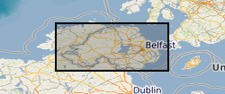
The 1:250k Geological Maps of Northern Ireland comprise the Superficial Deposits Map (Drift, 1991) and the Bedrock Map (Solid Geology, 1997). These maps identify landscape areas based on their lithology. The scale of the maps is 1:250 000 and provides a simplified interpretation of the geology that may be used as a guide at a regional level, but should not be relied on for local geology. Superficial deposits are younger geological deposits formed during the most recent geological time; the Quaternary. These deposits rest on older rocks or deposits referred to as bedrock. The superficial deposits theme defines landscape areas with a geological name and their deposit-type or lithological composition. The Superficial map shows the deposits within the extent of the six Counties of Northern Ireland. The Bedrock map comprises the bedrock geology and contains dykes and geological faults. Bedrock geology describes the main mass of solid rocks forming the earth's crust. Bedrock is present everywhere, whether exposed at surface in outcrops or concealed beneath superficial deposits or water bodies. Geological names are based on the lithostratigraphic or lithodemic hierarchy of the rocks. The lithostratigraphic scheme arranges rock bodies into units based on rock-type and geological time of formation. Where rock-types do not fit into the lithostratigraphic scheme, for example intrusive, deformed rocks subjected to heat and pressure resulting in new or changed rock types; then their classification is based on their rock-type or lithological composition. This assesses visible features such as texture, structure, mineralogy. Dykes defines small, narrow areas of a specific type of bedrock geology; that is igneous rocks which have been intruded into the landscape at a later date than the surrounding bedrock. Geological faults occur where a body of bedrock has been fractured and displaced by large scale processes affecting the earth's crust (tectonic forces). The Bedrock map shows the main bedrock geological divisions in Northern Ireland and coverage extends to the west into the Republic of Ireland. The printed map includes a stratigraphic column. Digital datasets have been derived from the maps and comprise three layers. 1. Superficial polygons, 2. Bedrock polygons and 3. Linear features. Attribute tables describe the polygon features. These data are generalised and superseded by the 1:10k Geological Maps of Northern Ireland.
 NERC Data Catalogue Service