
KML
Type of resources
Topics
Keywords
Contact for the resource
Provided by
Years
Formats
Representation types
Update frequencies
Service types
Scale
-
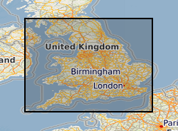
These maps provide an overview, at the national scale, of the spatial relationships between principal aquifers and some of the major shale and clay units in England and Wales. The data comprises a series of occurrence maps shows the distribution of rock units that form the principal aquifers and some major shale and clay units in England and Wales. In addition, a series of separation maps show the vertical separation between pairs of shales or clays and overlying aquifers. If shale gas resources are to be developed in the UK, the implications for groundwater will need to be considered as part of any risk assessment. A step in such an assessment will be to understand and quantify the spatial relationships between the potential shale gas source rocks (including both shales and some clay units) and overlying aquifers. The datasets used to produce the aquifer maps, the shale and clay occurrence maps and the separation maps are available to download for your own use. As with other BGS data sets available for download, this will enable you to work offline to develop your own systems and methodologies using BGS data. The data used to produce the aquifer, shale and clay maps are available below as ESRI GIS and KML files.
-
Isotope analysis data. Project details: The continental crust is our only archive of Earth history; not just of the crust itself but of the hydrosphere, atmosphere and biosphere, and of the deep Earth through its interactions with the crust. This archive, like the rock record itself, is incomplete and much effort is focused on interrogating the crust to gain a clearer and more complete picture of Earth history. The continental rock record is episodic with, for example, ages of igneous crystallization, metamorphism, continental margins, and seawater and atmospheric proxies distributed about a series of peaks and troughs that in part correspond with the cycle of supercontinent assembly and dispersal. At the core of the debate is what these well-established peaks of ages in the geological record represent and how they develop. The peaks of ages correspond with periods of global assembly of continents to form supercontinents. The project will address whether the peaks of ages are primary features associated with supercontinent assembly or break up, or they are they secondary features representing greater preservation potential at the times of supercontinent assembly. Our work will focus on the Rodinian supercontinent cycle, which extends from initiation of convergent plate interaction around 1.7 Ga, to continental collision at 1.1-1.0 Ga during the Grenville orogeny, to final breakup of the supercontinent by 0.54 Ga. Detrital zircons from sedimentary units throughout the supercontinent cycle provide a record of the magmatic activity for which the igneous rocks are often no longer preserved. We will determine (i) the ages ranges of magmatic activity preserved in the sedimentary rocks in the 600 Ma pre-collision phase, and (ii) how and when the distinctive Grenville peak of ages developed by comparing the zircon record from samples pre-, syn- and post- Rodinian supercontinent assembly with estimated volumes of magma and numbers of zircons produced during the same interval. This will differentiate primary generation processes from secondary processes, constraining when the dominant age peak developed, the tectonic processes that operated, and hence the method by which it developed. The wider implications of when the continental crust formed are considerable. Studies of continental growth continue to uncritically assume that the geological and isotopic record provide insight into processes of crust formation. Until it can be established whether the record is the outcome of generational or preservational processes, or a combination of both, then drawing conclusions on this fundamental question in the Earth Sciences are premature. If the record is a preservational record then this impacts on understanding continental growth through time and on secondary questions of how the crustal record is used to unravel the temporal evolution of the hydrosphere and biosphere, and the distribution of mineral deposits.
-

These services are a BGS contribution to the OneGeology project, providing UK onshore geological data at 1:625 000 scale and UK continental shelf seabed sediment data at 1:1 million scale. This map data is collected as part of an ongoing BGS project: Digital Geological Map of Great Britain (DiGMapGB). MapServer software is used to provide these OGC download APIs.