.tif
Type of resources
Topics
Keywords
Contact for the resource
Provided by
Years
Formats
Representation types
Update frequencies
-

This data includes 8 surfaces generated from 3D seismic interpretation of the Nadir Crater, offshore West Africa. These surfaces represent stratigraphic boundaries between the seabed and the top of Albian, and show the structural and stratigraphic characteristics of the Nadir Crater. These surfaces correspond to individual maps and horizons shown in "3D anatomy of the Cretaceous-Paleogene age Nadir Crater" in Nature Communications Earth & Environment. https://doi.org/10.21203/rs.3.rs-4363378/v1.
-
This dataset (1.5 GB) comprises SO2 emission data (SO2 camera and DOAS) of parts of the active 2013 phase from Colima, as well as Scanning electron microscope (SEM) images and microprobe data of the collected ash from explosions and lava and dome rock. These data were used in the following paper: Cassidy, M., Cole, P.D., Hicks, K.E., Varley, N.R., Peters, N., Lerner, A. 'Rapid and slow: Varying ascent rates as a mechanism for Vulcanian explosions' Earth and Planetary Science Letters. 420: 73-84. doi:10.1016/j.epsl.2015.03.025
-
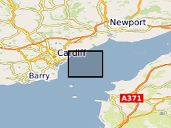
MEDIN Data. Within the project (WFA-CPC EMFF Protecting Our Seas), benthic and geophysical surveys were undertaken in the Severn Esturary/Môr Hafren SAC to explore the location of Sabellaria alveolata reefs, and collected bathymetry, sidescan sonar, AGDS and acoustic imagery data (ARIS) to identify areas of variable ground or potential features. A ten-day survey was undertaken in July 2020 to collect broad-scale acoustic data using an interferometric swath bathymetric system (GeoSwath Plus) and Acoustic Ground Discrimination System (RoxAnn™ AGDS). Twelve secondary survey areas were selected to be investigated in greater detail using high frequency sidescan sonar and an Acoustic Resonance Inspection System (ARIS Explorer 3000) camera in a second ten-day survey conducted in August 2020 (https://www.envision.uk.com/wp-content/uploads/2022/03/2018-1008-NRW-WFA-Protecting_Our_Seas_Final_Report_20210201.pdf) The data sets include: SSS (.tif) collected using Trident SeaStar MBES (.xyz) collected using GeoSwath Plus, AGDS (.csv and .asc) collected using RoxAnn™ AGDS ARIS imagery (.png and .mp4) collected using ARIS Explorer 3000 camera Shapefiles (.shp etc)
-
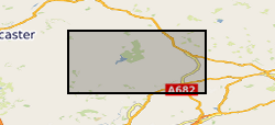
The data were produced by Joe Emmings, NERC-funded PhD student at the University of Leicester and British Geological Survey, between 2014 and 2017. Authors of these data: Joe Emmings a, b; Sarah Davies a; Christopher Vane b; Melanie Leng b, c; Vicky Moss-Hayes b; Michael Stephenson b a School of Geography, Geology and the Environment, University of Leicester, University Road, Leicester, LE1 7RH, UK. b British Geological Survey, Keyworth, Nottingham, NG12 5GG, UK. c School of Biosciences, Centre for Environmental Geochemistry, University of Nottingham, Sutton Bonington Campus, Leicestershire LE12 5RD, UK. Data include: 1) A range of photographs from the outcrop Hind Clough and boreholes MHD4 and Cominco S9, sample photographs, thin section scans, microphotographs (transmitted light and scanning electron microscopy) and hand specimen descriptions; 2) The results of 100 analyses from the outcrop Hind Clough and boreholes MHD4 and Cominco S9; x-ray fluorescence major and trace element concentrations, RockEval pyrolysis measurements, x-ray diffraction traces and LECO elemental C and S data. These data were interpreted together with 20 drill-core samples previously acquired from Hind Clough ('HC01' prefix). See http://dx.doi.org/10.5285/c39a32b2-1a30-4426-8389-2fae21ec60ad for further information regarding this drill-core dataset. Acknowledgements: This study was funded by NERC grant NE/L002493/1, a part of the Central England Training Alliance (CENTA). This study also received CASE funding from the BGS. Nick Riley (Carboniferous Ltd) is thanked for sharing his expertise, particularly regarding the field identification of marine faunas. Charlotte Watts is thanked for providing field assistance. Nick Marsh, Tom Knott and Cheryl Haidon are thanked for providing expertise and assistance during inorganic geochemical and mineralogical analyses.
-
Raw CT scan data for the following taxa (Euparkeria, Scelidosaurus, Lesothosaurus, Hypsilophodon, Herrerasaurus, Adeopapposaurus, Leyesaurus, Pantydraco, Heterodontosaurus, Coelphysis, Columba, Uromastyx), deposited as either .tif stacks or .dicom stacks, together with .vol files. CT reconstructions for each of these provided as .stls and in other file formats and also all files associated with the generation of Finite Element Models for each of these taxa. Reference photographs of specimens also provided where relevant. Scans and models are arranged in folders by taxon on a hard drive, accompanied by a Read Me file giving full details.
-
Data from onshore wells provided to BGS as part of an agreement with NSTA/OGA/DECC Digital data (includes, well logs, well reports and downhole data) for oil and gas exploration and appraisal wells drilled in the UK and held on behalf of the North Sea Transitory Authority (formerly the Oil & Gas Authority, formerly the Department of Energy and Climate Change). External data therefore BGS has no control on quality. Provided to OGA/DECC/BGS by oil companies as part of their obligations under licensing regulations, PON 9b regulations notice.
 NERC Data Catalogue Service