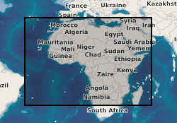
X-discontinuity observations beneath the African continent (NERC Grant NE/L002507/1)
X-discontinuity observations recorded from receiver function stacks of passive-source seismic data. Receiver functions are recorded between January 1990 and October 2021 at numerous seismometers on the African continent (see Pugh et al., 2023 for details). Receiver functions are downloaded, processed using SMURFPy (Cottaar et al., 2020). They are subsequently stacked in the depth and time-slowness domains in 1 degree radius overlapping bins and interpreted for the presence of the X-discontinuity. The dataset comprises 597 stacks, their location, the depth of the X-discontinuity, a classification of the stack and the amplitudes of the X-discontinuity. See Pugh et al., 2023 for further details on the method, the code used to download, process and stack receiver functions can be found at: https://doi.org/10.5281/zenodo.4337258 Pugh et al., 2023 - Multigenetic Origin of the X-discontinuity Below Continents: Insights from African Receiver Functions.
Simple
- Date (Creation)
- 2023-02-12
Originator
University of Cambridge
-
Stephen Pugh
(
PhD student
)
Department of Earth Sciences
,
Cambridge
,
CB2 3EQ
,
Originator
Imperial College London
-
Ian Bastow
(
Senior Lecturer
)
Faculty of Engineering, Department of Earth Science & Engineering
,
- Maintenance and update frequency
- notApplicable notApplicable
- GEMET - INSPIRE themes, version 1.0
- BGS Thesaurus of Geosciences
-
- Seismic data
- NGDC Deposited Data
- Citable Data
- Discontinuity
- dataCentre
- Keywords
-
- NERC_DDC
- Access constraints
- otherRestrictions Other restrictions
- Other constraints
- licenceOGL
- Use constraints
- otherRestrictions Other restrictions
- Other constraints
- The copyright of materials derived from the British Geological Survey's work is vested in the Natural Environment Research Council [NERC]. No part of this work may be reproduced or transmitted in any form or by any means, or stored in a retrieval system of any nature, without the prior permission of the copyright holder, via the BGS Intellectual Property Rights Manager. Use by customers of information provided by the BGS, is at the customer's own risk. In view of the disparate sources of information at BGS's disposal, including such material donated to BGS, that BGS accepts in good faith as being accurate, the Natural Environment Research Council (NERC) gives no warranty, expressed or implied, as to the quality or accuracy of the information supplied, or to the information's suitability for any use. NERC/BGS accepts no liability whatever in respect of loss, damage, injury or other occurence however caused.
- Other constraints
- Available under the Open Government Licence subject to the following acknowledgement accompanying the reproduced NERC materials "Contains NERC materials ©NERC [year]"
- Spatial representation type
- vector Vector
- Metadata language
- EnglishEnglish
- Topic category
-
- Geoscientific information
- Geographic identifier
-
AFRICA [id=600000]
- Date (Creation)
- 1979
N
S
E
W
))
- Begin date
- 1990-01-01
- End date
- 2021-09-30
Reference System Information
No information provided.
- Distribution format
-
-
Rich Text Format (RTF)
()
-
Text file (TXT)
()
-
Rich Text Format (RTF)
()
- OnLine resource
- Data ( WWW:DOWNLOAD-1.0-http--download )
- OnLine resource
-
Citation Information - Digital Object Identifier (DOI)
(
WWW:LINK-1.0-http--related
)
Pugh, S., Boyce, A., Bastow, I., Ebinger, C., Cottaar, S. (2023). X-discontinuity observations beneath the African continent. NERC EDS National Geoscience Data Centre. (Dataset). https://doi.org/10.5285/409dc3f0-f371-4322-bdc3-39cd439c28c9
- Hierarchy level
- dataset Dataset
- Other
- dataset
Conformance result
- Date (Publication)
- 2011
- Explanation
- See the referenced specification
- Pass
- No
Conformance result
- Date (Publication)
- 2010-12-08
- Explanation
- See http://eur-lex.europa.eu/LexUriServ/LexUriServ.do?uri=OJ:L:2010:323:0011:0102:EN:PDF
- Pass
- No
- Statement
- Seismic data are downloaded and processed as receiver functions using SMURFPy (Cottaar et al., 2020). One degree radius stacks of receiver functions are assessed for the presence of the X-discontinuity beneath Africa.
- File identifier
- f4cddb09-51af-12fa-e053-0937940a6554 XML
- Metadata language
- EnglishEnglish
- Hierarchy level
- dataset Dataset
- Date stamp
- 2025-12-11
- Metadata standard name
- UK GEMINI
- Metadata standard version
- 2.3
Point of contact
British Geological Survey
Environmental Science Centre,Keyworth
,
NOTTINGHAM
,
NOTTINGHAMSHIRE
,
NG12 5GG
,
United Kingdom
+44 115 936 3100
- Dataset URI
- http://data.bgs.ac.uk/id/dataHolding/13608028
Overviews

Spatial extent
N
S
E
W
))
Provided by

Associated resources
Not available
 NERC Data Catalogue Service