 NERC Data Catalogue Service
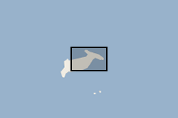
Waterlines delimiting the edge of the Hunga Tonga - Hunga Ha'apai island between April 2017 and April 2022 (NERC Grant NE/X002454/1)
Waterlines have been extracted to delimit the edge of the Hunga Tonga - Hunga Ha'apai island between April 2017 and April 2022. Waterline is defined as the instantaneous land - water boundary at the time of the imaging process. Waterlines have been generated by BGS - Earth Observation team through a thresholding-based classification based on Sentinel-2 multispectral imagery and developed on Google Earth Engine. Specifically, the thresholding has been applied to the Normalized Difference Water Index (NDWI) has been derived as a basis to discriminate between the land and sea based on their spectral characteristics. Changes in waterlines over volcanic islands can provide key information to understand volcanic processes. For more info on the methodology, see Novellino et al. (2020)
https://doi.org/10.3390/app10020536
Simple
- Date (Creation)
- 2022-11-24
Distributor
British Geological Survey
-
Enquiries
0115 936 3276
Environmental Science Centre, Nicker Hill, Keyworth
,
NOTTINGHAM
,
NOTTINGHAMSHIRE
,
NG12 5GG
,
United Kingdom
0115 936 3143
0115 936 3276
Originator
British Geological Survey
-
Enquiries
0115 936 3276
Environmental Science Centre, Nicker Hill, Keyworth
,
NOTTINGHAM
,
NOTTINGHAMSHIRE
,
NG12 5GG
,
United Kingdom
0115 936 3143
0115 936 3276
- Maintenance and update frequency
- notApplicable notApplicable
- GEMET - INSPIRE themes, version 1.0
- BGS Thesaurus of Geosciences
-
- Imagery
- Volcanic activity
- Satellite imagery
- dataCentre
- Keywords
-
- NERC_DDC
- Access constraints
- otherRestrictions Other restrictions
- Other constraints
- licenceOGL
- Use constraints
- otherRestrictions Other restrictions
- Other constraints
- The copyright of materials derived from the British Geological Survey's work is vested in the Natural Environment Research Council [NERC]. No part of this work may be reproduced or transmitted in any form or by any means, or stored in a retrieval system of any nature, without the prior permission of the copyright holder, via the BGS Intellectual Property Rights Manager. Use by customers of information provided by the BGS, is at the customer's own risk. In view of the disparate sources of information at BGS's disposal, including such material donated to BGS, that BGS accepts in good faith as being accurate, the Natural Environment Research Council (NERC) gives no warranty, expressed or implied, as to the quality or accuracy of the information supplied, or to the information's suitability for any use. NERC/BGS accepts no liability whatever in respect of loss, damage, injury or other occurence however caused.
- Other constraints
- Available under the Open Government Licence subject to the following acknowledgement accompanying the reproduced NERC materials "Contains NERC materials ©NERC [year]"
- Spatial representation type
- vector Vector
- Metadata language
- EnglishEnglish
- Topic category
-
- Geoscientific information
- Geographic identifier
-
TO
- Date (Revision)
- 2009
- Geographic identifier
-
TON
- Date (Revision)
- 2009
- Geographic identifier
-
TONGA [id=936000]
- Date (Creation)
- 1979
N
S
E
W
))
- Begin date
- 2017-04-01
- End date
- 2022-04-30
- Unique resource identifier
- WGS 84 / UTM zone 1S (EPSG::32701)
- Distribution format
-
-
ESRI Shapefile
(
1994
)
-
ESRI Shapefile
(
1994
)
Distributor
British Geological Survey
-
Enquiries
0115 936 3276
Environmental Science Centre, Nicker Hill, Keyworth
,
NOTTINGHAM
,
NOTTINGHAMSHIRE
,
NG12 5GG
,
United Kingdom
0115 936 3143
0115 936 3276
- OnLine resource
- Data ( WWW:DOWNLOAD-1.0-http--download )
- Hierarchy level
- dataset Dataset
- Other
- dataset
Conformance result
- Date (Publication)
- 2011
- Explanation
- See the referenced specification
- Pass
- No
Conformance result
- Date (Publication)
- 2010-12-08
- Explanation
- See http://eur-lex.europa.eu/LexUriServ/LexUriServ.do?uri=OJ:L:2010:323:0011:0102:EN:PDF
- Pass
- No
- Statement
- The Sentinel-2 images used as input to the workflow comprised Level-1C image products. These are composed of 100 × 100 km2 tiles that are ortho-images in cartographic geometry according to the UTM/WGS84 projection, with radiometric corrections applied to convert each pixel value from the digital number (DN) to Top of Atmosphere (TOA) reflectance. We use median values within a month period, pending availability of the data due to cloud coverage. The remaining images have been thresholded based on the Normalized Difference Water Index (NDWI) is used to as a basis to discriminate between the land and sea based on their spectral characteristics. Methodology is described in detail in Novellino et al., (2021) at https://doi.org/10.3390/app10020536
- File identifier
- f287da43-4913-77ff-e053-0937940a0d43 XML
- Metadata language
- EnglishEnglish
- Hierarchy level
- dataset Dataset
- Date stamp
- 2026-05-06
- Metadata standard name
- UK GEMINI
- Metadata standard version
- 2.3
Point of contact
British Geological Survey
Environmental Science Centre,Keyworth
,
NOTTINGHAM
,
NOTTINGHAMSHIRE
,
NG12 5GG
,
United Kingdom
+44 115 936 3100
- Dataset URI
- http://data.bgs.ac.uk/id/dataHolding/13608017
Overviews
Spatial extent
N
S
E
W
Provided by

Associated resources
Not available