 NERC Data Catalogue Service
Probabilistic models of earthquake location and velocity structure beneath Preston New Road, UK
The models are probabilistic inferences of earth structure and earthquake location based around travel times of P and S waves recorded at seismic stations above Preston New Road, Lancashire, UK. For each point in the subsurface, we present many different values of the P- and S-wave velocity which are compatible with the data. Likewise, we present many event locations for each earthquake included in the dataset. These different models represent the posterior probability distribution respectively for the subsurface velocity and earthquake locations.
Simple
- Date (Creation)
- 2022-10-28
- Maintenance and update frequency
- notApplicable notApplicable
- GEMET - INSPIRE themes, version 1.0
- BGS Thesaurus of Geosciences
-
- Citable Data
- NGDC Deposited Data
- Earthquake magnitude
- Induced seismicity
- Monte Carlo method
- dataCentre
- Keywords
-
- NERC_DDC
- Access constraints
- otherRestrictions Other restrictions
- Other constraints
- licenceOGL
- Use constraints
- otherRestrictions Other restrictions
- Other constraints
- The copyright of materials derived from the British Geological Survey's work is vested in the Natural Environment Research Council [NERC]. No part of this work may be reproduced or transmitted in any form or by any means, or stored in a retrieval system of any nature, without the prior permission of the copyright holder, via the BGS Intellectual Property Rights Manager. Use by customers of information provided by the BGS, is at the customer's own risk. In view of the disparate sources of information at BGS's disposal, including such material donated to BGS, that BGS accepts in good faith as being accurate, the Natural Environment Research Council (NERC) gives no warranty, expressed or implied, as to the quality or accuracy of the information supplied, or to the information's suitability for any use. NERC/BGS accepts no liability whatever in respect of loss, damage, injury or other occurence however caused.
- Other constraints
- Available under the Open Government Licence subject to the following acknowledgement accompanying the reproduced NERC materials "Contains NERC materials ©NERC [year]"
- Metadata language
- EnglishEnglish
- Topic category
-
- Geoscientific information
- Geographic identifier
-
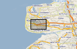
Lancashire County [id=5156]
- Date (Revision)
- 2009
N
S
E
W
))
- Begin date
- 2018-10-01
- End date
- 2018-12-31
- Unique resource identifier
- WGS 84 (EPSG::4326)
- Distribution format
-
-
NetCDF
()
-
NetCDF
()
- OnLine resource
- Data ( WWW:DOWNLOAD-1.0-http--download )
- OnLine resource
-
Citation Information - Digital Object Identifier (DOI)
(
WWW:LINK-1.0-http--related
)
Nowacki, A., Roy, C., Zhang, X., Curtis, A., Baptie, B. (2022). Probabilistic models of earthquake location and velocity structure beneath Preston New Road, UK. NERC EDS National Geoscience Data Centre. (Model). https://doi.org/10.5285/26d60a47-d8dd-480e-907b-e871844deb4c
- Hierarchy level
- model Model
- Other
- model
Conformance result
- Date (Publication)
- 2011
- Explanation
- See the referenced specification
- Pass
- No
Conformance result
- Date (Publication)
- 2010-12-08
- Explanation
- See http://eur-lex.europa.eu/LexUriServ/LexUriServ.do?uri=OJ:L:2010:323:0011:0102:EN:PDF
- Pass
- No
- Statement
- The suite of models are created by sampling the posterior probability distribution using a Markov chain Monte Carlo approach. The methods are described in the open-access paper below: Roy, C., Nowacki, A., Zhang, X., Curtis, A., Baptie, B., 2021. Accounting for natural uncertainty within monitoring systems for induced seismicity based on earthquake magnitudes. Front. Earth Sci. 9, 634688. https://doi.org/10.3389/feart.2021.634688
- File identifier
- ec6ade01-2017-0ba2-e053-0937940a5172 XML
- Metadata language
- EnglishEnglish
- Hierarchy level
- model Model
- Hierarchy level name
- model
- Date stamp
- 2025-12-11
- Metadata standard name
- UK GEMINI
- Metadata standard version
- 2.3
Point of contact
British Geological Survey
Environmental Science Centre,Keyworth
,
NOTTINGHAM
,
NOTTINGHAMSHIRE
,
NG12 5GG
,
United Kingdom
+44 115 936 3100
- Dataset URI
- http://data.bgs.ac.uk/id/dataHolding/13607992
Overviews
Spatial extent
N
S
E
W
Provided by

Associated resources
Not available