 NERC Data Catalogue Service
GeoScour v2 - A geological assessment of the potential for river scour
Simple
- Date (Creation)
- 2022-04
0115 936 3276
0115 936 3276
- Maintenance and update frequency
- asNeeded As needed
- GEMET - INSPIRE themes, version 1.0
- BGS Thesaurus of Geosciences
-
- Geohazards
- Scouring
- Catchment
- Floods
- dataCentre
- Keywords
-
- NERC_DDC
- Access constraints
- otherRestrictions Other restrictions
- Other constraints
- no limitations
- Other constraints
- Tier 1 and 2 datasets are released under the Open Government Licence (OGL), Tier 3 is licenced.
- Other constraints
- The dataset is made freely available for access, e.g. via the Internet. Either no third party data / information is contained in the dataset or BGS has secured written permission from the owner(s) of any third party data / information contained in the dataset to make the dataset freely accessible.
- Use constraints
- otherRestrictions Other restrictions
- Other constraints
- The copyright of materials derived from the British Geological Survey's work is vested in the Natural Environment Research Council [NERC]. No part of this work may be reproduced or transmitted in any form or by any means, or stored in a retrieval system of any nature, without the prior permission of the copyright holder, via the BGS Intellectual Property Rights Manager. Use by customers of information provided by the BGS, is at the customer's own risk. In view of the disparate sources of information at BGS's disposal, including such material donated to BGS, that BGS accepts in good faith as being accurate, the Natural Environment Research Council (NERC) gives no warranty, expressed or implied, as to the quality or accuracy of the information supplied, or to the information's suitability for any use. NERC/BGS accepts no liability whatever in respect of loss, damage, injury or other occurence however caused.
- Other constraints
- The dataset is made available to external clients under BGS Digital Data Licence terms and conditions. Revert to the IPR Section (iprdigital@bgs.ac.uk ) if further advice is required with regard to permitted usage.
- Other constraints
- Available under the Open Government Licence subject to the following acknowledgement accompanying the reproduced NERC materials "Contains NERC materials ©NERC [year]"
- Spatial representation type
- vector Vector
- Metadata language
- EnglishEnglish
- Topic category
-
- Geoscientific information
- Geographic identifier
-
GBN
- Date (Revision)
- 2009
- Geographic identifier
-
GREAT BRITAIN [id=139600]
- Date (Creation)
- 1979
))
- Begin date
- 2004
- End date
- 2021
- Unique resource identifier
- OSGB 1936 / British National Grid (EPSG::27700)
- Unique resource identifier
- WGS 84 (EPSG::4326)
- Distribution format
-
-
ESRI Shapefile
(
1994
)
-
ESRI Shapefile
(
1994
)
0115 936 3276
- OnLine resource
-
BGS Datasets - BGS GeoScour Premium
(
WWW:LINK-1.0-http--link
)
Resource page for dataset with contact and licensing details.
- OnLine resource
-
Citation Information - Digital Object Identifier (DOI)
(
WWW:LINK-1.0-http--related
)
British Geological Survey. (2022). BGS GeoScour v2. British Geological Survey. (Dataset). https://doi.org/10.5285/42b74017-8907-4067-9c52-ae634864b53d
- Hierarchy level
- dataset Dataset
- Other
- dataset
Conformance result
- Date (Publication)
- 2011
- Explanation
- See the referenced specification
- Pass
- No
Conformance result
- Date (Publication)
- 2010-12-08
- Explanation
- See http://eur-lex.europa.eu/LexUriServ/LexUriServ.do?uri=OJ:L:2010:323:0011:0102:EN:PDF
- Pass
- No
- Statement
- A range of BGS datasets were used to develop the datasets including: BGS Quaternary Domain Descriptors, BGS Glaciation Limits, BGS Geology 50K v8 (Bedrock and Superficial), BGS Permeability v8, BGS Advanced Superficial Thickness model (ASTM), BGS Civils Strength v6, and BGS Parent Materials v6. Additionally, a range of external datasets sourced from the Environment Agency, Natural Resource Wales, Scottish Environment Protection Agency, Scottish National Heritage and Natural England (e.g. Water Framework Directive Management Catchments, conservation areas, etc.) were used. OS Open data was used to assess urban coverage and Bluesky DTM data was used for data analyses. More information in the BGS GeoScour v2 User Guide. https://www.bgs.ac.uk/datasets/bgs-geoscour-premium/
- File identifier
- deccdcac-fea9-4fff-e053-0937940a332f XML
- Metadata language
- EnglishEnglish
- Hierarchy level
- dataset Dataset
- Date stamp
- 2026-05-03
- Metadata standard name
- UK GEMINI
- Metadata standard version
- 2.3
- Dataset URI
- http://data.bgs.ac.uk/id/dataHolding/13607933
Overviews
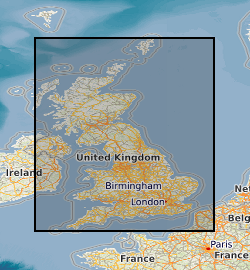
Spatial extent
Provided by
