 NERC Data Catalogue Service
BGS Debris Flow Susceptibility Model GB (version 6.1)
Simple
- Date (Creation)
- 2022-03
0115 936 3276
0115 936 3276
- Maintenance and update frequency
- notPlanned Not planned
- GEMET - INSPIRE themes, version 1.0
- BGS Thesaurus of Geosciences
-
- Landslides
- Natural hazards
- dataCentre
- Keywords
-
- NERC_DDC
- Access constraints
- otherRestrictions Other restrictions
- Other constraints
- license
- Use constraints
- otherRestrictions Other restrictions
- Other constraints
- The copyright of materials derived from the British Geological Survey's work is vested in the Natural Environment Research Council [NERC]. No part of this work may be reproduced or transmitted in any form or by any means, or stored in a retrieval system of any nature, without the prior permission of the copyright holder, via the BGS Intellectual Property Rights Manager. Use by customers of information provided by the BGS, is at the customer's own risk. In view of the disparate sources of information at BGS's disposal, including such material donated to BGS, that BGS accepts in good faith as being accurate, the Natural Environment Research Council (NERC) gives no warranty, expressed or implied, as to the quality or accuracy of the information supplied, or to the information's suitability for any use. NERC/BGS accepts no liability whatever in respect of loss, damage, injury or other occurence however caused.
- Other constraints
- The dataset is made available to external clients under BGS Digital Data Licence terms and conditions. Revert to the IPR Section (iprdigital@bgs.ac.uk ) if further advice is required with regard to permitted usage.
- Spatial representation type
- vector Vector
- Metadata language
- EnglishEnglish
- Topic category
-
- Geoscientific information
- Geographic identifier
-
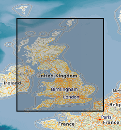
GBN
- Date (Revision)
- 2009
- Geographic identifier
-
GREAT BRITAIN [id=139600]
- Date (Creation)
- 1979
))
- Begin date
- 2013
- End date
- 2021
- Unique resource identifier
- OSGB 1936 / British National Grid (EPSG::27700)
- Distribution format
-
-
ESRI Grid
(
witheld
)
-
ESRI ASCII Grid (ASC)
()
-
ESRI Grid
(
witheld
)
0115 936 3276
- OnLine resource
-
BGS Datasets - BGS GeoSure: debris flow susceptibility model
(
WWW:LINK-1.0-http--link
)
Resource page for dataset with contact and licensing details.
- OnLine resource
-
Citation Information - Digital Object Identifier (DOI)
(
WWW:LINK-1.0-http--related
)
British Geological Survey (2022). BGS Debris Flow Susceptibility Model GB (version 6.1). British Geological Survey. (Dataset). https://doi.org/10.5285/88f7591f-8cbe-4ead-9f0a-85ac25d96d93
- Hierarchy level
- dataset Dataset
- Other
- dataset
Conformance result
- Date (Publication)
- 2011
- Explanation
- See the referenced specification
- Pass
- No
Conformance result
- Date (Publication)
- 2010-12-08
- Explanation
- See http://eur-lex.europa.eu/LexUriServ/LexUriServ.do?uri=OJ:L:2010:323:0011:0102:EN:PDF
- Pass
- No
- Statement
- The BGS Debris Flow Model for Great Britain v6.1 has been produced using Bluesky 5 m DTM (BGS v2.0) and the BGS Soil Parent Material v6 data. The Geological Controls on Infiltration v8 dataset (based on BGS Superficial and Bedrock Permeability v8 data) has also been created as an input to the BGS debris flow model. An Ice-scoured domain polygon was created for the model using a combination of a Quaternary Domain Map and a Landslide Domain Map created by BGS scientists. The data has been analysed, processed and combined within a Geographical Information System (GIS) environment following a methodology derived with BGS engineering geologists and data scientists to produce the resultant model.
- File identifier
- db0c79e0-851e-6096-e053-0937940acc77 XML
- Metadata language
- EnglishEnglish
- Hierarchy level
- dataset Dataset
- Date stamp
- 2026-05-06
- Metadata standard name
- UK GEMINI
- Metadata standard version
- 2.3
- Dataset URI
- http://data.bgs.ac.uk/id/dataHolding/13607925
Overviews
Spatial extent
Provided by
